Hay River/Merlyn Carter Airport | |||||||||||||||
|---|---|---|---|---|---|---|---|---|---|---|---|---|---|---|---|
 Hay River Airport sign | |||||||||||||||
 Airport terminal | |||||||||||||||
| Summary | |||||||||||||||
| Airport type | Public | ||||||||||||||
| Operator | Government of the Northwest Territories | ||||||||||||||
| Location | Hay River, Northwest Territories | ||||||||||||||
| Time zone | MST (UTC−07:00) | ||||||||||||||
| • Summer (DST) | MDT (UTC−06:00) | ||||||||||||||
| Elevation AMSL | 541 ft / 165 m | ||||||||||||||
| Coordinates | 60°50′23″N115°46′58″W / 60.83972°N 115.78278°W | ||||||||||||||
| Map | |||||||||||||||
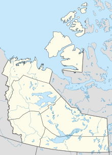 CYHY Location in the Northwest Territories  CYHY CYHY (Canada) | |||||||||||||||
 | |||||||||||||||
| Runways | |||||||||||||||
| |||||||||||||||
| Statistics (2010) | |||||||||||||||
| |||||||||||||||
Hay River/Merlyn Carter Airport( IATA : YHY, ICAO : CYHY) is located 1.5 nautical miles (2.8 km; 1.7 mi) north of Hay River, Northwest Territories, Canada.
Contents
The airport is named for former bush pilot Merlyn Carter, who was killed by a black bear in 2005. [4]
Sandhill cranes may be found nesting on the airport from May until September.