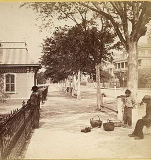
White Point Garden is a 5.7 acre public park located in peninsular Charleston, South Carolina, at the tip of the peninsula. It is the southern terminus for the Battery, a defensive seawall and promenade. It is bounded by East Battery, Murray Blvd., King St., and South Battery.

Johnson Hagood Stadium, is an 11,500-seat football stadium, the home field of The Citadel Bulldogs, in Charleston, South Carolina, USA. The stadium is named in honor of Brigadier General Johnson Hagood, CSA, class of 1847, who commanded Confederate forces in Charleston during the Civil War and later served as Comptroller and Governor of South Carolina.
College Park is a stadium in Charleston, South Carolina. It was primarily used for baseball and was the home of Charleston RiverDogs. The ballpark has a capacity of 4,000 people and opened in 1940. The grandstand is constructed of metal bleachers and is largely covered by a roof. The first few rows of seats between the dugouts are situated below ground level, giving fans the rare perspective seen from dugout level.
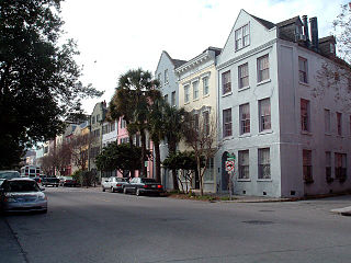
Rainbow Row is the name for a series of thirteen colorful historic houses in Charleston, South Carolina. It represents the longest cluster of Georgian row houses in the United States. The houses are located north of Tradd St. and south of Elliott St. on East Bay Street, that is, 79 to 107 East Bay Street. The name Rainbow Row was coined after the pastel colors they were painted as they were restored in the 1930s and 1940s. It is a popular tourist attraction and is one of the most photographed parts of Charleston.

Historic Charleston Foundation (HCF) was founded in 1947 to preserve and protect the integrity of architectural, historical and cultural heritage of Charleston, South Carolina, United States. The Foundation undertakes advocacy, participation in community planning, educational and volunteer programs, the preservation of properties, research, and technical and financial assistance programs. Katharine "Kitty" Robinson has served as president and CEO of the Historic Charleston Foundation since 2000.

Brittlebank Park is a ten-acre park located between Lockwood Boulevard and the Ashley River in Charleston, South Carolina. To the south is a condominium project and to the north is the minor league baseball stadium, the Joseph P. Riley, Jr. Park.

Allan Park is a park in Charleston, South Carolina, USA. It is bounded by Ashley Ave., South Allan Park, Glenwood Ave., and North Allan Park.

McMahon Playground is a playground located between Hampton Park and Rutledge Ave. in Charleston, South Carolina, USA. The playground is named for Genevieve Kanapaux McMahon. She was, for nearly twenty years, the supervisor of the Hampton Park playground. The playground was named in her honor on October 2, 1999.
Concord Park is a 9.1 acre development Charleston, South Carolina, near the Cooper River and South Carolina Aquarium. The name is used to refer to a 5.4 acre public park planned for the center of the development, the 3.7 acre mixed-use development along the north and south edges, and the overall development.

Bees Landing Recreation Center is a public park west of the Ashley in Charleston, South Carolina. Seventeen of the twenty-five acres are high ground surrounded by wetlands. The city had envisioned creating a park in West Ashley since the mid-1990s and had budgeted $2 million to acquire the property. The developer of the surrounding community, known as Grand Oaks Plantation, donated the property to the city for a park, and the city hired a consultant to develop plans.
Etiwan Park is a public park on Daniel Island in Charleston, South Carolina. The city spent $100,000 on the first phase of the park's development starting in late 1995. Work continued, and the city spent $325,000 in the fall of 1998.
Moultrie Playground is a public park in Charleston, South Carolina.
Mitchell Playground is a public park in Charleston, South Carolina bounded by Fishburne St. (north), Perry St. (east), Sheppard St. (south), and Rutledge Ave. (west). It is named for the Julian Mitchell Elementary School to the immediate east of the playground.
Melton Peter Demetre Park is a municipal park in Charleston, South Carolina. Some locals still refer to it by the nickname "Sunrise Park", the park was officially dedicated and named Melton Peter Demetre Park around 2007 after its owner, who deeded the land to the City Of Charleston for use as a park.
Corrine Jones Playground was formerly known as Hester Park because of its location along Hester Street in Charleston, South Carolina.

Vivan Anderson Moultrie Playground was created in the early 1970s to mitigate the effects of I-26's routing across the peninsula of Charleston, South Carolina, United States. After the elevated interstate was completed, a sandbox and play equipment were installed under the roadway. The new recreation area was known as Linear Park. In 2000, the City of Charleston improved the playground and renamed it in honor of a longtime resident.
Colonial Lake is a tidal pond in Charleston, South Carolina with wide walkways around it. The area is used as a park. For many years the lake was known as the Rutledge Street Pond; some residents still call it "The Pond." It acquired the name Colonial Lake in 1881, in honor of the "Colonial Commons" established in 1768.

The Joseph Floyd Manor is a retirement home in the upper peninsula area of Charleston, South Carolina. The building is located at the northwest corner of Mt. Pleasant St. and King St. The 12-story building was originally known as the Darlington Apartments and was designed by William G. Lyles, Bissett, Carlisle & Wolff of Columbia, South Carolina. The apartments cost $1,626,000 when it was built, starting in 1950. The ground floor was supposed to have space for commercial spaces, and the second floor was to have professional offices such as lawyers or doctors along with 156 apartments. Rent for an apartment ranged from $75 per month for a one-bedroom efficiency to $175 a month for one of three three-bedroom penthouse apartments. The property had been bought by Mr. Leonard D. Long in 1933 when it housed a tent community and there were only two nearby houses. Immediately before the construction began in January 1950, the site was home to a World War II-era nightclub known as the Windmill which was being used as a grocery store. The apartments were meant to cater to single men and women and retirees.

The Louis DeSaussure House is an antebellum house at 1 East Battery, Charleston, South Carolina. The house was designed and built for Louis DeSaussure by William Jones and completed in late 1859. The three-story, masonry house follows a traditional side hall plan; two adjacent parlors are fronted with piazzas along the south side while a stair hall runs along the north side with a front door facing east onto East Battery. In 1865 during the Civil War, the house was damaged when evacuating Confederate forces blew up a large cannon at the corner of East Battery and South Battery; a piece of the cannon was lodged in the attic of the house. The balconies on the East Battery façade and window ornaments were installed when the house was restored after the earthquake of 1886 by Bernard O'Neill, who bought it in 1888. The house was used by the military to house Navy officers during World War II and was later converted into apartments. The carriage house for 1 East Battery was later subdivided into a separate house known as 2 South Battery.

Theodora Park is a small public park in Charleston, South Carolina operated by the City of Charleston. The park was masterminded by David Rawle, public relations and marketing firm founder, who lives nearby in the historic Ansonborough neighborhood. The park, named for his mother, is one of Charleston's most unusual pocket parks.


