Hazerswoude

Last updated

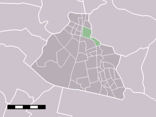
Hazerswoude is a former municipality in the Dutch province of South Holland. It contained the towns of Hazerswoude-Dorp and Hazerswoude-Rijndijk, and the villages of Groenendijk and Bent.

Netherlands Constituent country of the Kingdom of the Netherlands in Europe

The Netherlands is a country located mainly in Northwestern Europe. The European portion of the Netherlands consists of twelve separate provinces that border Germany to the east, Belgium to the south, and the North Sea to the northwest, with maritime borders in the North Sea with Belgium, Germany and the United Kingdom. Together with three island territories in the Caribbean Sea—Bonaire, Sint Eustatius and Saba— it forms a constituent country of the Kingdom of the Netherlands. The official language is Dutch, but a secondary official language in the province of Friesland is West Frisian.

South Holland Province of the Netherlands

South Holland is a province of the Netherlands with a population of just over 3.6 million as of 2015 and a population density of about 1,300/km2 (3,400/sq mi), making it the country's most populous province and one of the world's most densely populated areas. Situated on the North Sea in the west of the Netherlands, South Holland covers an area of 3,403 km2 (1,314 sq mi), of which 585 km2 (226 sq mi) is water. It borders North Holland to the north, Utrecht and Gelderland to the east, and North Brabant and Zeeland to the south. The provincial capital is The Hague, while its largest city is Rotterdam.

Hazerswoude-Dorp Village in South Holland, Netherlands

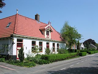
Hazerswoude-Dorp is a town in the west of the Netherlands. It is located in the municipality of Alphen aan den Rijn, South Holland, about 7 km southwest of the town of Alphen aan den Rijn.

Hazerswoude was a separate municipality until 1991, when it became part of Rijneveld. [1]

Rijneveld, in 1993 changed in Rijnwoude, has been a part of Alphen aan den Rijn since 2014.

Alphen aan den Rijn Municipality in South Holland, Netherlands

Alphen aan den Rijn is a town and municipality in the western Netherlands, in the province of South Holland, between Leiden and Utrecht. The town is situated on the banks of the river Oude Rijn, where the river Gouwe branches off. The municipality had a population of 109,449 in 2017, and covers an area of 132.49 km2 (51.15 sq mi) of which 5.91 km2 (2.28 sq mi) is water.

Related Research Articles

North Holland Province of the Netherlands

North Holland is a province of the Netherlands located in the northwestern part of the country. It is situated on the North Sea, north of South Holland and Utrecht, and west of Friesland and Flevoland. In 2015, it had a population of 2,762,163 and a total area of 2,670 km2 (1,030 sq mi).

Rijnwoude Former municipality in South Holland, Netherlands

Rijnwoude was a municipality in the western Netherlands, in the province of South Holland. The municipality covered an area of 57.89 km2 (22.35 sq mi) of which 1.20 km2 (0.46 sq mi) was water.

Ter Aar Place in Zuid-Holland, Netherlands

Ter Aar is a town and former municipality in the western Netherlands, in the province of South Holland. It is located about 6 km northeast of Alphen aan den Rijn. The town had a population of 9,007 on 1 July 2006.

Wormerveer Place in Noord-Holland, Netherlands

Wormerveer is a town in the Dutch province of North Holland. It is a part of the municipality of Zaanstad, and lies about 13 km northwest of Amsterdam.

Grafhorst is a small town about 3 km north of Kampen, in the Dutch province of Overijssel. It received city rights in 1333.

Hoogmade Place in Zuid-Holland, Netherlands

Hoogmade is a village in the Dutch province of South Holland. It is located about 7 km east of Leiden, in the municipality of Kaag en Braassem.

Rijpwetering Place in Zuid-Holland, Netherlands

Rijpwetering is a village in the Dutch province of South Holland. It is a part of the municipality of Kaag en Braassem, and lies about 8 kilometres (5.0 mi) east of Leiden.

Sloten, Amsterdam Village in Noord-Holland, Netherlands

Sloten is a village in the Dutch province of North Holland. It is a part of the municipality of Amsterdam, and lies about 6 km west of the city centre. Sloten was a separate municipality until 1921. Since then, Sloten(founded in the year 990) became the oldest part of Amsterdam.

Barwoutswaarder is a village in the municipality of Woerden in the Netherlands. It is located to the west of the city of Woerden.

Blokker, Netherlands farm village in the Netherlands

Blokker is a village in the northwest Netherlands, in the province of North Holland and the region of West Friesland.

Buiksloot is a former village in the Dutch province of North Holland. It is now a neighbourhood of Amsterdam-Noord.

Schoten, Netherlands former municipality in the Netherlands, now part of Haarlem

Schoten is a former village in the Dutch province of North Holland. It was located between Haarlem and Santpoort.

Nieuw-Vossemeer human settlement in the Netherlands

Nieuw-Vossemeer is a village in the Dutch province of North Brabant. It is located in the municipality of Steenbergen, about 10 km northeast of Bergen op Zoom.

Benthorn Hamlet in South Holland, Netherlands

Benthorn is a hamlet in the Dutch province of South Holland. It is located in the municipality of Alphen aan den Rijn, about 2 km east of the centre of Benthuizen.

Hogeveen

Hogeveen is a hamlet in the Dutch province of South Holland. It is located in the municipality of Alphen aan den Rijn, about 2 km south of Hazerswoude-Dorp.

Leimuiden Place in South Holland, Netherlands

Leimuiden is a village in the Dutch province of South Holland. It is located about 9 km south of the town of Hoofddorp, in the municipality of Kaag en Braassem.

Moerkapelle is a small town in the Dutch province of South Holland. It is located about 6 km east of the city of Zoetermeer, in the municipality of Zuidplas.

Stompwijk Place in South Holland, Netherlands

Stompwijk is a village in the Dutch province of South Holland. It is located between the cities Leiden and Zoetermeer and is part of the municipality of Leidschendam-Voorburg.

Strijensas Place in Zuid-Holland, Netherlands

Strijensas is a village in the Dutch province of South Holland. It is located about 12 km southwest of the city of Dordrecht, in the municipality of Strijen.

Bent is a small hamlet in the Dutch province of South Holland. It is located in the municipality of Alphen aan den Rijn, about 2 km northwest of the village Hazerswoude-Dorp.

References

  1. Ad van der Meer and Onno Boonstra, Repertorium van Nederlandse gemeenten , KNAW, 2006.

Coordinates: 52°06′N4°35′E / 52.100°N 4.583°E / 52.100; 4.583

Geographic coordinate system Coordinate system

A geographic coordinate system is a coordinate system that enables every location on Earth to be specified by a set of numbers, letters or symbols. The coordinates are often chosen such that one of the numbers represents a vertical position and two or three of the numbers represent a horizontal position; alternatively, a geographic position may be expressed in a combined three-dimensional Cartesian vector. A common choice of coordinates is latitude, longitude and elevation. To specify a location on a plane requires a map projection.