
Minneapolis–Saint Paul is a metropolitan area in the Upper Midwestern United States centered around the confluence of the Mississippi, Minnesota, and St. Croix rivers in the U.S. state of Minnesota. It is commonly known as the Twin Cities after the area's two largest cities, Minneapolis and Saint Paul. Minnesotans often refer to the two together simply as "The Cities". The area is Minnesota's economic, cultural, and political center.

Minneapolis–Saint Paul International Airport — also less commonly known as Wold–Chamberlain Field — is a joint civil-military public international airport serving the Twin Cities in the U.S. state of Minnesota. It is located in Fort Snelling Unorganized Territory. Although situated within the unorganized territory, the airport is centrally located within 10 miles of both downtown Minneapolis and downtown Saint Paul. In addition to primarily hosting commercial flights from major American and some international airlines, the airport is also home to several United States Air Force and Minnesota Air National Guard operations. The airport is also used by a variety of air cargo operators. MSP is the busiest airport in the Upper Midwest.

Mitchell Lee Hedberg was an American stand-up comedian known for his surreal humor and deadpan delivery. His comedy typically featured short, sometimes one-line jokes mixed with absurd elements and non sequiturs.
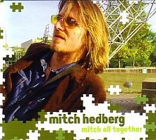
Mitch All Together is the second comedy album by Mitch Hedberg, and the final released in his lifetime. It is a recording of a performance at the Acme Comedy Club in Minneapolis, Minnesota, from May 2003. The CD was packaged with a DVD of Hedberg's 1999 Comedy Central special in two versions, the first being the one edited down to a half-hour and shown on Comedy Central, and the second being the raw unedited taping which is about 15 minutes longer. The DVD also features his appearance on a 1998 episode of Comedy Central's Premium Blend. The CD is packaged in a double-fold digipack.

Holland is a neighborhood in the Northeast community in Minneapolis. It is one of ten neighborhoods in Ward 1 of Minneapolis, currently represented by Council President Elliott Payne.

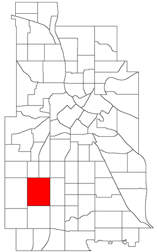
Minneapolis is officially defined by its city council as divided into 83 neighborhoods. The neighborhoods are historically grouped into 11 communities. Informally, there are city areas with colloquial labels. Residents may also group themselves by their city street suffixes: North, Northeast, South, and Southeast.
WLOL is a radio station in the Twin Cities region of Minnesota. It broadcasts a Catholic radio format and is part of the Relevant Radio network. WLOL's transmitter is located along the Minnesota River in Savage.
Green Giant and Le Sueur are brands of frozen and canned vegetables owned by B&G Foods. The company's mascot is the Jolly Green Giant.

Anders Hedberg is a Swedish former professional ice hockey player who was one of the first European-born players to make an impact in North America. He played internationally for the Sweden men's national ice hockey team, and was inducted into the IIHF Hall of Fame in 1997. Along with countryman Ulf Nilsson, Hedberg signed a contract to play for the Winnipeg Jets in the World Hockey Association (WHA) in 1974, after having represented both Modo Hockey and Djurgårdens IF in his native Sweden. Hedberg subsequently played during seven seasons in the National Hockey League (NHL) for the New York Rangers. He was twice voted best junior in Sweden and as such the only one and is a graduate from the Stockholm School of Physical Education (GIH).
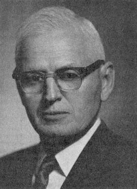
Hollis Dow Hedberg was an American geologist specializing in petroleum exploration. His contribution to stratigraphic classification of rocks and procedures is a monumental work which received universal acceptance. The firm he worked for, the Gulf Oil Corporation in Venezuela, trusted his findings and explored what had until then been uncharted territory. As a result, they reaped huge benefits from their petroleum findings. Hedberg taught at Princeton University from 1959 until his retirement in 1971. He was awarded the Mary Clark Thompson Medal by the National Academy of Sciences in 1973. In 1975 he was awarded the Wollaston Medal by the Geological Society of London. Hedberg won the Sidney Powers Memorial Award in 1963.
East Harriet is a neighborhood in the Southwest community in Minneapolis. Its boundaries are West 36th Street to the north, Lyndale Avenue South to the east, West 46th Street to the south, and Lake Harriet, Lakewood Cemetery, and William Berry Parkway to the west.
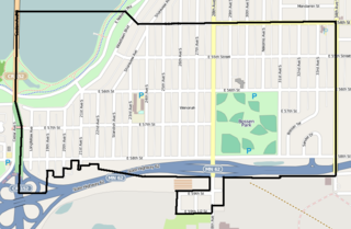
Wenonah is a neighborhood on the southeast side of Minneapolis, Minnesota. Its boundaries are 54th Street to the north, 34th Avenue to the east, the Minneapolis-Saint Paul International Airport to the south, and Cedar Avenue to the west. The neighborhood contains a portion of Lake Nokomis.
Randy R. Hedberg is an American football coach and a former player. He is the associate head coach and quarterbacks coach at North Dakota State University. Hedberg played as a quarterback for the Tampa Bay Buccaneers of the National Football League (NFL) in 1977. He was the head football coach at Minot State University, his alma mater, from 1982 to 1989 and St. Cloud State University from 1999 to 2007, compiling a career college football record of 92–74–2.

KBEW is a radio station located in Blue Earth, Minnesota that broadcasts an oldies format. The station is currently owned by Carolyn and Doyle Becker, through licensee Riverfront Broadcasting of Minnesota, Inc. and features programing from CBS News Radio.
KUOO is a radio station that broadcasts an adult contemporary format. Licensed to Spirit Lake, Iowa, United States, it serves the Iowa Great Lakes Area. KUOO is owned by Community First Broadcasting. The station shares a studio location with sister station KUQQ in Spirit Lake.

Fredrik Gabriel Hedberg was a Finnish Lutheran pastor and vicar. He was a Neo-Lutheran theologian, a prominent figure in the Finnish evangelical revival movement and a leader of confessional Lutheranism in Finland.
Hedberg is a Swedish surname. Notable people with the surname include:

The Hedberg Public Library is a public library located in Janesville, Wisconsin. The library is a member of the Arrowhead Library System.
The 2014–15 SHL season was the 40th season of the Swedish Hockey League (SHL). The regular season began on 10 September 2014 and ended on 5 March 2015. The following playoffs began on 12 March and ended on 23 April 2015.