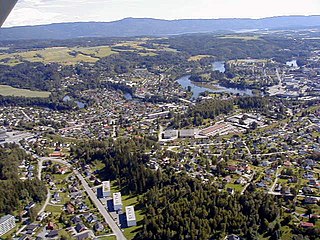
Hønefoss is a town and the administrative center of the municipality of Ringerike in Buskerud county, Norway. Hønefoss is an industrial center of inner Østlandet, containing several factories and other industry. As of 1 January 2008, Hønefoss has 14,177 inhabitants. In 1852, Hønefoss received town status and was separated from Norderhov. In 1964, Hønefoss ceased being a separate municipality and became part of Ringerike.

Valdres is a traditional district in central, southern Norway, situated between Gudbrandsdalen and Hallingdal. The region around Valdres consists of the six municipalities of Nord-Aurdal, Sør-Aurdal, Øystre Slidre, Vestre Slidre, Vang and Etnedal. Valdres has about 18,000 inhabitants and is known for its excellent trout fishing and "beautiful" dialect. Its main road is E16 and Fylkesveg 51.

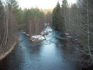
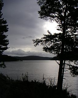
Tyrifjorden is a lake in Norway. It lies 40 kilometres (25 mi) northwest of Oslo and is the nation's fifth largest lake with an area of 137 km2. It has a volume of 13 km3, is 295 meters deep at its deepest, and lies 63 meters above sea level. The lake's primary source is the Begna river, which discharges into Tyrifjorden at Hønefoss where the river forms the waterfall of Hønefossen. Its primary outlet is at Vikersund near the lake's southwest corner, where Tyrifjorden discharges into the Drammenselva river.

Kroksund is a small village in the municipality of Hole, in Buskerud, Norway.

Sundvollen is a village in the municipality of Hole, in the county of Buskerud, Norway. Sundvollen is located along the east side of Tyrifjorden where the E16 crosses west over Steinsfjorden, the northeastern arm of Tyrifjorden, to Kroksund. The village had 801 inhabitants as of January 2009.
Vestbygda is a village in the municipality of Ringerike in the county of Buskerud, Norway.

Tyristrand is a village in Ringerike municipality in Buskerud county, Norway.

Åsa is a village in Ringerike municipality in Buskerud, Norway. Åsa is located at the upper end of Steinsfjorden, the eastern branch of lake Tyrifjorden. The village stretches from Åsaporten, the first road tunnel towards Åsa from Norderhov, and around the north end and east side of the fjord area, south to the border with Hole.
Nakkerud is a small village in Ringerike municipality, Buskerud, Norway. Its population is 350.
Hvalsmoen was the site of a former military camp to the north of Hønefoss in Ringerike, Norway.

Hen is a small village in the municipality of Ringerike in Buskerud, Norway.
Ådal is a valley in the municipality of Ringerike and was a former municipality in Buskerud County, Norway.
Trandum leir is a former army camp Ullensaker, Norway. The camp was shut down when the civilian airport at Gardermoen was built since most of the buildings were located directly underneath the flightpath for planes landing there.

Ringerike Hospital is a hospital which deals with patients from the Buskerud area, especially around Hønefoss. The hospital is part of Vestre Viken Hospital Trust of Southern and Eastern Norway Regional Health Authority. It is the main hospital for around 75,000 people, with capacity for 872 in-patients. It covers the districts of Ringerike and Hole, the municipalities of Jevnaker and Sør-Aurdal, as well as parts of Hallingdal and Valdres. Included in its remit as hospital of Hønefoss, is the smaller clinic of Hallingdal Hospital at Ål. Ringerike Hospital deals with somatics and psychiatry, and in 2005 dealt with around 11,200 patients in surgery, internal medicine, psychiatry, birth and gynecology and paediatrics. In the same year, there were around 62,300 polyclinic consultations. Until 2009 the hospital was its own health trust, Ringerike Hospital Trust.
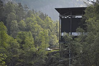
Allmannajuvet is a ravine or canyon located along the river Storelva in the municipality of Sauda in Rogaland county, Norway. The ravine is located in a rural, forested area along the Norwegian County Road 520 between the town of Sauda and the village of Hellandsbygda.
Næs Ironworks in Holt, was an iron works which started operation in 1665 under the name “Baaseland Værk”. The blast furnace and foundry were located at the Båsland farm, while the associated forge was located a kilometer further east, by the Storelva river at Næs. The blast furnace was new, and not an extension of the Barbu jernverk at Arendal which ceased operations in the 1650s. “Baaseland Værk” was given the name Naes blast furnace operation when the buildings were concentrated by Storelva in 1738. About 1840 the firm was renamed Jacob Aall & Søn. It ceased operation in 1959.

Ringerike is a traditional district in Norway, commonly consisting of the municipalities Hole, and Ringerike in Buskerud county. In older times, Ringerike had a larger range which went westward, to the municipalities Krødsherad, Modum, and Sigdal, also in Buskerud.