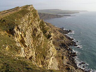
The Jurassic Coast is a World Heritage Site on the English Channel coast of southern England. It stretches from Exmouth in East Devon to Studland Bay in Dorset, a distance of about 96 miles (154 km), and was inscribed on the World Heritage List in mid-December 2001.

The South West Coast Path is England's longest waymarked long-distance footpath and a National Trail. It stretches for 630 miles (1,014 km), running from Minehead in Somerset, along the coasts of Devon and Cornwall, to Poole Harbour in Dorset. Because it rises and falls with every river mouth, it is also one of the more challenging trails. The total height climbed has been calculated to be 114,931 ft (35,031 m), almost four times the height of Mount Everest. It has been voted 'Britain's Best Walking route' twice in a row by readers of The Ramblers' Walk magazine, and regularly features in lists of the world's best walks.

Durdle Door is a natural limestone arch on the Jurassic Coast near Lulworth in Dorset, England. It is privately owned by the Weld family, who own the Lulworth Estate, but it is also open to the public.

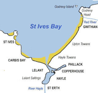
Godrevy is an area on the eastern side of St Ives Bay, west Cornwall, England, United Kingdom, which faces the Atlantic Ocean. It is popular with both the surfing community and walkers. It is part owned by the National Trust, and offshore on Godrevy Island is a lighthouse maintained by Trinity House which is said to be the inspiration for Virginia Woolf's novel To the Lighthouse. Godrevy lies within the Cornwall Area of Outstanding Natural Beauty (AONB) and the South West Coast Path runs around the whole promontory. There are several public car parks on the western side where the National Trust owns and operates a café.

Crackington Haven is a coastal village in Cornwall, England, United Kingdom. It is in the civil parish of St Gennys at grid reference SX140972 at the head of a cove on the Atlantic coast. The village is seven miles (11 km) south-southwest of Bude and four miles (7 km) north-northeast of Boscastle.

Priest Cove or Priest's Cove is a small cove one mile (1.6 km) west of St Just, Cornwall, UK. The name is from the Cornish Porth Ust, the port or cove of St Just, which was shortened to Por’ Ust. The apostrophised name "Priest’s" is a spelling mistake and the site has no connection with the clergy.

Treyarnon is a hamlet west of St Merryn in Cornwall, England, UK near Padstow. Treyarnon Beach is a small beach nearby with a caravan park, Youth Hostel and café.

Harlyn is a small village on the north coast of Cornwall, England, United Kingdom. It is situated inland from Harlyn Bay three miles from Padstow and about one mile from St. Merryn.

Gunwalloe is a coastal civil parish in Cornwall, England, United Kingdom. It is situated on the Lizard Peninsula three miles (4.8 km) south of Helston and partly contains The Loe, the largest natural freshwater lake in Cornwall. The parish population including Berepper at the 2011 census was 219. The hamlets in the parish are Chyanvounder, Berepper and Chyvarloe. To the east are the Halzephron cliffs and further east the parish church.

Nanjizal, also known as Mill Bay, is a beach and cove in the civil parish of St Levan, Cornwall, on the south-western coast of Great Britain. Situated one mile to the south-east of Land's End, Nanjizal has no direct access via road, and is usually reached via the South West Coast Path from Land's End in the north, or from Porthgwarra to the south. Nanjizal is also a noted bird watching location.

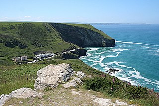
Trebarwith Strand is a section of coastline located near the coastal settlement of Trebarwith on the north coast of Cornwall, Britain, UK, 2+1⁄2 miles (4.0 km) south of Tintagel. It has 800m of sandy beach contained by cliffs in which natural caves are found. The beach can only be accessed at low tide. The strand was once used to land ships to export slate from the nearby quarries while sand from the beach was used for agricultural purposes. The view from the beach is dominated by rocks 300m offshore known as Gull Rock or Otterham Rocks.

Gurnard's Head is a prominent headland on the north coast of the Penwith peninsula in Cornwall, England. The name is supposed to reflect that the rocky peninsula resembles the head of the gurnard fish.

Pedn Vounder is a tidal beach on the south coast of the Penwith peninsula in Cornwall, England. It is immediately to the west of the Logan Rock headland, below Treen Cliff. The name is from the Late Cornish 'pedn' and 'an vownder'.

Mawgan Porth is a beach and small settlement in north Cornwall, England. It is north of Watergate Bay, approximately four miles (6 km) north of Newquay, on the Atlantic Ocean coast.

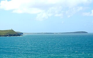
Trevose Head is a headland on the Atlantic coast of north Cornwall, on the south-western coast of Great Britain. It is situated approximately 5 miles (8.0 km) west of Padstow. The South West Coast Path runs around the whole promontory and is within the Cornwall Area of Outstanding Natural Beauty and the Trevose Head Heritage Coast. In clear weather, visitors to Trevose Head can see virtually the whole length of the north Cornwall coast; to the north, the view extends beyond the Cornwall county boundary to Hartland Point, Devon; to the south, it extends beyond St Ives to the headland at Pendeen Watch.

St Oswald's Bay is located near Lulworth on the Jurassic Coast in Dorset, England.

Trevaunance Cove is a small bay on the north Cornish coast and a residential area of St Agnes, Cornwall, England, United Kingdom. In the 18th and 19th centuries it was a busy harbour despite storms often destroying the quay. The South West Coast Path passes over the coastal slope to the north.

Baulk Head to Mullion is a coastal Site of Special Scientific Interest (SSSI) in Cornwall, England, UK, noted for both its biological and geological characteristics.

Gerrans Bay to Camels Cove is a coastal Site of Special Scientific Interest (SSSI) in south Cornwall, England, UK, noted for both its biological and geological interest.

Freshwater Bay is a bay on the east side of the Isle of Portland, Dorset, England, south from Church Ope Cove and between the villages of Wakeham and Southwell. It forms part of the Jurassic Coast.


