Suldal is a municipality in the northeast corner of Rogaland county, Norway. It is located in the traditional district of Ryfylke. Since 1965, the administrative centre of Suldal is the village of Sand i Ryfylke. Other villages in Suldal include Hålandsosen, Jelsa, Marvik, Nesflaten, and Suldalsosen.

Etne is a municipality in Hordaland county, Norway. It is located in the traditional district of Sunnhordland, although it is also sometimes considered to be part of the district of Haugaland. The administrative centre of the municipality is the village of Etnesjøen. Other villages in the municipality include Skånevik and Fjæra. The two largest villages in the municipality are Etnesjøen with 1,159 residents and Skånevik with 594 residents.

Haugaland or Haugalandet is a traditional district situated on the western coast of Norway. Haugaland is one of the 15 traditional districts located within the Vestlandet region.

Saudafjord or Saudafjorden is a fjord in Rogaland county, Norway. The fjord stretches from the town of Sauda in the municipality of Sauda in the north to the village of Sand in the municipality of Suldal where the Saudafjorden and Hylsfjorden join together to form the Sandsfjorden.

Tananger is a village in Sola municipality in Rogaland county, Norway. The village is located on the west side of the Stavanger Peninsula between the North Sea and the Hafrsfjorden. It lies about 10 kilometres (6.2 mi) southwest of the city centre of Stavanger. The 4.46-square-kilometre (1,100-acre) village has a population (2015) of 6,377 which gives the village a population density of 1,430 inhabitants per square kilometre (3,700/sq mi). The village has grown significantly, more than doubling in size from 1980 until 2015. Tananger Chapel and Tananger Church are both located in the village.

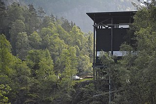
Oltedalsvatnet is a lake in the municipality of Gjesdal in Rogaland county, Norway. The 3.12-square-kilometre (1.20 sq mi) lake lies just south of the village of Oltedal. It is a reservoir along the river Oltedalsåna that is used to store water for the Oltedal Hydroelectric Power Station. The lake sits at an elevation of 101.5 to 112.5 metres and it holds about 28,800,000 cubic metres.

Holmavatnet is a lake the Setesdalsheiene mountains of Southern Norway. It is located on the border of the municipalities of Suldal, Vinje, and a small part in Bykle. The southeastern corner of the lake is in Bykle, and it is the northernmost part of all of Aust-Agder county. The lake Skyvatn is located about 5 kilometres (3.1 mi) to the south of the lake.
Holmevatnet or Holmevatn is a lake in the Setesdalsheiene area of Norway. It is located in the mountains on the border of the municipalities of Bykle in Aust-Agder county and Suldal in Rogaland county. The 4.76-square-kilometre (1.84 sq mi) lake lies just west of the lake Store Urevatn and to the northeast of the lake Blåsjø. The nearest villages are Berdalen in Bykle, about 20 kilometres (12 mi) to the east and Suldalsosen, about 30 kilometres (19 mi) to the west. The mountain Kaldafjellet lies about 6 kilometres (3.7 mi) north of the lake.

Saudasjøen is a village in Sauda municipality in Rogaland county, Norway. The village is located along the northern coast of the Saudafjorden about 3.5 kilometres (2.2 mi) southwest of the town of Sauda. For statistical purposes it is considered a part of the urban area of the town of Sauda. The village is mostly a bedroom community for the nearby town of Sauda. There are some small industries in Saudasjøen as well as the Saudasjøen Chapel. County Road 520 runs through the village along the shore of the fjord.
Amdal is a small farming village in Sauda municipality in Rogaland county, Norway. The village is located just a short distance inland from the Saudafjorden, about 1.5 kilometres (0.93 mi) north of the village of Saudasjøen and about 2.5 kilometres (1.6 mi) west of the town of Sauda.
Skaulen is a mountain in Rogaland county, Norway. The 1,538-metre (5,046 ft) mountain lies on the border of the municipalities of Sauda and Suldal. The mountain lies in the Ryfylkesheiane mountains, about 7.5 kilometres (4.7 mi) southeast of the village of Hellandsbygda in Sauda and about 13 kilometres (8.1 mi) west of the village of Nesflaten in Suldal.
Kyrkjenuten is a mountain in the municipality of Sauda in Rogaland county, Norway. The 1,602-metre (5,256 ft) tall mountain is the highest mountain in Sauda and also the 7th highest mountain in the county. It is located in northeastern Sauda, about 12 kilometres (7.5 mi) north of the village of Hellandsbygda and about the same distance southeast of the village of Fjæra in Etne municipality to the north of the mountain, just over the county border with Hordaland.
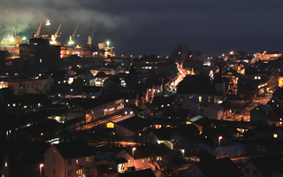
Sauda is a town in Sauda municipality in Rogaland county, Norway. The town, which is also the administrative centre of the municipality, is located in a river valley at the northern end of the Saudafjorden. The small suburb of Saudasjøen lies about 3 kilometres (1.9 mi) west of the town centre. A large part of the industrial harbour area of Sauda is built on reclaimed land that was once underwater in the fjord.

Sauda Church is the main parish church in Sauda municipality in Rogaland county, Norway. It is located in the town of Sauda. The church is part of the Sauda parish in the Ryfylke deanery in the Diocese of Stavanger.
Saudasjøen Chapel is a chapel in Sauda in Rogaland county, Norway. It is located in the village of Saudasjøen. The chapel is part of the Sauda parish in the Ryfylke deanery in the Diocese of Stavanger. The concrete chapel was built in 1973 and it seats about 300 people.