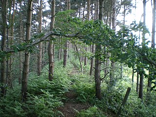
Dinas Emrys is a rocky and wooded hillock near Beddgelert in Gwynedd, north-west Wales. Rising some 76 m (250 ft) above the floor of the Glaslyn river valley, it overlooks the southern end of Llyn Dinas in Snowdonia.

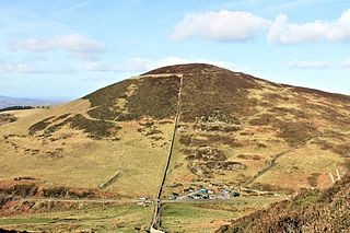
Pen Dinas is the name of a large hill within the boundary of the village of Penparcau, on the coast of Ceredigion, Wales, upon which an extensive Iron Age, Celtic hillfort of international significance is situated. The site can easily be reached on foot from Aberystwyth town center and is accessible via a series of well marked trails. Boasting a commanding position at the confluence of the River Ystwyth and Afon Rheidol, it has been described as "the pre-eminent hillfort on the Cardigan Bay coast".
Humbleton Hill is a hill in Northumberland, England, about 1.5 miles (2.4 km) west of Wooler.

Moel y Gaer is an Iron Age hillfort at the northern end of the Clwydian Range, located on a summit overlooking the valley of the River Wheeler, near the village of Bodfari, Denbighshire, Wales, five miles north-east of Denbigh. The site is a scheduled monument, classified as a prehistoric defensive hillfort.

Moel y Gaer, also known as Moel-y-Gaer Camp or Moel y Gaer Hillfort, is an Iron Age hillfort located on a western spur of the Clwydian Range, near the village of Llanbedr, Denbighshire, Wales. The site is a scheduled monument, classified as a prehistoric defensive hillfort.
Moel y Gaer is an Iron Age hillfort on a summit of Llantysilio Mountain, northwest of the town of Llangollen, Denbighshire, Wales. The site is a scheduled monument classified as a prehistoric defensive hillfort.

Blewburton Hill is the site of an Iron Age hillfort located in Oxfordshire, in the southeast of England. It was a univallate hillfort. The area is mostly farmland with some small areas of wooded copse to the south and the northeast. The hill fort may have been occupied from the 4th century BC to the 1st century BC, and replaced a small settlement surrounded by a stockade, which is estimated to have been built in the 5th or 6th century BC.

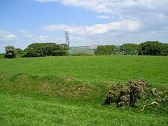
Buarth-y-Gaer is an Iron Age hillfort or enclosure on the summit of Mynydd-y-Gaer, 300 m (980 ft) above sea level. It is in Briton Ferry community, near Neath, in Neath Port Talbot, South Wales. A large hilltop enclosure is bounded by a single bank and ditch. Within the enclosed area is a Bronze Age burial mound.

Beacon Hill, also known as Harting Beacon, is a hillfort on the South Downs, in the county of West Sussex in southern England. The hillfort is located in the parish of Elsted and Treyford, in Chichester District. It is a Scheduled Ancient Monument with a list entry identification number of 1015915. The hilltop enclosure is dated to the Late Bronze Age, from the 8th to 6th centuries BC. The hillfort defences were renewed during the Late Iron Age.
Llwyn Bryn-Dinas is an Iron Age hillfort on the north side of the Tanat valley, about 1 mile (1.6 km) west of the village of Llangedwyn, in Powys, Wales.

Craig Gwrtheyrn, or Caer Gwrtheyrn, is an Iron Age hillfort on the south side of the River Teifi, about 1.2 miles (1.9 km) west of the village of Llanfihangel-ar-Arth, in Carmarthenshire, Wales.
Bury Walls is an Iron Age hillfort about 1 mile (1.6 km) south-east of Weston-under-Redcastle, in Shropshire, England. It is a scheduled monument.

Hollingbury Castle, also known as Hollingbury Camp and Hollingbury Hillfort, is an Iron Age hillfort on the northern edge of Brighton, in East Sussex, England. It is adjacent to Hollingbury Park Golf Course.
Moel Arthur is an Iron Age hillfort in Flintshire, Wales, at the boundary with Denbighshire, about 5 miles (8.0 km) east of Denbigh.
Berth Hill is an Iron Age hillfort in Staffordshire, England, about 5 miles (8.0 km) south-west of Newcastle-under-Lyme, and near the village of Maer. It is a scheduled monument. Other forms of its name have been Bryth, Bruff and Burgh Hill.

Caer Euni [Grid reference SJ 00027 41266] is an Iron Age hillfort, about 2.5 miles (4 km) north-east of the village of Llandderfel and about 5 miles (8 km) north-east of Bala Lake, in Gwynedd, Wales. It is a scheduled monument.
Cefn Carnedd is an Iron Age hillfort, about 1.5 miles (2 km) south-west of Caersws, in Powys, Wales. It is a scheduled monument.

Castell Nadolig is an Iron Age hillfort, about 2.5 miles (4 km) east of the village of Aberporth and about 1 mile (2 km) south of the village of Penbryn, in Ceredigion, Wales. It is a scheduled monument. The Penbryn Spoons, of the late Iron Age, were found here.

Maiden Bower is an Iron Age hillfort near Dunstable in Bedfordshire, England. The site, which also has traces of a Neolithic causewayed enclosure, is a scheduled monument.

Woodbury Hill is a hill near Bere Regis in Dorset, England. It is the site of an Iron Age hillfort, and the location of an annual fair from medieval times until the mid 20th century.