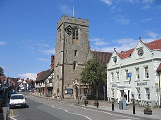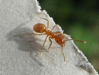
Brandon Marsh is a Site of Special Scientific Interest (SSSI) and nature reserve in Warwickshire, England. It is situated adjacent to the River Avon, near the village of Brandon, a few miles east of Coventry.
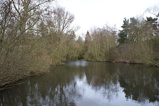
Ufton Fields is a biological Site of Special Scientific Interest and local nature reserve in Warwickshire, England. It is situated on the A425 close to the village of Ufton, between Southam and Leamington Spa. The reserve is owned by Warwickshire County Council and is administered and run by the Warwickshire Wildlife Trust. It covers an area of 77 acres (310,000 m2).

Chiddingfold Forest is a 542.5-hectare (1,341-acre) biological Site of Special Scientific Interest in Chiddingfold in Surrey and West Sussex. One part of it, Fir Tree Copse, is a nature reserve which is managed by the Surrey Wildlife Trust

Hackhurst and White Downs is a 185.1-hectare (457-acre) biological Site of Special Scientific Interest west of Dorking in Surrey. White Downs is a Nature Conservation Review site, Grade 2, and part of it is in the 200-hectare (490-acre) White Downs nature reserve, which is owned by the Wotton Estate and managed by the Surrey Wildlife Trust (SWT). Hackhurst Downs is a 29.9-hectare (74-acre) Local Nature Reserve, which part of the 40-hectare (99-acre) Hackhurst Downs nature reserve, which is owned by Surrey County Council and also managed by the SWT.

Lady's Wood is a 7.1 hectare nature reserve west of Upwood in Cambridgeshire. It is managed by the Wildlife Trust for Bedfordshire, Cambridgeshire and Northamptonshire.

Alvecote Pools is a Site of Special Scientific Interest (SSSI) and nature reserve situated alongside the River Anker, adjacent to the hamlet of Alvecote on the border of Warwickshire and Staffordshire in England. The majority of the reserve lies in the former county. Consisting of two discrete areas, Pooley Fields and Alvecote Meadows, the site covers 128 ha in total and is the largest SSSI in Warwickshire. First notified in 1955, the site has been owned by the Warwickshire Wildlife Trust since 1997.
New Ferry Butterfly Park is a 2-hectare (4.9-acre) urban nature reserve in New Ferry, on the Wirral Peninsula, England. It is managed by the Cheshire Wildlife Trust.

Warburg Nature Reserve is a nature reserve and site of special scientific interest in Oxfordshire, England that is owned and managed by the Berkshire, Buckinghamshire and Oxfordshire Wildlife Trust. It is located in the Chiltern Hills area of outstanding natural beauty in the Bix valley, 4 miles northwest of Henley-on-Thames. The name commemorates Oxford botanist Dr. E. F. Warburg, a founder member of the Trust.

Foxley Wood is a nature reserve in Foxley, Norfolk, England, the largest ancient woodland and coppice in Norfolk. The Norfolk Wildlife Trust, which manages this reserve, bought it in 1998. It is 123 hectares in size. It is a Site of Special Scientific Interest, a Nature Conservation Review site, Grade 2, and a National Nature Reserve.

King Barrow Quarry is a disused site of former 19th century stone quarries on the Isle of Portland, Dorset, England. It is located in the north-east corner of Tophill. The quarry, now a Dorset Wildlife Trust nature reserve, covers 12.2 hectares. Both King Barrow and the nearby Tout Quarry make up the Dorset Wildlife Trust's Portland Quarries Nature Park. Portland also has two butterfly reserves; Broadcroft Quarry and Perryfield Quarry.

Farthinghoe Nature Reserve is a 3.7 hectare Local Nature Reserve north-west of Brackley in Northamptonshire. It is owned by Northamptonshire County Council and managed by the Wildlife Trust for Bedfordshire, Cambridgeshire and Northamptonshire.
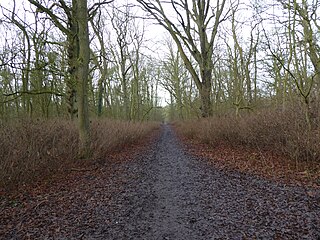
King's Wood is a 31.7 hectare Local Nature Reserve in Corby in Northamptonshire. It managed by the Wildlife Trust for Bedfordshire, Cambridgeshire and Northamptonshire.

Tailby Meadow is a 4.9 hectare Local Nature Reserve in Desborough in Northamptonshire. It is owned by Kettering Borough Council and managed by the Wildlife Trust for Bedfordshire, Cambridgeshire and Northamptonshire.

The Plens is a 5 hectare nature reserve in Desborough in Northamptonshire. It is managed by the Wildlife Trust for Bedfordshire, Cambridgeshire and Northamptonshire.

Duston Mill Meadow is a one hectare nature reserve in Northampton. It is managed by the Wildlife Trust for Bedfordshire, Cambridgeshire and Northamptonshire (WTBCN).
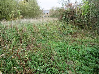
Lucas Marsh is a 1.5 hectare Local Nature Reserve in Oadby in Leicestershire. It is part of Brock's Hill Country Park, and is owned by Oadby and Wigston Borough Council and managed by the Leicestershire and Rutland Wildlife Trust.

Wymeswold Meadows is a 4.5 hectare nature reserve east of Wymeswold in Leicestershire. It is owned and managed by the Leicestershire and Rutland Wildlife Trust.

Ant Broads and Marshes is a 745.3-hectare (1,842-acre) biological Site of Special Scientific Interest north-east of Norwich in Norfolk. Most of the it is a Nature Conservation Review site, Grade 1, and it is part of the Broadland Ramsar and Special Protection Area, and The Broads Special Area of Conservation. Part of it is the Barton Broad nature reserve, which is managed by the Norfolk Wildlife Trust, and two areas are National Nature Reserves.
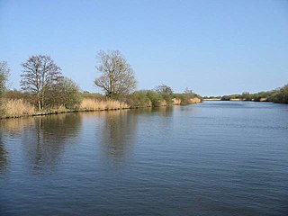
Bure Broads and Marshes is a 741.1-hectare (1,831-acre) biological Site of Special Scientific Interest north-east of Norwich in Norfolk. Most of it is a Nature Conservation Review site, Grade I and National Nature Reserve. Two areas are nature reserves managed by the Norfolk Wildlife Trust, Cockshoot Broad and Ranworth Broad. It is part of the Broadland Ramsar site and Special Protection Area and The Broads Special Area of Conservation,

