This article has multiple issues. Please help improve it or discuss these issues on the talk page . (Learn how and when to remove these messages)
|
| Hermannsberg | |
|---|---|
 | |
| Highest point | |
| Elevation | 705.1 m (2,313 ft) |
| Geography | |
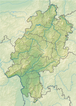
| Location | Hesse, Germany |
This article has multiple issues. Please help improve it or discuss these issues on the talk page . (Learn how and when to remove these messages)
|
| Hermannsberg | |
|---|---|
| | |
| Highest point | |
| Elevation | 705.1 m (2,313 ft) |
| Geography | |
| Location | Hesse, Germany |
The Hermannsberg is located in the Upland, the northeastern part of the Rothaargebirge, in the Diemelsee Nature Park. Its summit rises approximately 800 m south-southeast of Rattlar and 2.5 km (as the crow flies) north-northwest of Usseln, two Willingen districts. To the east, its landscape slopes down into the valley of the Diemel River and to the west into that of the Wiedbach, a small tributary of the Dommelbach. District Road 65 runs along the Wiedbach stream between Rattlar and Usseln.
Neighboring mountains and elevations of the Hermannsberg include Schetenkopf (approx. 650 m) and Hegekopf (approx. 641 m) to the north, Dommel (738 m) to the north-northeast, Ellenberg (655.5 m) to the northeast, Sähre (726 m) to the southeast, Osterkopf (708.5 m) to the south-southeast, Heimberg (approx. 690 m) to the south, Schneeberg (726.3 m) to the south-southwest, Lüerberg (713 m) to the southwest, and Höhekopf (621.7 m) to the north-northwest.
The Hermannsberg belongs to the Southern Uplands (No. 33) of the natural main unit group, the Rothaargebirge (including the Hochsauerland) (333), and the Uplands (333.9) subunit, the Inner Uplands (333.90).
51°18′28″N8°38′59″E / 51.30778°N 8.64972°E
| | This Hesse location article is a stub. You can help Wikipedia by expanding it. |