Location and description
The Hessian Ried lies between the River Rhine to the west, the Bergstraße route in the east and between the town of Lampertheim in the south to town of Groß-Gerau.

Lampertheim is a town in the Bergstraße district in Hesse, Germany. In 1984, the town hosted the 24th Hessentag state festival.

Groß-Gerau is the district seat of the Groß-Gerau district, lying in the southern Frankfurt Rhein-Main Region in Hesse, Germany, and serving as a hub for the surrounding area. In 1994, the town hosted the 34th Hessentag state festival.
In former times the lowlands of the Ried were largely marshland and repeatedly affected by serious flooding of the Rhine and Weschnitz. During the time of the Roman Empire the area was therefore avoided and the road, the Strata Montana, on the Bergstraße, built higher up along the edge of the Odenwald. Later Lorsch Abbey became an important centre in the middle of the Ried.

The Weschnitz is a 59.4 km long right tributary of the Rhine River running through the German states of Hesse and Baden-Württemberg. The name of the river traces to the Celtic god Visucius, who was worshiped in the region.
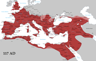
The Roman Empire was the post-Republican period of ancient Rome, consisting of large territorial holdings around the Mediterranean sea in Europe, North Africa and West Asia ruled by emperors. From the accession of Caesar Augustus to the military anarchy of the third century, it was a principate with Italy as metropole of the provinces and its city of Rome as sole capital. The Roman Empire was then ruled by multiple emperors and divided into a Western Roman Empire, based in Milan and later Ravenna, and an Eastern Roman Empire, based in Nicomedia and later Constantinople. Rome remained the nominal capital of both parts until 476 AD, when it sent the imperial insignia to Constantinople following the capture of Ravenna by the barbarians of Odoacer and the subsequent deposition of Romulus Augustus. The fall of the Western Roman Empire to Germanic kings, along with the hellenization of the Eastern Roman Empire into the Byzantine Empire, is conventionally used to mark the end of Ancient Rome and the beginning of the Middle Ages.
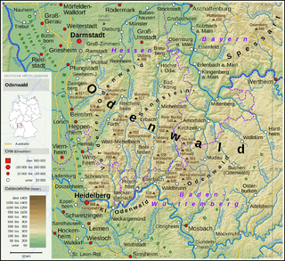
The Odenwald (help·info) is a low mountain range in the German states of Hesse, Bavaria and Baden-Württemberg.
Not until the regulation of the Rhine and Weschnitz did it become increasingly suitable for agriculture. In addition, widespread drainage produced land for agricultural use in the wake of the "General Cultural Plan" of 1925. In the mild climate asparagus and tobacco thrive. Because of the proximity of the large centres of population nearby (the Rhine-Main and Rhine-Neckar regions) vegetables and lettuce are grown widely. Due to the low precipitation in the Hessian Ried, increasing amounts of artificial watering is needed.

Agriculture is the science and art of cultivating plants and livestock. Agriculture was the key development in the rise of sedentary human civilization, whereby farming of domesticated species created food surpluses that enabled people to live in cities. The history of agriculture began thousands of years ago. After gathering wild grains beginning at least 105,000 years ago, nascent farmers began to plant them around 11,500 years ago. Pigs, sheep and cattle were domesticated over 10,000 years ago. Plants were independently cultivated in at least 11 regions of the world. Industrial agriculture based on large-scale monoculture in the twentieth century came to dominate agricultural output, though about 2 billion people still depended on subsistence agriculture into the twenty-first.

On Earth, interactions between the five parts of the climate system that produce daily weather and long-term averages of weather are called "climate". Some of the meteorological variables that are commonly measured are temperature, humidity, atmospheric pressure, wind, and precipitation. The climate of a location is affected by its latitude, terrain, and altitude, as well as nearby water bodies and their currents.
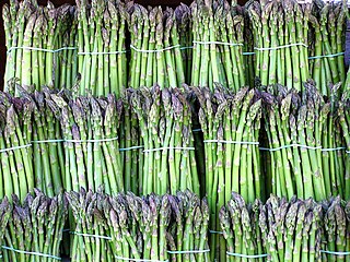
Asparagus, or garden asparagus, folk name sparrow grass, scientific name Asparagus officinalis, is a perennial flowering plant species in the genus Asparagus. Its young shoots are used as a spring vegetable.
Heavy groundwater extraction for public water supplies, for industry and for agriculture have, especially in dry periods (around 1976 and 1993), led to subsidence and damage to buildings and, especially in the forests and wetlands to damage to groundwater-dependent vegetation. This led to considerable disputes between the water companies, landowners, farmers, the forestry industry and conservation agencies. These conflicts were defused by the introduction of a more flexible management of groundwater extraction that is now oriented towards the groundwater-land relationship. In addition the Hessian Ried Water Association was founded in 1979 and had worked to improve the groundwater.

Groundwater is the water present beneath Earth's surface in soil pore spaces and in the fractures of rock formations. A unit of rock or an unconsolidated deposit is called an aquifer when it can yield a usable quantity of water. The depth at which soil pore spaces or fractures and voids in rock become completely saturated with water is called the water table. Groundwater is recharged from the surface; it may discharge from the surface naturally at springs and seeps, and can form oases or wetlands. Groundwater is also often withdrawn for agricultural, municipal, and industrial use by constructing and operating extraction wells. The study of the distribution and movement of groundwater is hydrogeology, also called groundwater hydrology.

Subsidence is the sudden sinking or gradual downward settling of the ground's surface with little or no horizontal motion. The definition of subsidence is not restricted by the rate, magnitude, or area involved in the downward movement. It may be caused by natural processes or by human activities. The former include various karst phenomena, thawing of permafrost, consolidation, oxidation of organic soils, slow crustal warping, normal faulting, caldera subsidence, or withdrawal of fluid lava from beneath a solid crust. The human activities include sub-surface mining or extraction of underground fluids, e. g. petroleum, natural gas, or groundwater. Ground subsidence is of global concern to geologists, geotechnical engineers, surveyors, engineers, urban planners, landowners, and the public in general.
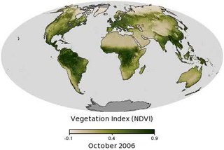
Vegetation is an assemblage of plant species and the ground cover they provide. It is a general term, without specific reference to particular taxa, life forms, structure, spatial extent, or any other specific botanical or geographic characteristics. It is broader than the term flora which refers to species composition. Perhaps the closest synonym is plant community, but vegetation can, and often does, refer to a wider range of spatial scales than that term does, including scales as large as the global. Primeval redwood forests, coastal mangrove stands, sphagnum bogs, desert soil crusts, roadside weed patches, wheat fields, cultivated gardens and lawns; all are encompassed by the term vegetation.
Bergstraße, pronounced ˈbɛɐkˌʃtʀaːsə, is a Kreis (district) in the south of Hesse, Germany. It is at the northern end of the Bergstraße route. Neighboring districts are Groß-Gerau, Darmstadt-Dieburg, Odenwaldkreis, Rhein-Neckar-Kreis, the urban district Mannheim, the Rhein-Pfalz-Kreis, and the urban district of Worms. Kreis Bergstraße belongs both to the Rhine Neckar Area and the Rhein-Main Region.

Bensheim is a town in the Bergstraße district in southern Hessen, Germany. Bensheim lies on the Bergstraße and at the edge of the Odenwald mountains while at the same time having an open view over the Rhine plain. With about 40,000 inhabitants (2016), it is the district's biggest town.
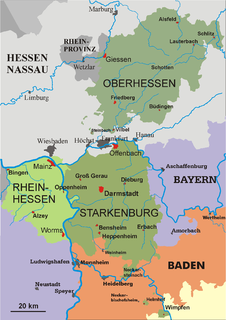
Starkenburg is an historical region in the State of Hesse, Germany, comprising the area south of the Main River and east of the Rhine, around the regional capital Darmstadt.

Zwingenberg lies in the Bergstraße district in southern Hesse, Germany, south of Frankfurt and Darmstadt, and with the granting of town rights coming in 1274 it is the oldest town on the Hessian Bergstraße.

Einhausen is a community in the Bergstraße district in Hesse, Germany, some 15 km east of Worms.

Biblis is a community in the Bergstraße district in southern Hessen, Germany.

The Bergstraße is 80-kilometre-long (50 mi) ancient trade route in the south-west of Germany. The route and the area around it is a mountainous "theme route" running north–south along the western edge of the Odenwald forest in southern Hesse and northern Baden-Württemberg. The route passes through the Bergstraße administrative district, and independent viticultural regions of Hessische Bergstraße and Badische Bergstraße. Between the cities of Heidelberg and Weinheim the Upper Rhine Railway Company (OEG) tram route runs alongside.

Lorsch is a town in the Bergstraße district in Hessen, Germany, 60 km south of Frankfurt. Lorsch is well known for the Lorsch Abbey, which has been named a World Heritage Site by UNESCO.

Riedstadt, with its municipal area of 73.76 km² is Groß-Gerau district's biggest town by land area. It lies in Hesse, Germany, about 12 km southwest of Darmstadt.

Bürstadt is a town in the Bergstraße district in southern Hesse, Germany, 7 km east of Worms, and 17 km north of Mannheim. In 1981, the town hosted the 21st Hessentag state festival.
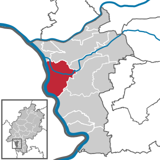
Trebur is a community in Groß-Gerau district in Hessen, Germany. It is 13 km southeast of Mainz, and 8 km south of Rüsselsheim.

Gernsheim is a town in Groß-Gerau district and Darmstadt region in Hesse, Germany, lying on the Rhine.
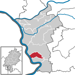
Stockstadt am Rhein is a community in Groß-Gerau district in Hesse, Germany, lying on the southern edge of the Frankfurt Rhein-Main Region.

Groß-Rohrheim is a community in the Bergstraße district in Hesse, Germany.
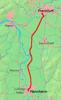
Mannheim–Frankfurt railway is a German standard gauge, electrified railway line and runs in southern Hesse and northern Baden-Württemberg between Frankfurt and Mannheim. It is also called the Riedbahn. The line runs through an area called the Hessische Ried, hence the name. The term Riedbahn was originally used for the Darmstadt–Worms railway and the two lines share the central section between Groß-Gerau and Biblis.
The Nibelung Railway is a 23.9 km long electrified line between Worms in the German state of Rhineland-Palatinate and Bensheim in Hesse. Its name refers to the fact that the line connects several places that play an important role in the Nibelung legend.
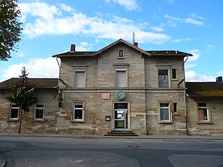
Riedstadt-Goddelau station, along with Riedstadt Wolfskehlen station, serves the town of Riedstadt in the south of the German state of Hesse on the Mannheim–Frankfurt railway and the Darmstadt–Worms railway. The station is classified by Deutsche Bahn as a category 4 station. It is served by local and S-Bahn trains.
The Darmstadt–Worms railway is a standard-gauge railway that is now partially closed. It runs through southern Hesse through the Hessian Ried and so it is also called the Riedbahn.

The Bergstraße-Odenwald Nature Park is a nature park in southern Germany with an area of 3,500 km² that lies between the rivers Rhine, Main (river) and Neckar. In the south it overlaps in places with the Neckar Valley-Odenwald Nature Park on the territory of Baden-Württemberg. In the east it meets the Bavarian Spessart Nature Park at the River Main. The nature park covers parts of the states of Baden-Württemberg, Bavaria and Hesse.
This page is based on this
Wikipedia article Text is available under the
CC BY-SA 4.0 license; additional terms may apply.
Images, videos and audio are available under their respective licenses.


