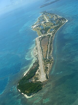
St. George's Caye is an island in the Caribbean Sea, eight miles east of Belize City. It is part of the Belize District of Belize, Central America. The village on the island is also known as St. George's Caye. As of 2000, St. George's Caye had a permanent population of about 20 people.
Sud (French) or Sid is one of the ten departments of Haiti and located in southern Haiti. It has an area of 2,653.60 square kilometres (1,024.56 sq mi) and a population of 774,976. Its capital is Les Cayes.

East Grand Bahama is a district of the Bahamas, situated on the eastern part of the island of Grand Bahama has a population collectively of 11,411 people.

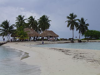
Grenadines is an administrative parish of Saint Vincent and the Grenadines, comprising the islands of the Grenadines other than those belonging to Grenada. The capital is Port Elizabeth.
Pedro Bank is a large bank of sand and coral, partially covered with seagrass, about 80 km south and southwest of Jamaica, rising steeply from a seabed of 800 metres depth. It slopes gently from the Pedro Cays to the west and north with depths from 13 to 30 metres. The total area of the bank within the 100-metre (328-foot) isobath measures 8,040 square kilometres. The area of a depth to 40 metres is triangular, 70 kilometres long east-west, and 43 kilometres wide. 2,400 square kilometres are less than 20 metres deep. With its islets, cays and rocks, a total land area of 270,000 m2 (2,906,256 sq ft), it is the location of one of the two offshore island groups of Jamaica, the other one being the Morant Cays. The bank is centered at 17°06′N78°20′W.
Goff's Caye is a small island off the shore of Belize City, Belize. It sits right on the edge of the Belize Barrier Reef with waters to the south and east being only 0.6 to 3 metres deep. Goff's Caye is registered as an archaeological site due to its colonial-era settlement. During the Colonial times, the island served as a fishing camp, trade center and cemetery. Among those interred in the cemetery are a number of crew members from HMS Blossom, who died of Yellow Fever during a visit to the colony in August 1830.
The Bay of Santa Clara is a bay on Cuba's north coast, located between the Nicholas Channel and the northern coast of the provinces of Matanzas and Villa Clara.
The Caribbean Coral Reef Ecosystems (CCRE) program began with a collaborative field project conceived by six National Museum of Natural History scientists during the early 1970s. The scientists interests included a range of disciplines central to reef ecology, including: invertebrate and vertebrate zoology, botany, carbonate geology, and paleobiology. The primary work site is the Carrie Bow Marine Field Station, a research station at Carrie Bow Caye on the Meso-American Barrier Reef in Belize. The program is an extended duration study of coral reefs, mangroves, sea grass meadows, and the sandy bottoms. It has been a functioning research program since the early 1970s when it was called the Investigations of Marine Shallow-Water Ecosystems (IMSWE).
Northern Caye is an island of the Lighthouse Reef Atoll 50 miles (80 km) off the coast of Belize. The former Lighthouse Reef Resort catered to scuba diving enthusiasts. The caye is noted for its saltwater crocodiles and snowy egrets.

Gladden Spit and Silk Cayes Marine Reserve (GSSCMR) is a protected marine reserve in the central part of Belize's Barrier Reef. It covers approximately 25,980 acres (10,510 ha) lying 36 kilometres (22 mi) off the coast of Placencia. Established in 2003, The reserve comes under the authority of the government's Fisheries Department, but is managed by the Southern Environmental Association, a community-based organisation.

Turneffe Atoll is located southeast of Ambergris Caye and Caye Caulker, off the coast of Belize in Central America, 20 miles from Belize City. It is one of three atolls of the Belize Barrier Reef, along with Glover's Reef and Lighthouse Reef. It is approximately 30 miles long and 10 miles wide, making it the largest coral atoll in Belize and in the Mesoamerican Barrier Reef System. The atoll was officially declared a marine reserve on November 22, 2012.

The extensive trade networks of the Ancient Maya contributed largely to the success of their civilization spanning three millennia. Maya royal control and the wide distribution of foreign and domestic commodities for both population sustenance and social affluence are hallmarks of the Maya visible throughout much of the iconography found in the archaeological record. In particular, moderately long-distance trade of foreign commodities from the Caribbean and Gulf Coasts provided the larger inland Maya cities with the resources they needed to sustain settled population levels in the several thousands. Though the ruling class essentially controlled the trade economy, a middle merchant class supervised import and export from cities and trade ports. Not much is known of the Maya merchant class; however, merchants of royal lineage are sometimes represented in the iconography. Notably, a canoe paddle often accompanies the royal merchant depictions, signifying their association with marine resources.

Lighthouse Reef is an atoll in the Caribbean Sea, the easternmost part of the Belize Barrier Reef and one of its three atolls, the other two being Turneffe Atoll and Glover's Reef. Lighthouse Reef is located about 80 kilometres (50 mi) southeast of Belize City. The atoll is of oblong shape, approximately 35 kilometres (22 mi) long from north to south, and about 8 kilometres (5.0 mi) wide. It forms a shallow sandy lagoon with an area of 120 square kilometres (46 sq mi) and a depth between 2 and 6 metres deep.
Harvest Caye is a private island owned by Norwegian Cruise Line, located in southern Belize. The caye features wildlife exhibitions including a blue morpho butterfly house.

The Principality of Islandia is an incipient micronation that claims Coffee Caye in the Caribbean Sea off the coast of Belize as its territory. Coffee Caye is a currently uninhabited island of 1.2 acres (0.5 ha) separated by a short boat trip from Belize City. Founded in 2018 by Gareth Johnson and Marshall Mayer, the project is the first attempt to create a micronation to be crowdfunded. At present the island, which is covered in mangroves and surrounded by coral reefs, can be rented for camping excursions.
This page is based on this
Wikipedia article Text is available under the
CC BY-SA 4.0 license; additional terms may apply.
Images, videos and audio are available under their respective licenses.