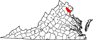
Prince William County lies beside the Potomac River in the Commonwealth of Virginia. At the 2020 census, the population was 482,204, making it Virginia's second most populous county. The county seat is the independent city of Manassas. A part of Northern Virginia, Prince William County is part of the Washington metropolitan area. In 2020, it had the 24th highest income of any county in the United States.

Catawba County is a county in the U.S. state of North Carolina. As of the 2020 census, the population was 160,610. Its county seat is Newton, and its largest community is Hickory.

Hickory County is located in the U.S. state of Missouri. As of the 2020 census, the population was 8,279. Its county seat is Hermitage. The county was organized February 14, 1845, and named after President Andrew Jackson, whose nickname was "Old Hickory." The Pomme de Terre Dam, a Corps of Engineers facility, is located three miles south of Hermitage and forms Lake Pomme de Terre by damming the Pomme de Terre River and Lindley Creek. Truman Reservoir, also a Corps of Engineers facility, floods the Pomme de Terre Reservoir from the northern border of the county southward to the city limits of Hermitage.

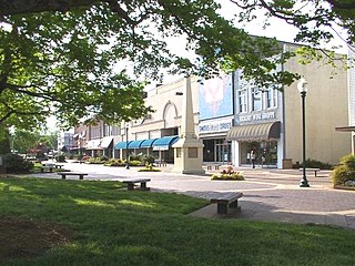
Hickory is a city in western North Carolina primarily located in Catawba County. The 25th most populous city in the state, it is located approximately 60 miles (97 km) northwest of Charlotte.

The Southwest Mountains of Virginia are a mountain range centered on Charlottesville, parallel to and geologically associated with the Blue Ridge Mountains, which lie about 30 miles (50 km) to the west. The range is breached by the Rivanna River between Monticello and Pantops Mountain. Some of the more prominent peaks include Carters Mountain, Fan Mountain, Brush Mountain, Peters Mountain, Walton's Mountain, and Hightop Mountain.

The West End is a part of Richmond, Virginia. Definitions of the bounds of the West End vary, it may include only the western part of the city of Richmond or extend as far as western Henrico County. As there is no one municipal organization that represents this specific region, the boundaries are loosely defined as being north of the James River, west of I-195, and south of Broad Street. Historically, the Richmond neighborhoods of the Fan and the Museum District were a part of the West End. A primary conduit through the West End is Interstate 64.
Chesapeake Public Schools (CPS), also known as Chesapeake City Public Schools, is the school division that administers public education in the United States city of Chesapeake, Virginia. The superintendent is Dr. Jared A. Cotton. On July 27, 2020, the division school board voted a 100% online start to the 2020–21 school year.

Toano, formerly Burnt Ordinary, is an unincorporated community in James City County, Virginia, United States. It is in Virginia’s 1st Congressional District.

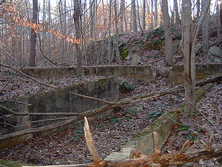
Hickory Ridge is an extinct unincorporated town in Prince William County, Virginia. The town was located on land that is now part of Prince William Forest Park, a National Park Service property located adjacent to Marine Corps Base Quantico. The town was established shortly after the opening of the now defunct Cabin Branch Pyrite Mine in 1889 and was home to many of the mine employees.
Batestown is an extinct unincorporated community in Prince William County, Virginia. The town was located along the farthest terminus of Batestown Road in what is now a western neighborhood of Dumfries along the banks of Quantico Creek. It was an enclave for freed slaves named for Mary Bates, the matriarch of the community.
The Southeastern District is a district of the Virginia High School League. The schools in the Southeastern District compete in the 6A, 5A, and 4A divisions.

Hickory Hill is a middle-class, predominantly African American community in the southeast region of Memphis, Tennessee, United States.
Fort Lewis Mountain is a mountain which stretches from Ironto in Montgomery County, Virginia to Masons Cove in Roanoke County, Virginia. The rural community of Bradshaw is located in the narrow valley between the south slope of Catawba Mountain and the north slope of Fort Lewis Mountain. The south slope of the mountain faces the western Roanoke Valley and is directly across from Poor Mountain. Fort Lewis Mountain is separated from Brushy Mountain by a narrow gap formed by Masons Creek. Brushy Mountain stretches in the same southwest to northeast direction for several more miles into Botetourt County, Virginia. Another narrow gap separates Fort Lewis Mountain from Little Brushy Mountain, a small 1,926 foot high peak, which is located in Roanoke County just north of Salem, Virginia.

Hickory High School is a high school in Chesapeake, Virginia. There are approximately 1,581 students. The mascot is a hawk and the school colors are teal, grey, white, and black.
Highland is an unincorporated community and census-designated place in Howard County, Maryland, United States. As of the 2020 census it had a population of 1,133. It uses the 20777 zip code.

Hickory Flat is an unincorporated community in southeastern Cherokee County, Georgia, United States. It geographic center is now a triangle formed by GA 140 on the north and east, Hickory Rd on the south, and East Cherokee Drive on the west. This triangle is now the business hub of the community with two shopping centers anchored by grocery stores. It also contains the Hickory Flat Public Library and the Sequoyah High School educational complex which includes feeder schools; Hickory Flat Elementary and Dean Rusk Middle School.
The Covenant School (TCS) is a private Christian school in Charlottesville, Virginia, in the United States. It is composed of the Birdwood Campus, which houses the Lower School, located in the former McIntire High School, and the Hickory Campus, which is home to the Middle and Upper Schools. The Hickory Campus is in Albemarle County in a building completed in 2002.
Springwood is an unincorporated community in Botetourt County, Virginia, United States. Located in the northern part of the Roanoke Valley and at the southern tip of the Shenandoah Valley, Springwood is part of the Roanoke Metropolitan Area and sits along the banks of the James River.

Hickory Hill is an estate in Hanover County, Virginia. The 3,300 acre former plantation is located approximately 20 miles (32 km) north of the independent city of Richmond and 5 miles (8.0 km) east of the incorporated town of Ashland. The property was listed in the National Register of Historic Places and the Virginia Landmarks Register in 1974.


