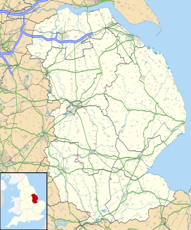
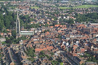
Horncastle is a market town and civil parish in the East Lindsey district in Lincolnshire, England. It is 17 miles (27 km) east of Lincoln. Its population was 6,815 at the 2011 census and estimated at 7,123 in 2019. A section of the ancient Roman walls remains.
East Lindsey is a local government district in Lincolnshire, England. Its council is based in Horncastle and the largest town is Skegness. Other towns include Alford, Burgh le Marsh, Coningsby, Louth, Mablethorpe, Spilsby, Sutton on Sea, Wainfleet All Saints, Wragby and Woodhall Spa. The district also covers a large rural area, including many smaller settlements.
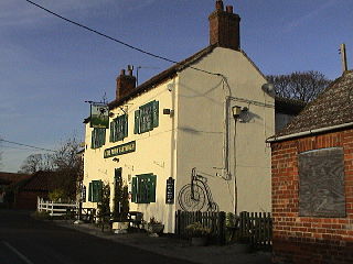
Timberland is a village in the North Kesteven district of Lincolnshire, England. The population of the civil parish at the 2011 census was 578. It is situated 9 miles (14 km) north-east from Sleaford, and on the Timberland Fen. Its closest neighbouring village is Martin, less than 1 mile (1.6 km) to the north.
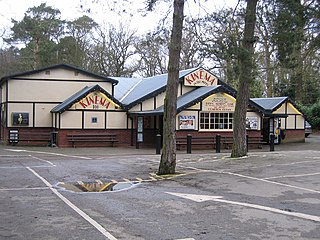
Woodhall Spa is a former spa town and civil parish in the East Lindsey district of Lincolnshire, England, on the southern edge of the Lincolnshire Wolds, 6 miles (10 km) south-west of Horncastle, 23 miles (37 km) west of Skegness, 15 miles (24 km) east-south-east of Lincoln and 17 miles (27 km) north-west of Boston. It is noted for its mineral springs, historic cinema and its Second World War association with the RAF 617 Squadron, commonly referred to as 'The Dambusters'.

Roughton is a village and civil parish in the East Lindsey district of Lincolnshire, England. The parish population was 644 in 2011.

Royal Air Force Woodhall Spa, or more simply RAF Woodhall Spa, is a former Royal Air Force satellite station located 2 miles (3.2 km) north of Coningsby, Lincolnshire and 16 miles (26 km) southeast of Lincoln, Lincolnshire, England.

Kirkby on Bain is a village and civil parish in the East Lindsey district of Lincolnshire, England. It lies on the River Bain between Horncastle and Coningsby, and just west of the A153 road. Close to the north is the village of Haltham. In 2011 the parish had a population of 295.
Woodhall or Wood Hall may refer to:

Old Woodhall or Woodhall, is a village and former civil parish, now in the parish of Stixwould and Woodhall, in the East Lindsey district, in the county of Lincolnshire, England. It is located about 3 miles (4.8 km) south west of Horncastle. In 1961 the parish had a population of 123.

Woodhall Spa railway station was a station in Woodhall Spa, Lincolnshire on a small branch line running north from Woodhall Junction to Horncastle. Both the station and the line are now closed.

Ostler's Plantation is a woodland east of Woodhall Spa, Lincolnshire on Kirkby Moor. It has public access and lies to the west of an open area of Lowland Heath, the Kirkby Moor Nature Reserve; both are noted for having large numbers of adders.

Stixwould is a small village in the civil parish of Stixwould and Woodhall, in the East Lindsey district of Lincolnshire, England.

Tattershall Thorpe is a hamlet and civil parish in the East Lindsey district of Lincolnshire, England. It is situated approximately 3 miles (5 km) south from Woodhall Spa, and 1 mile (1.6 km) north-east from Tattershall.
The geology of Lincolnshire in eastern England largely consists of an easterly dipping succession of Mesozoic age sedimentary rocks, obscured across large parts of the county by unconsolidated deposits dating from the last few hundred thousand years of the present Quaternary Period.
St Hugh's School is a coeducational, preparatory school in the village of Woodhall Spa, Lincolnshire, England, founded in 1925. It was originally known as a boarding school, although a significant proportion of its students are now day pupils or flexi-boarders. The headmaster is Jeremy Wyld, who has been in post since September 2019.
Wellsyke Wood is a small woodland on Roughton Moor to the east of the village of Woodhall Spa, Lincolnshire.
Big Rous Holt is a small woodland beside the B1191 to the north east of the village of Woodhall Spa in Lincolnshire on Roughton Moor. To its south west is Little Rous Holt, and bordering it to the north east is Roughton Scrubs.
Roughton Scrubs is a small woodland beside the B1191 to the north east of the village of Woodhall Spa in Lincolnshire on Roughton Moor. Bordering it to the south west is Big Rouse Holt with the area to the north across Horncastle Road known as The Wilderness where can be found evidence of medieval Ridge and Furrow farming surrounding the embankment of the long abandoned Woodhall Spa to Horncastle railway.
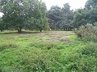
Kirkby Moor is an elevated area of lowland heath, woodland and farmland in central Lincolnshire between the villages of Woodhall Spa to the west and Kirkby on Bain to the east. Roughton Moor lies to the north and the former RAF Woodhall Spa and the Lincolnshire Fens beyond to the south.
