Related Research Articles

Coosan is a townland and suburb just north of Athlone, County Westmeath in Ireland. The suburb is surrounded on three sides by Lough Ree and on one side by Athlone.

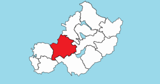
Rathconrath, previously the barony of Rathcomyrta, before that Daltons country, is a barony in the west of County Westmeath, in the Republic of Ireland. It was formed by 1542. It is bordered by County Longford to the north–west and five other Westmeath baronies: Moygoish to the north, Moyashel and Magheradernon to the east, Moycashel and Clonlonan to the south and Kilkenny West to the west. Note that the village of Rathconrath is not synonymous with the barony of the same name.

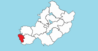
Kilkenny West, previously Maherquirke or Dillons country, is a barony in west County Westmeath, Ireland. It was formed by 1542. It is bordered by County Longford to the west; it is also bordered by three other Westmeath baronies: Rathconrath, Brawny and Clonlonan. The largest centre of population in the barony is the village of Glassan.

Brawny is a barony in south–west County Westmeath, Ireland. It was formed by 1672. It is bordered by County Roscommon to the west. It also borders two other Westmeath baronies: Kilkenny West and Clonlonan. The largest centre of population in the barony is the town of Athlone.

Clonlonan is a barony in south–west County Westmeath, Ireland. It was formed by 1672. It is bordered by County Offaly to the south and a small part of County Roscommon at Long Island on the River Shannon to the west. It also borders four other Westmeath baronies: Kilkenny West and Rathconrath, Moycashel and Brawny. The largest centre of population in the barony is the town of Moate.
Leny is a townland in County Westmeath, Ireland. It is located about 12 kilometres (7 mi) north–west of Mullingar. This name also applies to the civil parish of Leny. Not to be confused with the Falls of Leny in Scotland.
Kilpatrick is a townland in County Westmeath, Ireland. It is located about 10 kilometres (6 mi) north-west of Mullingar. The name Kilpatrick also applies to four other townlands in County Westmeath.
Tyfarnham is a civil parish in County Westmeath, Ireland. It is located about 7.5 kilometres (5 mi) north of Mullingar.
Down is a townland in County Westmeath, Ireland. It is located about 8.17 kilometres (5 mi) north of Mullingar.

Golden Island Shopping Centre is a shopping centre located on the outskirts of Athlone, County Westmeath, Ireland.
Gaulstown, also spelt Gallstown is a townland in County Westmeath, Ireland. The townland is located in between the towns of Rochfortbridge and Milltownpass, close to the R446 regional road.. Neighbouring townlands include Bellfield, Corcloon, Drumman, Milltown and Windmill to the east, Gibbonstown and Gortumly to the west and Mahonstown to the north.

Dalystown is a village in Carrick, County Westmeath, Ireland. It is located in the south of the county on the N52 road, to the north of Tyrrellspass and Rochfortbridge.
Cloghanboy(Strain) is a townland in Athlone, County Westmeath, Ireland. The townland is in the civil parish of St. Mary's.
Killmacuagh (Cooke) is a townland in Athlone, County Westmeath, Ireland. The townland is in the civil parish of St. Mary's.
Loughanaskin is a townland in Athlone, County Westmeath, Ireland. The townland is in the civil parish of St. Mary's.

Moydrum is a townland near Athlone, County Westmeath, Ireland. The townland is in the civil parishs of St. Mary's and Ballyloughloe (Clonlonan).
Ardivaghan is a small townland in Mullingar in County Westmeath, Ireland. The townland is approximately 0.3 square kilometres (0.12 sq mi) in size. It is located to the north-west of the town, and is bordered by Irishtown to the north, Grange North to the south, Sarsanstown to the east and Walshestown South to the west. No population was recorded for the townland in the 2011 census.
Gaybrook Demesne more commonly known as Gaybrook is a townland in the civil parish of Enniscoffey in County Westmeath, Ireland.

Ballinea or Ballina, is a village and townland in County Westmeath, Ireland. It is located to the west of Mullingar, on the R390 road. The Royal Canal flows through the village, with the Ballinea Bridge being used to cross to the western side.
Claremount also known as Cummingstown is a townland in the civil parish of Enniscoffey in County Westmeath, Ireland.
References
- ↑ "Hillquarter Townland, Co. Westmeath". www.townlands.ie. Retrieved 1 June 2020.
- ↑ "Hillquarter". Logainm.ie. Retrieved 1 June 2020.
- ↑ "The Tithe Applotment Books, 1823-37". titheapplotmentbooks.nationalarchives.ie. Retrieved 1 June 2020.
- ↑ "Relation History: Hillquarter (4175063)". OpenStreetMap. Retrieved 1 June 2020.