One Tree Hill is a town on the outskirts of Adelaide, South Australia. It is located in the City of Playford.

The City of Port Adelaide Enfield, located across inner north and north-western suburbs of Adelaide, is one of the largest metropolitan councils within South Australia. It was established on 26 March 1996 by the amalgamation of the City of Port Adelaide and the City of Enfield.

The Town of Gawler is a local government area located north of Adelaide city centre in South Australia containing Gawler and its suburbs. The corporate town was established in 1857 due to the township's residents' dissatisfaction at being governed by three different district councils.
Glengowrie is a suburb of the Australian city of Adelaide, approximately 12 kilometres south west of the city centre. The name Glengowrie means "Glen of Gowrie", so called in honour of Lord Gowrie, Governor-General of Australia from 1936-1944.

Prospect is the seat of the City of Prospect and an inner northern suburb of greater Adelaide. It is located 5 km (3.1 mi) north of Adelaide's centre.

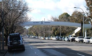
Wayville is an inner-southern suburb of Adelaide in the City of Unley. It is most notable for hosting of the Royal Adelaide Show at the Adelaide Showgrounds.

Ferryden Park is a north-western suburb of Adelaide 6.3 km from the central business district, in the state of South Australia, Australia. Situated in the City of Port Adelaide Enfield local government area, it is adjacent to Kilkenny, Angle Park, Woodville Gardens, Croydon Park, and Regency Park. It is bounded to the north by Murray Street, west by Liberty Grove and Hassell Street, south by Regency Road and to the east by Days Road.
The City of Adelaide is a local government area in the metropolitan area of Adelaide, South Australia. It covers the original Adelaide city centre,, North Adelaide, and the Adelaide Park Lands which surround North Adelaide and the city centre.

The City of Holdfast Bay is a local government area in the south-western coastal suburbs of Adelaide, South Australia.

Light Square also known as Wauwi is one of five squares in the City of Adelaide. Located in the centre of the north-western quarter of the Adelaide city centre, the Square is named after the city's planner, Colonel William Light.

Rymill Park, also known as Park 14 and Mullawirraburka in Kaurna, is a recreation park located in the East Park Lands of the South Australian capital of Adelaide. It is bordered by East and Dequetteville Terraces, and Rundle and Bartels Roads. It is in close proximity to the Adelaide Botanic Garden, Hutt Street, Rundle park and Victoria Park.
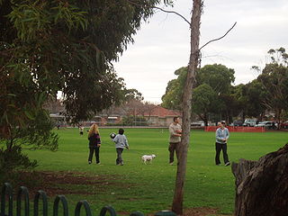
Victoria Park, also known as Park 16 and Pakapakanthi, is a park located in the Southeastern Park Lands of the South Australian capital of Adelaide. It is bordered by Fullarton Road, Greenhill Road, East Terrace and Wakefield Road. It hosts a variety of major events throughout the year, the most prominent of which being the Adelaide 500/Clipsal 500.
Park 10, also known as Bullrush Park and Warnpangga is one of the Adelaide Park Lands in the city of Adelaide, South Australia. It is one of the few parks to still be known most commonly by its assigned number, and is enclosed by McKinnon Parade, Bundey's Road, War Memorial Drive and Frome Road. The park is used extensively by University of Adelaide sporting clubs.
Rundle Park, also known as Park 13 and by its Kaurna name Kadlitpina/Kadlitpinna, is a part of the Adelaide Park Lands in Adelaide, South Australia. The park is bounded by East Terrace, Botanic Road (north), Dequetteville Terrace (east) and Rundle Road (south).

The Himeji City Tegarayama Botanical Garden, also known as the Himeji Tegarayama Green House, is a botanical garden located within a greenhouse in Tegarayama Central Park at 93 Tegara, Himeji, Hyogo, Japan.

Para Wirra Conservation Park is a 1,417-hectare (3,500-acre) protected area located in the foothills of the Mount Lofty Ranges in the northern end of the Adelaide metropolitan area in South Australia. The conservation park is part of a larger, 2,573-hectare (6,360-acre) block of contiguous native vegetation, the remainder of which is owned by PIRSA Forestry, SA Water and private landholders.

East Terrace marks the eastern edge of the city centre of Adelaide, the capital city of South Australia. It is one of the main north-south thoroughfares through the east side of the city. Although the terrace essentially runs north-south between North Terrace and South Terrace, unlike Adelaide's other three terraces, its path is far from a straight line; travelling the entire length of East Terrace requires turning at right angles at most intersections. After crossing South Terrace, the street continues through the parklands as Beaumont Road, but unlike other roads through the parklands it is not a thoroughfare; there is a break in the middle of it.

Salisbury is a northern suburb in Adelaide, South Australia. It is the seat of the City of Salisbury, and in the South Australian Legislative Assembly electoral district of Ramsay and the Australian House of Representatives divisions of Wakefield and Port Adelaide. The suburb is a service area for the City of Salisbury district, with an abundance of parklands, shops, cafes and restaurants. Parabanks Shopping Centre is also located in Salisbury, which includes Woolworths, Coles and Big W as its signature retailers..