Eswatini, officially the Kingdom of Eswatini and also known by its former official name Swaziland and formerly the Kingdom of Swaziland, is a landlocked country in Southern Africa. It is bordered by Mozambique to its northeast and South Africa to its north, west, south, and southeast. At no more than 200 km (120 mi) north to south and 130 km (81 mi) east to west, Eswatini is one of the smallest countries in Africa; despite this, its climate and topography are diverse, ranging from a cool and mountainous highveld to a hot and dry lowveld.
Artifacts indicating human activity dating back to the early Stone Age have been found in the Kingdom of Eswatini. The earliest known inhabitants of the region were Khoisan hunter-gatherers. Later, the population became predominantly Nguni during and after the great Bantu migrations. People speaking languages ancestral to the current Sotho and Nguni languages began settling no later than the 11th century. The country now derives its name from a later king named Mswati II. Mswati II was the greatest of the fighting kings of Eswatini, and he greatly extended the area of the country to twice its current size. The people of Eswatini largely belong to a number of clans that can be categorized as Emakhandzambili, Bemdzabu, and Emafikamuva, depending on when and how they settled in Eswatini.
The flag of Eswatini was adopted on 6 October 1968 after Eswatini gained independence from the British Empire one month before. The design by King Sobhuza II features a black and white shield, with a staff and two spears, on a field of blue, yellow, and red horizontal bands.
Hlathikulu Forest is a coastal scarp forest in the Lebombo Mountains of South Africa, between Ingwavuma and the Pongola Gorge. The forest is also known as the Gwaliweni Forest. The forest is part of the IUCN's Maputaland Centre of Plant Endemism

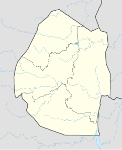
Hhohho is a region of Eswatini, located in the north western part of the country. Hhohho was named after the capital of King Mswati II, who expanded the Swazi territory to the north and west, taking in the districts of Barberton, Nelspruit, Carolina and Piet Retief. These areas were later acquired by what was the Province of Transvaal and today they form part of the Mpumalanga Province of South Africa. It has an area of 3,625.17 km², a population of 320,651 (2017), and is divided into 14 tinkhundla. The administrative center is the national capital of Mbabane. It borders Lubombo Region on the southeast and Manzini Region in the southwest.

The Maputo River, also called Great Usutu River, Lusutfu River, or Suthu River, is a river in South Africa, Eswatini, and Mozambique. The name Suthu refers to Basotho people who lived near the source of the river, but were attacked and displaced by the Swazis. It is also said to mean 'dark brown', a description of the river's muddy water.
"Nkulunkulu Mnikati wetibusiso temaSwati" is the national anthem of Eswatini. It is a compromise between Swazi and Western styles of music and was adopted after independence in 1968. The lyrics were authored by Andrease Enoke Fanyana Kukies Simelane, and the composer of the tune was David Kenneth Rycroft.
The Eswatini national football team, nicknamed Sihlangu Semnikati, represents Eswatini, formerly known as Swaziland, in international football and is controlled by the Eswatini Football Association. It has never qualified for the World Cup or the Africa Cup of Nations finals. Swaziland's best performance in an international tournament is a semi-final finish in the COSAFA Cup.

Lobamba is a city in Eswatini, and is one of the two capitals, serving as the legislative, traditional, spiritual, seat of government of the Parliament of Eswatini, and Ludzidzini Royal Village, the residence of Queen Ntfombi, the Queen Mother.

Manzini is a large city in Eswatini (Swaziland), which is also the city of Eswatini's Manzini Region. The city is the country's second largest urban center behind the capital Mbabane, with a population of 110,000 (2008). It is known as "The Hub" of Eswatini and lies on the MR3 road. Eswatini's primary industrial site at Matsapha lies near the town's western border.

Kaapschehoop or Kaapsehoop is a village situated in Mpumalanga province of South Africa.
Bulembu is a small town located in northwestern Hhohho, Eswatini, 10 km west of the town of Piggs Peak and close to the border with South Africa. Located above the Komati Valley in Eswatini's Highveld, Bulembu is named after the siSwati word for a spider's web.

Haudivillers is a commune in the Oise department in northern France.

The N17 is a national route in South Africa which runs from Johannesburg to Oshoek (Ngwenya) on the border with Eswatini. It passes through Springs, Bethal and Ermelo.
The Eswatini AIDS Support Organisation, It is the first organized group of people living with HIV in Eswatini, established in 1993 under the auspices of The AIDS Information Center (TASC). Its mandate is to bring hope through positive living.
Kwaluseni is an inkhundla of Eswatini, located in the Manzini District. Its population as of the 2007 census was 41,780. It is divided in two imiphakatsi:

The Zambezian and mopane woodlands is a tropical and subtropical grasslands, savannas, and shrublands ecoregion of southeastern Africa.
Eswatini Bank, also known as Eswatini Development & Savings Bank (EDSP), is a development finance institution, which doubles as a commercial bank in Eswatini. It is licensed and supervised by the Central Bank of Eswatini, the national banking regulator. As of April 2019 Eswatini Bank was the only indigenous commercial bank in the country, with the other three having their headquarters in neighboring South Africa.
Eswatini remained a British protectorate throughout World War II. As such, it fought alongside the Allies against the Axis. While no large scale battles or major military operations took place in or around Eswatini, the colony did supply the Allies with troops during the war. World War II was also responsible for several important domestic developments in Eswatini.