The North American Aviation P-51 Mustang is an American long-range, single-seat fighter and fighter-bomber used during World War II and the Korean War, among other conflicts. The Mustang was designed in April 1940 by a team headed by James H. Kindelberger of North American Aviation (NAA) in response to a requirement of the British Purchasing Commission. The commission approached NAA to build Curtiss P-40 fighters under license for the Royal Air Force (RAF). Rather than build an old design from another company, NAA proposed the design and production of a more modern fighter. The prototype NA-73X airframe was completed on 9 September 1940, 102 days after contract signing, achieving its first flight on 26 October.

The Bakerloo line is a London Underground line that runs from Harrow & Wealdstone in suburban north-west London to Elephant & Castle in south London, via the West End. Printed in brown on the Tube map, it serves 25 stations, 15 of which are underground, over 23.2 kilometres (14.4 mi). It runs partly on the surface and partly through deep-level tube tunnels.

Regent's Park is one of the Royal Parks of London. It occupies 410 acres (170 ha) in north-west Inner London, administratively split between the City of Westminster and the Borough of Camden. In addition to its large central parkland and ornamental lake, it contains various structures and organizations both public and private, generally on its periphery, including Regent's University and London Zoo.

Haymarket is a street in the St James's area of the City of Westminster, London. It runs from Piccadilly Circus in the north to Pall Mall at the southern end. Located on the street are the Theatre Royal, His Majesty's Theatre, New Zealand House, a cinema complex and restaurants.

London Guildhall University was a university in the United Kingdom from 1992 to 2002, established when the City of London Polytechnic was awarded university status. On 1 August 2002, it merged with the University of North London to form London Metropolitan University. The former London Guildhall University premises now form the new university's City campus, situated on various sites in the City of London.

Cannizaro Park is a public park in Wimbledon in the London Borough of Merton. Located towards the south-western edge of Wimbledon Common, it is known for its ornamental landscaped gardens with ponds and sculpture.

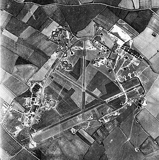
Royal Air Force Chelveston or more simply RAF Chelveston is a former Royal Air Force station located on the south side of the B645, 5 miles (8.0 km) east of Wellingborough, near the village of Chelveston in Northamptonshire, England. During the Second World War the airfield was occupied by both the Royal Air Force and the United States Army Air Forces. It was given the USAAF designation Station 105.

Westonbirt House is a country house in Gloucestershire, England, about 3 miles (5 km) southwest of the town of Tetbury. It belonged to the Holford family from 1665 until 1926. The first house on the site was an Elizabethan manor house. The Holfords replaced it first with a Georgian house, and then Robert Stayner Holford, who inherited Westonbirt in 1839, replaced that house between 1863 and 1870 with the present mansion which was designed by Lewis Vulliamy. He also remodelled the gardens, diverted the main road and relocated the villagers.

Hammersmith Hospital, formerly the Military Orthopaedic Hospital, and later the Special Surgical Hospital, is a major teaching hospital in White City, West London. It is part of Imperial College Healthcare NHS Trust in the London Borough of Hammersmith and Fulham, and is associated with the Imperial College Faculty of Medicine. Confusingly the hospital is not in Hammersmith but is located in White City adjacent to Wormwood Scrubs and East Acton.

Albany Street is a road in London running from Marylebone Road to Gloucester Gate following the east side of Regent's Park. It is about three-quarters of a mile in length.
There are several long-established Nordic churches in London. All seek to provide Lutheran Christian worship and pastoral care to their respective national communities in their own languages. Many of the churches also organise language classes and organise a wide range of social activities.

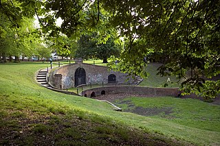
Carshalton Park is a public park in Carshalton, in the London Borough of Sutton. It is situated south of the High Street, in the area bounded by Ruskin Road, Ashcombe Road, Woodstock Road and The Park. Carshalton Park and some of the surrounding houses, are within a conservation area.

Portland Place is a street in the Marylebone district of central London. Named after the 3rd Duke of Portland, the unusually wide street is home to the BBC's headquarters Broadcasting House, the Chinese and Polish embassies, the Royal Institute of British Architects and numerous residential mansion blocks.
The bombing of Sandhurst Road School occurred during an air raid on Wednesday, 20 January 1943 when the school on Ardgowan Road, Catford, south east London was seriously damaged. A German fighter-bomber dropped a single 500-kilogram (1,100 lb) bomb on the school at 12:30 pm, killing 38 children and 6 staff and injuring another 60 people. Many were buried for hours under the rubble.
Regent's Park College dates to the foundation of the London Baptist Education Society in 1752. The appointment of the first Principal came in 1810 when the college moved to Stepney, East London. In 1855, under the then-president, Dr Joseph Angus, the college moved to Holford House in the centre of Regent's Park, London, where it operated as a Constituent College of the University of London. In 1927, the college moved to Oxford, with the first students arriving in 1928, and matriculating under name of the then St Catherine's Society, later St Catherine's College, Oxford. After taking advantage of links with both St Catherine's Society and Mansfield College, Oxford, to matriculate undergraduates for study within the university, the college became a permanent private hall of the University of Oxford in 1957.

Staveley Road is a road in Chiswick in the London Borough of Hounslow which was the site of the first successful V-2 missile attack against Britain.

St. Mark's Church is located in the Borough of Camden, London, near Regent's Park on Prince Albert Road and Regent's Park Road in Primrose Hill. Built in 1851-2, it was consecrated in 1853 and belongs to the Diocese of London within the Church of England. Originally designed by Thomas Little, alterations in 1888-90 were made by Arthur Blomfield, it is constructed of Kentish ragstone in the early English style.

Nuffield Lodge is a house on Prince Albert Road, Regent's Park, London, England. It is Grade I listed. Both the house and its gardens fall within Regent's Park, which is Grade I listed on the Register of Historic Parks and Gardens. It is owned by the Sultan of Oman.

Bartlett's Buildings, once known as Bartlett's Court, was the name of a street, off Holborn Circus in the City of London, known for the number of lawyers who had offices there. It was a cul-de-sac but an alley ran from the west side to Fetter Lane that was known as Bartlett's Passage. It was destroyed in 1941 during a Second World War air raid.

The Baptist College, Stepney, was opened in Stepney in the East End of London in 1810 by the Particular Baptists. Its buildings included rooms for tutors and students, a refectory, a library and a chapel. The college relocated to larger premises at Holford House in 1856 and became Regent's Park College.


