Holywood (District Electoral Area)

Last updated
Holywood DEA (1993-2014) within North Down North Down 1993 Holywood highlight.svg
Holywood DEA (1993-2014) within North Down

Holywood was one of the four district electoral areas in North Down, Northern Ireland which existed from 1985 to 2014. The district elected five members to North Down Borough Council and formed part of the North Down constituencies for the Northern Ireland Assembly and UK Parliament.

Contents

It was created for the 1985 local elections, replacing North Down Area D which had existed since 1973, and contained the wards of Craigavad, Cultra, Holywood Demesne, Holywood Priory and Loughview. It was abolished for the 2014 local elections and replaced by the Holywood and Clandeboye DEA.

Councillors

ElectionCouncillor
(Party)
Councillor
(Party)
Councillor
(Party)
Councillor
(Party)
Councillor
(Party)
2011 Andrew Muir
(Alliance)
Laurence Thompson
(Alliance)
Ellie McKay
(UUP)
Jennifer Gilmour
(DUP)
Gordon Dunne
(DUP)
2005 David Alderdice
(Alliance)
Ian Parsley
(Alliance)
Diana Peacocke
(UUP)
2001 Susan O'Brien
(Alliance)
Dennis Ogborn
(Independent)
1997 Richard Good
(Alliance)
1993 Laurence Kennedy
(Conservative)
James White
(Independent)
1989 Gordon Dunne
(DUP)
1985 Michael Clarke
(Alliance)
John Auld
(UUP)

2011 Election

2005: 2 x UUP, 2 x Alliance, 1 x DUP

2011: 2 x Alliance, 2 x DUP, 1 x UUP

2005-2011 Change: DUP gain from UUP

Holywood - 5 seats [1]
PartyCandidateFPv%Count
123456
DUP Gordon Dunne *24.79%1,081     
Alliance Andrew Muir 22.73%991     
UUP Ellie McKay*15.48%675739.94    
Alliance Laurence Thompson9.20%401414.26 645.65 810.65  
DUP Jennifer Gilmour5.78%252449.52 503.03 627.22 658.54 668.66
Green (NI) John Barry 12.04%525533.5 550.78 611.2 663.4 665.6
UUP Gillian McGimpsey5.73%250262.92 268.05    
NI Conservatives David O'Callaghan4.24%185189.76 192.73    
Electorate: 9,433  Valid: 4,360 (46.22%)  Spoilt: 76  Quota: 727  Turnout: 4,436 (47.03%)  

    2005 Election

    2001: 2 x UUP, 1 x Alliance, 1 x DUP, 1 x Independent

    2005: 2 x UUP, 2 x Alliance, 1 x DUP

    2001-2005 Change: Alliance gain from Independent

    Holywood - 5 seats [2]
    PartyCandidateFPv%Count
    12345
    DUP Gordon Dunne *25.42%1,282    
    Alliance David Alderdice 24.58%1,240    
    UUP Ellie McKay*19.81%999    
    UUP Diana Peacocke*11.95%603954   
    Alliance Ian Parsley 6.80%343379.45 714.01 830.65 903.55
    Green (NI) John Barry 11.44%577629.65 691.19 731.75 771.35
    Electorate: 9,107  Valid: 5,044 (55.39%)  Spoilt: 83  Quota: 841  Turnout: 5,127 (56.30%)  

      2001 Election

      1997: 2 x Alliance, 1 x UUP, 1 x DUP, 1 x Independent

      2001: 2 x UUP, 1 x Alliance, 1 x DUP, 1 x Independent

      1997-2001 Change: UUP gain from Alliance

      Holywood - 5 seats [3]
      PartyCandidateFPv%Count
      123456
      UUP Ellie McKay*21.98%1,346     
      Alliance Susan O'Brien*17.47%1,070     
      DUP Gordon Dunne *14.96%916954.25 998.5 1,021.5  
      Independent Dennis Ogborn*13.31%815863.75 868.5 905.75 977.5 1,110.5
      UUP Diana Peacocke8.02%491673.25 696.25 764.25 806.75 904.5
      NI Women's Coalition Norma Heaton8.31%509521.75 525.75 539.5 575 751.25
      Alliance Laurence Thompson7.12%436448.5 453.25 472.5 513.5  
      Independent Robert Irvine3.79%232241 259.25 270.5   
      NI Conservatives Lindsay Cumming3.07%188196.5 202.75    
      PUP David Rose 1.99%122126     
      Electorate: 10,063  Valid: 6,125 (60.87%)  Spoilt: 124  Quota: 1,021  Turnout: 6,249 (62.10%)  

        1993 Election

        1993: 2 x Independent, 1 x Alliance, 1 x UUP, 1 x Conservative

        1997: 2 x Alliance, 1 x UUP, 1 x DUP, 1 x Independent

        1993-1997 Change: Alliance and DUP gain from Conservative and Independent

        Holywood - 5 seats [4]
        PartyCandidateFPv%Count
        123456
        UUP Ellie McKay*22.31%863     
        Alliance Susan O'Brien*19.82%767     
        Independent Dennis Ogborn*14.09%545594.66 608.26 630.3 677.5 
        DUP Gordon Dunne 10.78%417474.72 477.12 570.44 644.08 694.08
        Alliance Richard Good11.22%434449.08 544.92 560.42 607.8 643.48
        Independent James White*7.21%279297.2 300.4 309.18 317.72 442.62
        Independent Bobby Irvine6.20%240248.58 251.3 259.3 274.38  
        NI Conservatives Jennifer Cumming4.26%165199.58 201.5 233.88   
        UK Unionist Jeffrey Dudgeon 4.11%159187.6 188.24    
        Electorate: 10,434  Valid: 3,869 (37.08%)  Spoilt: 52  Quota: 645  Turnout: 3,921 (37.58%)  

          1993 Election

          1989: 1 x Alliance, 1 x Conservative, 1 x UUP, 1 x DUP, 1 x Independent

          1993: 2 x Independent, 1 x Alliance, 1 x UUP, 1 x Conservative

          1989-1993 Change: Independent gain from DUP

          Holywood - 5 seats [5]
          PartyCandidateFPv%Count
          123456
          Independent Dennis Ogborn*19.70%871     
          UUP Ellie McKay*18.89%835     
          Alliance Susan O'Brien*15.27%675721.24 723.73 738  
          Independent James White7.69%340353.76 358.92 366.84 623.76 737.76
          NI Conservatives Laurence Kennedy*9.36%414442.48 524.56 551.92 565.56 680.68
          DUP Gordon Dunne*11.83%523537.4 548.88 582 600.96 615.76
          Alliance John Coates7.67%339354.68 364.84 369.88 382.44  
          Independent Robert Irvine7.01%310318.16 322.16 327.8   
          NI Conservatives Lindsay Cumming2.58%114117.68     
          Electorate: 10,411  Valid: 4,421 (42.46%)  Spoilt: 89  Quota: 737  Turnout: 4,510 (43.32%)  

            1989 Election

            1985: 2 x UUP, 2 x Alliance, 1 x DUP

            1989: 1 x Alliance, 1 x Conservative, 1 x UUP, 1 x DUP, 1 x Independent

            1985-1989 Change: Conservative and Independent gain from UUP and Alliance

            Holywood - 5 seats [6]
            PartyCandidateFPv%Count
            123456
            NI Conservatives Laurence Kennedy16.14%775852    
            UUP Ellie McKay*12.27%589641 694 704.12 1,035.12 
            Independent Dennis Ogborn14.47%695712 755 764.2 804.2 
            DUP Gordon Dunne *11.68%561564 576 578.76 659.28 805.28
            Alliance Susan O'Brien*13.74%660670 696 701.52 732.96 754.96
            Alliance Paul De Haan11.50%552559 585 592.36 626.12 659.12
            UUP John Auld*9.85%473498 549 564.64   
            NI Conservatives Alice Kennedy5.60%269299     
            NI Conservatives Michael Weir2.81%135     
            UUP Ian Sinclair*1.94%93     
            Electorate: 10,290  Valid: 4,802 (46.67%)  Spoilt: 116  Quota: 801  Turnout: 4,918 (47.79%)  

              1985 Election

              1985: 2 x UUP, 2 x Alliance, 1 x DUP

              Holywood - 5 seats [7]
              PartyCandidateFPv%Count
              1234
              UUP Ellie McKay*16.36%786944  
              UUP John Auld*16.32%784882  
              DUP Gordon Dunne *13.62%654813  
              Alliance Susan O'Brien*15.93%765793 819 
              Alliance Michael Clarke*14.62%702720 738 758
              Independent Dennis Ogborn12.18%585629 675 694
              UPUP James White6.45%310   
              UUP Roger Lomas2.39%115   
              DUP Elizabeth Graham2.12%102   
              Electorate: 9,824  Valid: 4,803 (48.89%)  Spoilt: 93  Quota: 801  Turnout: 4,896 (49.84%)  

                Related Research Articles

                <span class="mw-page-title-main">Castle (District Electoral Area)</span> District Electoral Area in Belfast, Northern Ireland

                Castle is one of the ten district electoral areas in Belfast, Northern Ireland. Located in the north of the city, the district elects six members to Belfast City Council and contains the wards of Bellevue, Cavehill, Chichester Park, Duncairn, Fortwilliam and Innisfayle. Castle, along with Oldpark district and parts of the Court district and Newtownabbey Borough Council, forms the Belfast North constituency for the Northern Ireland Assembly and UK Parliament. The district is bounded to the east by the Victoria Channel, to the north by Newtownabbey Borough Council and Belfast Lough, to the south by North Street and to the west by the Cavehill Road.
                <span class="mw-page-title-main">Pottinger (District Electoral Area)</span> Human settlement in Northern Ireland

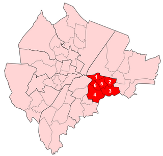
                Pottinger was one of the nine district electoral areas (DEA) in Belfast, Northern Ireland from 1985 to 2014. Located in the east of the city, the district elected six members to Belfast City Council and contained the wards of Ballymacarrett, Bloomfield, Orangefield, Ravenhill, The Mount, and Woodstock.

                <span class="mw-page-title-main">Victoria (District Electoral Area)</span> Electoral division in east Belfast, Northern Ireland

                Victoria was one of the nine district electoral areas (DEA) in Belfast, Northern Ireland, from 1985 to 2014, when it was mostly replaced by the Ormiston district.

                <span class="mw-page-title-main">Bangor West (District Electoral Area)</span>

                Bangor West is one of the seven district electoral areas (DEA) in Ards and North Down, Northern Ireland. The district elects five members to Ards and North Down Borough Council and contains the wards of Bryansburn, Kilcooley, Rathgael, Rathmore and Silverstream. Bangor West forms part of the North Down constituencies for the Northern Ireland Assembly and UK Parliament.

                <span class="mw-page-title-main">Newtownards (District Electoral Area)</span> District electoral area in Ards and North Down, Northern Ireland

                Newtownards is one of the seven district electoral areas (DEA) in Ards and North Down, Northern Ireland. The district elects five members to Ards and North Down Borough Council and contains the wards of Conway Square, Cronstown, Glen, Gregstown, Movilla, Scrabo and West Winds. Newtownards forms part of the Strangford constituencies for the Northern Ireland Assembly and UK Parliament.

                <span class="mw-page-title-main">Abbey (District Electoral Area)</span> District electoral areas in North Down, Northern Ireland

                Abbey was one of the four district electoral areas in North Down, Northern Ireland which existed from 1985 to 2014. The district elected six members to North Down Borough Council and formed part of the North Down constituencies for the Northern Ireland Assembly and UK Parliament.

                <span class="mw-page-title-main">Ballyholme and Groomsport (District Electoral Area)</span> District electoral areas in North Down, Northern Ireland

                Ballyholme and Groomsport was one of the four district electoral areas in North Down, Northern Ireland which existed from 1985 to 2014. The district elected six members to North Down Borough Council until 1993 and seven members until 2014, and formed part of the North Down constituencies for the Northern Ireland Assembly and UK Parliament.

                <span class="mw-page-title-main">Castlereagh Central (District Electoral Area)</span> District electoral areas in Ards, Northern Ireland

                Castlereagh Central was one of the district electoral areas in Castlereagh, Northern Ireland which existed from 1985 to 2014. It was one of three Castlereagh DEAs until 1993, and one of four until 2014. The district elected seven members to Castlereagh Borough Council from 1985 to 1993, and six members from 1993 to 2014. It formed part of the Strangford constituency until 1997, the Strangford and Belfast East constituencies from 1997 to 2010 and the Belfast East and Belfast South constituencies for the Northern Ireland Assembly and UK Parliament.

                <span class="mw-page-title-main">Killultagh (District Electoral Area)</span> District electoral area in Northern Ireland

                Killultagh is one of the seven district electoral areas (DEA) in Lisburn and Castlereagh, Northern Ireland. The district elects five members to Lisburn and Castlereagh City Council and contains the wards of Ballinderry, Glenavy, Maghaberry, Stonyford and White Mountain. Killultagh forms part of the Lagan Valley constituencies for the Northern Ireland Assembly and UK Parliament, and part of the South Antrim constituencies for the Northern Ireland Assembly and UK Parliament.

                <span class="mw-page-title-main">Downshire (District Electoral Area)</span> District electoral areas in Ards, Northern Ireland

                Downshire was one of the district electoral areas in Lisburn, Northern Ireland which existed from 1985 to 2014. It was one of four Lisburn DEAs until 1993, and one of five until 2014. The district elected seven members to Lisburn City Council from 1985 to 1993, and five members from 1993 to 2014, and formed part of Lagan Valley constituencies for the Northern Ireland Assembly and UK Parliament.

                <span class="mw-page-title-main">Ballyclare (District Electoral Area)</span> District electoral area in Northern Ireland

                Ballyclare is one of the seven district electoral areas (DEA) in Antrim and Newtownabbey, Northern Ireland. The district elects five members to Antrim and Newtownabbey Borough Council and contains the wards of Ballyclare East, Ballyclare West, Ballynure, Ballyrobert and Doagh. Ballyclare forms part of the South Antrim constituencies for the Northern Ireland Assembly and UK Parliament.

                <span class="mw-page-title-main">Antrim Line (District Electoral Area)</span> District electoral areas in Newtownabbey, Northern Ireland

                Antrim Line was one of the district electoral areas in Newtownabbey, Northern Ireland which existed from 1985 to 2014, one of five DEAs until 1993 and one of four DEAs until 2014. The district elected five members to Newtownabbey Borough Council until 1993 and seven members until 2014, and formed part of the South Antrim constituencies for the Northern Ireland Assembly and UK Parliament and part of the Belfast North constituencies for the Northern Ireland Assembly and UK Parliament.

                <span class="mw-page-title-main">Antrim South East (District Electoral Area)</span> District electoral areas in Antrim, Northern Ireland

                Antrim South East was one of the three district electoral areas in Antrim, Northern Ireland which existed from 1985 to 2014. The district elected seven members to Antrim Borough Council and formed part of the South Antrim constituencies for the Northern Ireland Assembly and UK Parliament.

                <span class="mw-page-title-main">Knockagh (District Electoral Area)</span> District electoral area in County Antrim, Northern Ireland

                Knockagh is one of the seven district electoral areas (DEA) in Mid and East Antrim, Northern Ireland. The district elects five members to Mid and East Antrim District Council and contains the wards of Burleigh Hill, Gortalee, Greenland, Sunnylands and Woodburn. Knockagh forms part of the East Antrim constituencies for the Northern Ireland Assembly and UK Parliament.
                <span class="mw-page-title-main">Carrick Castle (District Electoral Area)</span> District electoral area in Northern Ireland

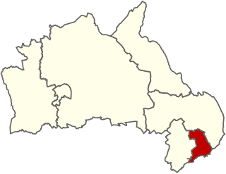
                Carrick Castle is one of the seven district electoral areas (DEA) in Mid and East Antrim, Northern Ireland. The district elects five members to Mid and East Antrim District Council and contains the wards of Boneybefore, Castle, Kilroot, Love Lane and Victoria. Carrick Castle forms part of the East Antrim constituencies for the Northern Ireland Assembly and UK Parliament.

                <span class="mw-page-title-main">Kilroot (District Electoral Area)</span> District electoral areas in Carrickfergus, Northern Ireland

                Kilroot was one of the three district electoral areas in Carrickfergus, Northern Ireland which existed from 1985 to 2014. The district elected five members to Carrickfergus Borough Council from 1985 to 1993, and six members from 1993 to 2014, and formed part of the East Antrim constituencies for the Northern Ireland Assembly and UK Parliament.

                <span class="mw-page-title-main">Coast Road (District Electoral Area)</span> District electoral area in Northern Ireland

                Coast Road is one of the seven district electoral areas (DEA) in Mid and East Antrim, Northern Ireland. The district elects five members to Mid and East Antrim District Council and contains the wards of Cairncastle, Carnlough and Glenarm, Craigyhill, Gardenmore and The Maidens. Coast Road forms part of the East Antrim constituencies for the Northern Ireland Assembly and UK Parliament.

                <span class="mw-page-title-main">Larne Town (District Electoral Area)</span> District electoral areas in Larne, Northern Ireland

                Larne Town was one of the three district electoral areas in Larne, Northern Ireland which existed from 1985 to 2014. The district elected five members to Larne Borough Council, and formed part of the East Antrim constituencies for the Northern Ireland Assembly and UK Parliament.

                <span class="mw-page-title-main">Banbridge (District Electoral Area)</span> District electoral area in Northern Ireland

                Banbridge is one of the seven district electoral areas (DEA) in Armagh City, Banbridge and Craigavon, Northern Ireland. The district elects seven members to Armagh City, Banbridge and Craigavon Borough Council and contains the wards of Banbridge East, Banbridge North, Banbridge South, Banbridge West, Gilford, Loughbrickland and Rathfriland. Banbridge forms part of the Upper Bann constituencies for the Northern Ireland Assembly and UK Parliament.

                <span class="mw-page-title-main">Rowallane (District Electoral Area)</span> District electoral area in Northern Ireland

                Rowallane is one of the seven district electoral areas (DEA) in Newry, Mourne and Down, Northern Ireland. The district elects five members to Newry, Mourne and Down District Council and contains the wards of Ballynahinch, Crossgar and Killyleagh, Derryboy, Kilmore and Saintfield. Rowallane forms part of the Strangford constituencies for the Northern Ireland Assembly and UK Parliament and part of the South Down constituencies for the Northern Ireland Assembly and UK Parliament.

                References

                1. "Holywood Result Sheet" (PDF). EONI. Retrieved 8 July 2021.
                2. "Local Government Results 2005". EONI. Archived from the original on 9 July 2021. Retrieved 8 July 2021.
                3. "Local Government Results 2001". EONI. Archived from the original on 6 August 2019. Retrieved 8 July 2021.
                4. "Local Government Results 1997". EONI. Archived from the original on 6 August 2019. Retrieved 8 July 2021.
                5. "Local Government Results 1993". EONI. Archived from the original on 9 July 2021. Retrieved 8 July 2021.
                6. "Local Government Results 1989". EONI. Archived from the original on 9 July 2021. Retrieved 8 July 2021.
                7. "Local Government Results 1985". EONI. Archived from the original on 6 August 2019. Retrieved 8 July 2021.