Related Research Articles
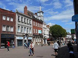
Nuneaton is a market town in the Borough of Nuneaton and Bedworth in northern Warwickshire, England, close to the county border with Leicestershire and West Midlands County. The population in 2020 was estimated at 91,334, making it the largest town in Warwickshire.

Southam is a market town and civil parish in the Stratford-on-Avon district of Warwickshire, England. Southam is situated on the River Stowe, which flows from Napton-on-the-Hill and joins Warwickshire's River Itchen at Stoneythorpe, just outside the town.

Warwickshire is a county in the West Midlands region of England. The county town is Warwick, and the largest town is Nuneaton. The county is famous for being the birthplace of William Shakespeare at Stratford-upon-Avon and Victorian novelist George Eliot,, at Nuneaton. Other significant towns include Rugby, Leamington Spa, Bedworth, Kenilworth and Atherstone. The county offers a mix of historic towns and large rural areas. It is a popular destination for international and domestic tourists to explore both medieval and more recent history.

Bulkington is a large village and former civil parish in the Nuneaton and Bedworth district of Warwickshire, England. In the 2011 census the ward had a population of 6,146 and 6,303 in the 2001 census. It is located around 6 miles (10 km) northeast of Coventry, just east of the towns of Nuneaton and Bedworth and 5 miles (8 km) southwest of Hinckley. Despite historically having stronger links with Bedworth, Bulkington forms part of the Nuneaton Urban Area. Bulkington was mentioned in the Domesday Book as Bochintone, meaning "estate associated with a man called Bulca".

Monks Kirby is a village and civil parish in north-eastern Warwickshire, England. The population of the parish is 445. Monks Kirby is located around one mile east of the Fosse Way, around 8 miles north-west of Rugby, seven miles north-east of Coventry and six miles west of Lutterworth. Administratively it forms part of the borough of Rugby. One of the largest and most important villages in this part of Warwickshire in the Anglo-Saxon and later medieval period, the village continued to be a local administrative centre into the early 20th century.
Coleshill is a market town in the North Warwickshire district of Warwickshire, England, taking its name from the River Cole, on which it stands. It had a population of 6,481 in the 2011 Census and is situated 10 miles (16 km) east-northeast of Birmingham, 8.5 miles (13.7 km) southeast of Sutton Coldfield, 11 miles (18 km) south of Tamworth and 12.5 miles (20.1 km) northwest of Coventry by road.

Ratby is a commuter village and civil parish in the Hinckley and Bosworth district of Leicestershire, England. It is situated to the west of Leicester, and just south of the M1 motorway. The population of the civil parish was measured in the 2011 census as 4,468. Other nearby places include Field Head, Kirby Muxloe, Glenfield and Markfield. The proximity of Ratby to Leicester causes it to form part of the Leicester Urban Area.
Olton is an area/suburban village within the Metropolitan Borough of Solihull in the West Midlands, England. In the 13th century, the Lords of the Manor moved their seat and formed a new settlement, at the junction of two major roads. It was then that Ulverlei was being referred to as ‘Oulton’ to distinguish itself from nearby Solihull. Historically within the county of Warwickshire, the village has gradually become contiguous with Solihull to the southeast, though it retains the character of a large independent village.
Ellistown is a village about 2 miles (3 km) south of Coalville in North West Leicestershire, England. It is named after Colonel Joseph Joel Ellis who died in 1885. The population from the 2011 census was included in the civil parish of Ellistown and Battleflat.
Whitestone is a suburban area of Nuneaton in Warwickshire in central England. It is located approximately two miles south-east of Nuneaton town centre. Historically part of Attleborough, the area has developed its own identity following extensive housing developments since the 1950s and 1960s. Today, it is generally considered one of Nuneaton's more desirable areas.
Attleborough is an area of Nuneaton, Warwickshire. It is about a mile south-east of the town centre.
St Nicolas Park is a suburban area of Nuneaton in Warwickshire, central England. It is a large housing estate, built between the 1960s and the 1990s. It is situated on the north-eastern edge of Nuneaton, close to the A5 and approximately 1½ miles from the town centre.
Amesbury Abbey was a Benedictine abbey of women at Amesbury in Wiltshire, England, founded by Queen Ælfthryth in about the year 979 on what may have been the site of an earlier monastery. The abbey was dissolved in 1177 by Henry II, who founded in its place a house of the Order of Fontevraud, known as Amesbury Priory.

The River Sence is a river which flows in Leicestershire, England. The tributaries of the Sence, including the Saint and Tweed, fan out over much of western Leicestershire from Charnwood Forest and Coalville in the north-east to Hinckley and almost to Watling Street in the south and south-west. Its watershed almost coincides with Hinckley and Bosworth Borough of Leicestershire, which was formed in 1974 by amalgamation of Market Bosworth Rural District and Hinckley Urban District. It flows into the Anker, which in turn flows into the River Tame. It is part of the wider River Trent catchment, which covers much of central England. In 1881, Sebastian Evans wrote that the usual names for this river were Shenton Brook and Sibson Brook.
Hermitage Manor is a small manor house in Warwickshire (UK) with a trihedral moat, associated land and farm. A manor house or fortified manor-house is a country house, which has historically formed the centre of a manor. The term is sometimes applied to relatively small country houses which belonged to gentry families, as well as to grand stately homes, particularly as a technical term for minor late medieval castles more intended for show than for defence.
The Birmingham Manor House or Birmingham Moat was a moated building that formed the seat of the Lord of the Manor of Birmingham, England during the Middle Ages, remaining the property of the de Birmingham family until 1536. The buildings were demolished and the moat filled-in in 1815-16, but the remains of medieval stone structures excavated in 1973-75 survive intact beneath the buildings of the Birmingham Wholesale Markets.
Grovebury Priory, also known as La Grave or Grava was a priory in Leighton Buzzard, Bedfordshire, England. It was established in 1164 and disestablished in 1414.
Monks Kirby Priory was a Benedictine priory established in 1077 in Monks Kirby, Warwickshire, England. The priory was suppressed in 1415 when its estates and revenues were given to the Carthusian priory of Axholme in Lincolnshire, in whose possession they continued until the Reformation. Remains of the priory form part of Monks Kirby village church today.

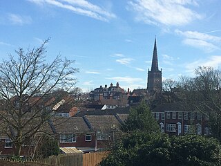
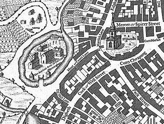
Nuneaton Priory was a medieval Benedictine monastic house in Nuneaton, Warwickshire, England. It was initially founded by Robert de Beaumont and Gervase Paganell in 1153 at Kintbury in Berkshire as a daughter house of Fontevraud Abbey in France. Soon afterwards, in around 1155 the foundation was moved to Etone in Warwickshire, which subsequently became known as Nuneaton.
References
- 1 2 'Site of Horeston Grange, Nuneaton', Historic site listing at Our Warwickshire website (ourwarwickshire.org.uk, retrieved 31 August 2022).
- ↑ Historic England Research Records: Horeston Grange, Hob Uid 336215, (Heritage Gateway).
- ↑ See an anecdotal (unreferenced) account of the history of Horeston Grange (adapted from an article by Peter Lee for the "Nuneaton Civic Society" website) at the Weddington Castle website (retrieved 1 September 2022).
- ↑ W. Brown, 'Attleborough: Palaeolithic finds from Horeston Grange (SP 3780 9150)', West Midlands Archaeology 36 (1993), pp. 81-82.
- 1 2 3 "Horeston Grange", in W. Dugdale, ed. and revised by W. Thomas, The Antiquities of Warwickshire Illustrated, 2nd Edition, 2 vols (John Osborn and Thomas Longman, London 1730), II, p. 1070 (Google): repeated in S. Whatley, England's Gazetteer, 3 vols (J. and P. Knapton, etc., London 1751), I, p. 315 (Google).
- ↑ "Horeston Grange" (referenced), J. Nichols, History and Antiquities of Aston Flamvile and Burbach, including the hamlets of Sketchley and Smockington, and the Granges of Leicester and Horeston, in the Counties of Leicester and Warwick: with an Appendix to the History of Hinckley (J. Nichols, London 1787), p. 240: in Bibliotheca Topographica Britanniae, Vol. VII (J. Nichols, London 1790), p. 352 (Google).
- ↑ "Priorissa de Eton h'et... apud grangea' de Horeston in eodem dec' sex car' terre & val' car' p' annu' 0-10-00; et h'et ib'm de p'fic' stauri p' annu' 0-07-00", Taxatio ecclesiastica Angliae et Walliae auctoritate P. Nicholai IV. circa A. D. 1291 (Commissioners, 1802), p. 256 b (Münchener DigitalisierungsZentrum, Digitale Bibliothek/Bayerische StaatsBibliothek) (digitale-sammlungen.de).
- ↑ B.M. Kerr, "Religious life for women from the twelfth century to the middle of the fourteenth century with special reference to the English foundations of the Order of Fontevraud" (Ph.D. Dissertation), St Anne's College, University of Oxford (Trinity 1995), p. 214 (pdf p. 233) (ora.ox.ac.uk).
- 1 2 'Houses of Benedictine nuns: Priory of Nuneaton', in W. Page (ed.), A History of the County of Warwick, II (V.C.H., London 1908), pp. 66-70 (British History Online).
- 1 2 'The Borough of Nuneaton: Horeston Grange', in L.F. Salzman (ed.), A History of the County of Warwick, IV: Hemlingford Hundred (V.C.H., London 1947), 165-73 (British History Online (accessed 31 August 2022).
- ↑ W.J.J., 'Hales, Stephen (d.1574), of Gladbury, Worcs., Tottenham, Mdx., Coventry and Exhall, Warws.', in P.W. Hasler (ed.), The History of Parliament: the House of Commons 1558-1603 (from Boydell and Brewer, 1981), History of Parliament Online, where they are called "Horeton Wood and fields".
- 1 2 "Horeston Grange Moat, Nuneaton", Warwick Museum Timetrail website, Record no. MWA 1691 (accessed 31 August 2022).
- 1 2 B. Gethin, (Observation of Warwickshire Museum trenches), Annual Report of the Medieval Settlement Research Group No. 9 (1994), p. 46.
- ↑ 'The Midland and the North British', The Railway News and Joint-Stock Journal, Vol. XIV, 19 November 1870, p. 605 (Google).
- ↑ 'Railway Extensions', The Engineer, Vol. XXX, 25 November 1870, p. 358 (Google).