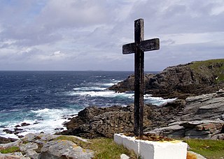
Hudson Strait in Nunavut links the Atlantic Ocean and the Labrador Sea to Hudson Bay in Canada. This strait lies between Baffin Island and Nunavik, with its eastern entrance marked by Cape Chidley, on the border between Newfoundland and Labrador Nunavut, and Resolution Island off Baffin Island. The strait is about 750 km (470 mi) long with an average width of 125 km (78 mi), varying from 70 km (43 mi) at the eastern entrance to 240 km (150 mi) at Deception Bay.

The Arctic Archipelago, also known as the Canadian Arctic Archipelago, is an archipelago lying to the north of the Canadian continental mainland, excluding Greenland and Iceland.

Sheridan County is a county located in the U.S. state of Kansas. Its county seat is Hoxie. As of the 2020 census, the county population was 2,447. The county was named in honor of Phillip Sheridan, a general during the American Civil War.

The Mid-Atlantic Ridge is a mid-ocean ridge located along the floor of the Atlantic Ocean, and part of the longest mountain range in the world. In the North Atlantic, the ridge separates the North American from the Eurasian Plate and the African Plate, north and south of the Azores Triple Junction. In the South Atlantic, it separates the African and South American plates. The ridge extends from a junction with the Gakkel Ridge northeast of Greenland southward to the Bouvet Triple Junction in the South Atlantic. Although the Mid-Atlantic Ridge is mostly an underwater feature, portions of it have enough elevation to extend above sea level, for example in Iceland. The ridge has an average spreading rate of about 2.5 centimetres (1 in) per year.

This is a list of the extreme points of Ireland – the points that are farthest north, south, east or west in Ireland. It includes the Republic of Ireland and Northern Ireland.

Grenadines is an administrative parish of Saint Vincent and the Grenadines, comprising the islands of the Grenadines other than those belonging to Grenada. The capital is Port Elizabeth.

Prospect Point is a headland at the west extremity of Velingrad Peninsula on Graham Coast in Graham Land, four kilometres south of Ferin Head and immediately east of the Fish Islands. Roughly charted by the British Graham Land Expedition (BGLE) under Rymill, 1934–37. Photographed by Hunting Aerosurveys Ltd. in 1956–57. The name was suggested in 1957 by E. P. Arrowsmith, Governor of the Falkland Islands.
Benichab is a town and urban commune in the Inchiri Region of southern-central Mauritania.
Tiraque Municipality is the first municipal section of the Tiraque Province in the Cochabamba Department, Bolivia. At the time of census 2001 - still including Shinahota Canton - it had a population of 35,017. Its seat is Tiraque.
The Porthos Range is the second range south in the Prince Charles Mountains of Antarctica, extending for about 30 miles in an east-to-west direction between Scylla Glacier and Charybdis Glacier. First visited in December 1956 by the Australian National Antarctic Research Expeditions (ANARE) southern party under W.G. Bewsher (1956-57) and named after Porthos, a character in Alexandre Dumas, père's novel The Three Musketeers, the most popular book read on the southern journey.
Infanzón is a village and municipality in Catamarca Province in northwestern Argentina.
Villa Dolores (Catamarca) is a municipality in Catamarca Province in northwestern Argentina. It is located within the Greater San Fernando del Valle de Catamarca area.
Pronunciamiento is a village and municipality in Entre Ríos Province in north-eastern Argentina.
Barber Glacier is a glacier rising just east of Mount Bruce in the Bowers Mountains and flowing north to the coast between Stuhlinger Ice Piedmont and Rosenau Head, Victoria Land, Antarctica. The glacier was mapped by the United States Geological Survey from surveys and from U.S. Navy air photos, 1960–65, and named by the Advisory Committee on Antarctic Names for Captain Don W. Barber, CE, USA, construction and equipment officer, U.S. Naval Support Force, Antarctica, 1967 and 1968. The glacier lies on the Pennell Coast, a portion of Antarctica lying between Cape Williams and Cape Adare.

The borders of the oceans are the limits of Earth's oceanic waters. The definition and number of oceans can vary depending on the adopted criteria. The principal divisions of the five oceans are the Pacific Ocean, Atlantic Ocean, Indian Ocean, Southern (Antarctic) Ocean, and Arctic Ocean. Smaller regions of the oceans are called seas, gulfs, bays, straits, and other terms. Geologically, an ocean is an area of oceanic crust covered by water.

Birley Glacier is a glacier, at least 10 nautical miles (19 km) long, flowing west into the eastern extremity of Barilari Bay north of Vardun Point, on the west coast of Graham Land. First seen and roughly surveyed in 1909 by the French Antarctic Expedition under Jean-Baptiste Charcot, it was re-surveyed in 1935–36 by the British Graham Land Expedition (BGLE) under John Rymill, and later named for Kenneth P. Birley, who contributed toward the cost of the BGLE, 1934–37.
Tofani Glacier is a glacier flowing northeast into the head of Solberg Inlet, Bowman Coast, to the north of Houser Peak. The feature was photographed from the air by United States Antarctic Service (USAS), 1940, U.S. Navy, 1966, and was surveyed by Falkland Islands Dependencies Survey (FIDS), 1946–48. Named by Advisory Committee on Antarctic Names (US-ACAN) in 1977 after Dr. Walter Tofani, M.D., station physician at Palmer Station, 1975.


