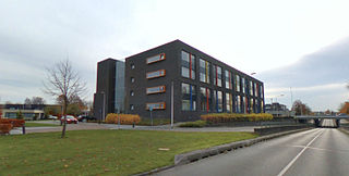
Vlijmen is a town in the Dutch province of North Brabant. It is located in the municipality of Heusden, about 6 km west of 's-Hertogenbosch.

Hei- en Boeicop is a small village in the Dutch province of Utrecht. Part of the municipality of Vijfheerenlanden, it lies about 9 km south of IJsselstein. The statistical area "Hei- en Boeicop", which includes the surrounding countryside, has a population of around 940.

Dodewaard is a town in the Dutch province of Gelderland. It is a part of the municipality of Neder-Betuwe, and lies about 7 km south of Wageningen.
Borkel en Schaft is a former municipality in the Netherlands, consisting of the villages of Borkel and Schaft. It was a separate municipality until 1934. The area is now part of the municipality of Valkenswaard. The spoken language is Kempenlands.
Born[bɔrn] is a town of approximately 6,000 inhabitants in the Dutch municipality of Sittard-Geleen. It has a port on the Julianakanaal. Born is also the site of the car factory VDL Nedcar and the headquarters and European Distribution Center of Mitsubishi Motors Europe. It has a zoo.
Obbicht en Papenhoven is a former municipality in the Dutch province of Limburg. It consisted of the villages Obbicht and Papenhoven, located on the River Meuse about 8 km northwest of Sittard.

Roggel is a village in the Dutch province of Limburg. It is located in the municipality of Leudal.
Bladel en Netersel is a former municipality in the Dutch province of North Brabant. It covered the villages of Bladel and Netersel.
Cuijk en Sint Agatha is a former municipality in the Dutch province of North Brabant. It covered the villages of Cuijk and Sint Agatha.

Deurne en Liessel is a former municipality in the Dutch province of North Brabant. It contained the villages of Deurne and Liessel.

Duizel en Steensel is a former municipality in the Dutch province of North Brabant, covering the villages of Duizel and Steensel.

Hooge en Lage Mierde was a municipality in the Dutch province of North Brabant. It included the villages of Lage Mierde, Hooge Mierde, and Hulsel.

Hoogeloon, Hapert en Casteren is a former municipality in the Dutch province of North Brabant. It covered the villages of Hoogeloon, Hapert and Casteren.
Oost-, West- en Middelbeers was a municipality in the Dutch province of North Brabant. It included the villages Oostelbeers, Middelbeers, and Westelbeers.
Oploo, Sint Anthonis en Ledeacker was a municipality in the Dutch province of North Brabant. It was created in 1821, in a merger of Oploo and Sint Anthonis en Ledeacker. The municipality existed until 1994, when it became part of a larger municipality St. Anthonis.
Udenhout is a village and a former municipality in the Dutch province of North Brabant. It is located northeast of Tilburg, north of Berkel-Enschot and south of the National Parc Loonse en Drunense Duinen.
Veldhoven en Meerveldhoven was a municipality in the Dutch province of North Brabant. It was located west of Eindhoven, and covered the village of Veldhoven and the former village Meerveldhoven.
Vlierden is a village in the Dutch province of North Brabant. It is located in the municipality of Deurne, about 20 km east of Eindhoven.
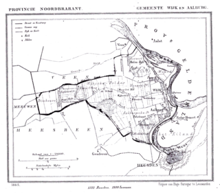
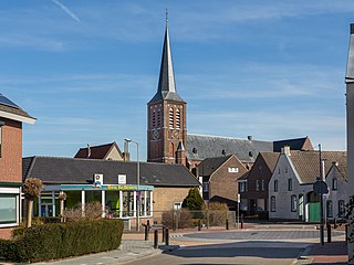
Wijk en Aalburg is a village in the Dutch province of North Brabant. It is located in the municipality of Aalburg, about 15 km northwest of 's-Hertogenbosch.


