Related Research Articles

Gatineau is a city in southwestern Quebec, Canada. It is located on the northern bank of the Ottawa River, immediately across from Ottawa, Ontario. Gatineau is the largest city in the Outaouais administrative region of Quebec and is also part of Canada's National Capital Region. As of 2021, Gatineau is the fourth-largest city in Quebec with a population of 291,041, and it is part of the Ottawa-Gatineau census metropolitan area with a population of 1,488,307 making it the fourth largest in Canada.

Buckingham is a former town located in the Outaouais region in the western portion of the province of Quebec, Canada. Since January 1, 2002, it has been part of the amalgamated city of Gatineau, which merged five former municipalities, including Masson-Angers, Buckingham, Hull, Aylmer and Gatineau, into a single entity. According to the 2016 Census, the population of the town was 16,685.
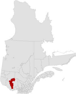
La Vallée-de-la-Gatineau is a regional county municipality in the Outaouais region of western Quebec, Canada. The seat is in Gracefield. It was incorporated on January 1, 1983 and was named for its location straddling the Gatineau River north of Low.
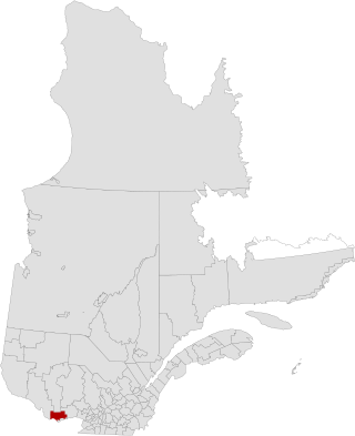
Les Collines-de-l'Outaouais is a regional county municipality in the Outaouais region of western Quebec, Canada. The region nearly encircles the City of Gatineau, which is to the south. Its administrative seat is in Chelsea, Quebec.
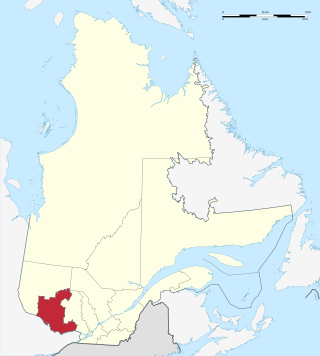
Outaouais is a region of western Quebec, Canada. It includes the city of Gatineau, the municipality of Val-des-Monts, the municipality of Cantley and the Papineau region. Geographically, it is located on the north side of the Ottawa River opposite Canada's capital, Ottawa. It has a land area of 30,457.52 square kilometres (11,759.71 sq mi) and its population was 405,158 inhabitants as of 2021.

Gatineau Park is a federal park located in the Outaouais region of Quebec, Canada. Administered by the National Capital Commission as part of the National Capital Region, Gatineau Park is a 361 square kilometres (139 sq mi) wedge of land extending north and west from the city of Gatineau. With a perimeter of 179.2 kilometres (111.3 mi), the park includes parts of the municipalities of Chelsea, Pontiac, La Pêche, and the City of Gatineau. The main entrance to the park is 4 kilometres (2.5 mi) north of downtown Ottawa, Ontario.

The Hull–Chelsea–Wakefield Railway was a 33 km (20.5 mi) heritage railway in Quebec, Canada, running tourist trains through the scenic Gatineau Hills and beside the Gatineau River between Hull and the tourist town of Wakefield from May to October, using a 1907 Swedish steam locomotive, E2 class number 909, and 1940s-built Swedish passenger cars. On average, the railway attracted about 50 000 tourists and generated revenues of about $8 million for the region.
Wright was a federal electoral district in Quebec, Canada, that was represented in the House of Commons of Canada from 1896 to 1948.
Autoroute 5 is a short controlled-access Autoroute in the Outaouais region of western Quebec. It connects the central urban area of Gatineau with the recreational areas of Gatineau Park and the exurban rural areas of Chelsea and La Pêche. The southern terminus provides access to the Macdonald-Cartier Bridge, which continues into downtown Ottawa. The A-5 generally has four lanes of traffic with the exception of southernmost section across the Macdonald-Cartier Bridge where A-5 widens to six lanes.
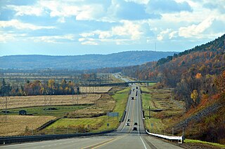
Autoroute 50 is an Autoroute in western Quebec, Canada. It links Canada's National Capital Region (Gatineau) and the Greater Montreal area (Mirabel).

Masson-Angers is a former municipality and now a sector within the city of Gatineau. It is located on the north shore of the Ottawa River, in Quebec, Canada, approximately 30 km (18.6 mi) northeast of downtown Ottawa, Ontario. According to the Canada 2011 Census, Masson-Angers had a population of 12,397.

The Rapibus is a bus rapid transit system for the Société de Transport de l'Outaouais (STO) in the city of Gatineau, Quebec. Construction was completed in the summer of 2013 with service beginning in the fall. The Rapibus aims to speed up the service for commuters in growing sub-divisions in the northern and eastern areas of the city by alleviating the congestion on key arteries currently served by bus-designated lanes. A direct link to Ottawa is included.
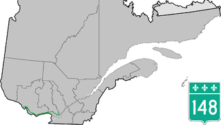
Route 148 is an east-west highway in Quebec, Canada. It runs from junction of Autoroute 13 and Autoroute 440 in Laval in the Montreal region to the Ontario-Quebec border in L'Isle-aux-Allumettes in western Quebec. For most of its length, Route 148 follows the north shore of the Ottawa River where it acted as the principal route between communities in the Outaouais region until the completion of Autoroute 50 in 2012. At the Ontario-Quebec border in L'Isle-aux-Allumettes Route 148 continues into Ontario as Highway 148.
Sylvain Simard is a politician and academic based in the Canadian province of Quebec. He represented Richelieu in the National Assembly of Quebec from 1994 to 2012, and was a cabinet minister in the governments of Lucien Bouchard and Bernard Landry. Simard is a member of the Parti Québécois (PQ).

The municipal history of Quebec started in 1796 with the creation of administrations for Montréal and Quebec City, but it really developed immediately prior to the creation of the Province of Canada in 1841 with the formation of municipal districts, followed in March 1845 when the Parliament of the Province of Canada adopted an Act to create local authorities in Lower Canada which took effect in July 1845.

The mayor of Gatineau is head of the executive branch of the Gatineau City Council. The mayor is elected alongside the city council every four years on the first Sunday of November; there are no term limits. While in office, mayors are styled His/Her Worship. The office of the mayor administers all city services, public property, police and fire protection, most public agencies, and enforces all city and provincial laws within Gatineau, Quebec.
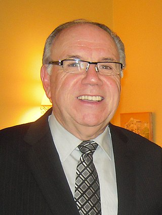
Gaétan Cousineau is an administrator and former politician in the Canadian province of Quebec. He was the mayor of Gatineau from 1983 to 1988 and is now president of the Commission des droits de la personne et des droits de la jeunesse.
Deschênes is a former municipality in Quebec, Canada, located in the Outaouais region. Along with Lucerne, it was a part of the municipality of Aylmer in 1975, itself amalgamated into the City of Gatineau in 2002. Originally, the name of the village was Deschênes Mills.
References
- ↑ "Gazette officielle du Québec. Québec official gazette., 21 janvier 1897, jeudi 21 (no extra)". Bibliothèque et Archives nationales du Québec. Retrieved 15 February 2024.
- ↑ "2 George V, chapitre 9 - Loi amendant la loi concernant la représentation à l'Assemblée législative". Gazette officielle du Québec. 1912-04-16. Retrieved 2024-02-09.
- ↑ "9 George V, chapitre 12 - Loi changeant le nom du comté d'Ottawa en celui de Hull et amendant en conséquence les Statuts refondus, 1909, le Code de procédure civile et certaines lois y relatives". Gazette officielle du Québec. 1919-03-29. Retrieved 2024-02-09.
- ↑ Hormisdas Magnan (1925). Dictionnaire historique et géographique des paroisses, missions et municipalités de la province de Québec. Arthabaska: L'imprimerie d'Arthabaska inc.[ permanent dead link ], p.100
- ↑ Liste des terrains concédés par la Couronne dans la province de Québec, de 1763 au 31 Décembre 1890. Québec: Langlois, imprimeur de la Reine, 1891 / ISBN 0-665-09831-6
- ↑ Annexe II- Historical background on Townships with List