Related Research Articles

The geography of Israel is very diverse, with desert conditions in the south, and snow-capped mountains in the north. Israel is located at the eastern end of the Mediterranean Sea in Western Asia. It is bounded to the north by Lebanon, the northeast by Syria, the east by Jordan and the West Bank, and to the southwest by Egypt. To the west of Israel is the Mediterranean Sea, which makes up the majority of Israel's 273 km (170 mi) coastline, and the Gaza Strip. Israel has a small coastline on the Red Sea in the south.

New Zealand is an island country located in the south-western Pacific Ocean, near the centre of the water hemisphere. It consists of a large number of islands, estimated around 600, mainly remnants of a larger land mass now beneath the sea. The two main islands by size are the North Island and the South Island, separated by the Cook Strait. The third-largest is Stewart Island, located 30 kilometres off the tip of the South Island across Foveaux Strait. Other islands are significantly smaller in area. The three largest islands stretch 1,500 kilometres across latitudes 34° to 47° south. New Zealand is the sixth-largest island country in the world, with a land size of 267,710 km2 (103,360 sq mi).

Western Australia is a state occupying the entire western third of Australia. It is bounded by the Indian Ocean to the north and west, and the Southern Ocean to the south, the Northern Territory to the north-east, and South Australia to the south-east. Western Australia is Australia's largest state, with a total land area of 2,529,875 square kilometres, and the second-largest country subdivision in the world, surpassed only by Russia's Sakha Republic. The state has about 2.6 million inhabitants – around 11 percent of the national total – of whom the vast majority live in the south-west corner, 79 per cent of the population living in the Perth area, leaving the remainder of the state sparsely populated.

The coconut tree is a member of the palm tree family (Arecaceae) and the only known living species of the genus Cocos. The term "coconut" can refer to the whole coconut palm, the seed, or the fruit, which botanically is a drupe, not a nut. The term is derived from the 16th-century Portuguese and Spanish word coco, meaning 'head' or 'skull' after the three indentations on the coconut shell that resemble facial features.

The Brisbane Water National Park is a protected national park that is located in the Central Coast region of New South Wales, in eastern Australia. The 11,506-hectare (28,430-acre) national park is situated 47 kilometres (29 mi) north of Sydney, 10 kilometres (6.2 mi) west of Woy Woy, and 12 kilometres (7.5 mi) southwest of Gosford.

A drainage basin is any area of land where precipitation collects and drains off into a common outlet, such as into a river, bay, or other body of water. The drainage basin includes all the surface water from rain runoff, snowmelt, and nearby streams that run downslope towards the shared outlet, as well as the groundwater underneath the earth's surface. Drainage basins connect into other drainage basins at lower elevations in a hierarchical pattern, with smaller sub-drainage basins, which in turn drain into another common outlet.

In meteorology, precipitation is any product of the condensation of atmospheric water vapour that falls under gravity. The main forms of precipitation include drizzle, rain, sleet, snow, graupel and hail. Precipitation occurs when a portion of the atmosphere becomes saturated with water vapor, so that the water condenses and "precipitates". Thus, fog and mist are not precipitation but suspensions, because the water vapor does not condense sufficiently to precipitate. Two processes, possibly acting together, can lead to air becoming saturated: cooling the air or adding water vapor to the air. Precipitation forms as smaller droplets coalesce via collision with other rain drops or ice crystals within a cloud. Short, intense periods of rain in scattered locations are called "showers."

No-till farming is an agricultural technique way of growing crops or pasture without disturbing the soil through tillage. No-till farming decreases the amount of soil erosion tillage causes in certain soils, especially in sandy and dry soils on sloping terrain such as found in many areas in the United States or Brazil. Other possible benefits which may or may not accrue in some instances by farmers using this method are an increase in the amount of water that infiltrates into the soil, the soil's retention of organic matter, and its cycling of nutrients. It increases the amount and variety of life in and on the soil, but that also includes disease-causing organisms and disease organisms. Conventional no-tillage systems require the use of very large amounts of herbicides to control weeds.
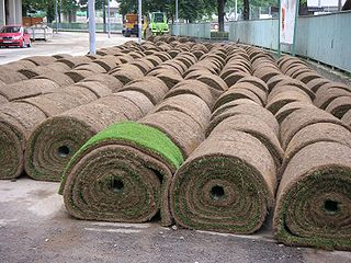
Sod or turf is grass and the part of the soil beneath it held together by its roots or another piece of thin material.

Sasthamcotta Lake or Sasthamkotta Lake, also categorized as a wetland, is the largest fresh water lake in Kerala, a state of India on the south of the West Coast. The lake is named after the ancient Sastha temple located on its bank. It meets the drinking water needs of half million people of the Quilon district and also provides fishing resources. The purity of the lake water for drinking use is attributed to the presence of large population of larva called cavaborus that consumes bacteria in the lake water. The lake is a designated wetland of international importance under the Ramsar Convention since November 2002.

Limarí Province is one of three provinces of the Chilean region of Coquimbo Region (IV). Its capital is the city of Ovalle

Chennai is located at 13.04°N 80.17°E on the southeast coast of India and in the northeast corner of Tamil Nadu. It is located on a flat coastal plain known as the Eastern Coastal Plains. The city has an average elevation of 6 metres (20 ft), its highest point being 60 m (200 ft).
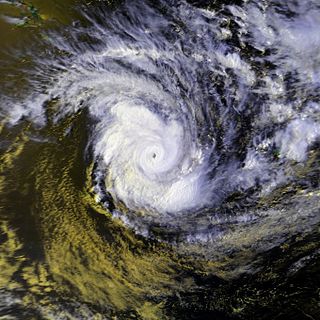
Cyclone Bola was one of the costliest cyclones in the history of New Zealand, causing severe damage as an extratropical cyclone when it passed near the country in March 1988. It formed on February 24 to the north of Fiji, and tracking generally southwestward it reached hurricane-force winds near Vanuatu on February 28. The next day it generated peak wind velocities of 195 km/h (120 mph), though it quickly weakened as it accelerated southward. On March 4, Bola transitioned into an extratropical storm, passing to the north of the North Island of New Zealand on March 8. It weakened further and was absorbed by a stationary trough near the South Island on March 12.

Rain is liquid water in the form of droplets that have condensed from atmospheric water vapor and then become heavy enough to fall under gravity. Rain is a major component of the water cycle and is responsible for depositing most of the fresh water on the Earth. It provides suitable conditions for many types of ecosystems, as well as water for hydroelectric power plants and crop irrigation.

The environment of New Zealand is characterised by an endemic flora and fauna which has evolved in near isolation from the rest of the world. The main islands of New Zealand span two biomes, temperate and subtropical, complicated by large mountainous areas above the tree line. There are also numerous smaller islands which extent into the sub antarctic. The prevailing weather systems bring significantly more rain to the west of the country. New Zealand's territorial waters cover a much larger area than its landmass and extend over the continental shelf and abyssal plateau in the South Pacific Ocean, Tasman Sea and Southern ocean.

Mining in New Zealand began when the Māori quarried rock such as argillite in times prior to European colonisation. Mining by Europeans began in the latter half of the 19th century.

Water pollution in New Zealand is an increasing concern for those who use and care for waterways and for New Zealand regulatory bodies. An increase in population is linked to an increase in water pollution, due to a range of causes such as rural land use, industrial use and urban development. Fresh water quality is under pressure from agriculture, hydropower, urban development, pest invasions and climate change. While pollution from point sources has been reduced, diffuse pollution such as nutrients, pathogens and sediments development and from stormwater in towns is not under control. There are more than 800 water quality monitoring sites around New Zealand that are regularly sampled.

Water pollution is an environmental issue on the West Coast of New Zealand.
Agriculture in the Southwest United States is very important economically in that region.

Comboyne is a village on the Mid North Coast region of New South Wales. It is situated on the Comboyne Plateau, some 60 km south-west of Port Macquarie, 35 km west of Kew and 54 km north-west of Taree. It is an attractive agricultural area with fertile soils and a high rainfall. The word "Comboyne" is a corruption of the local Biripi people's name for "a place of kangaroos" (Gambuyn). At the 2011 census, Comboyne had a population of 453.
References
- ↑ "Getting the best out of hump-and-hollow farming". Water Resources Update No 14. NIWA. 2005. Archived from the original on 2008-10-18. Retrieved 2008-04-17.
- ↑ Brown, Steph (2004). "Review of Humping and Hollowing on the West Coast" (PDF). Opus International Consultants. Archived from the original (PDF) on 27 September 2011. Retrieved 1 July 2011.