
Hundred of Hawarden was a Hundred of Gladstone County, Northern Territory of Australia. [2] [3]
Hundred of Hawarden was a Hundred of Gladstone County, Northern Territory of Australia. [2] [3]
The first European to visit the Hundred was Ludwig Leichhardt who went through what would become the hundred as in 1845, and in 1855 Augustus Charles Gregory passed to the south of the Hundred on his route to Gladstone, Queensland. This Hundred was one of just 6 Hundreds in the County of Gladstone (located in the Roper River area) which was gazetted 09/01/1873. The Hundred lapsed with the passage in 1976 and subsequent assent of the Crown Lands Ordinance 1976 (No. 1 of 1977) and the Crown Lands (Validation of Proclamations) Ordinance 1976.
Today the Hundred is completely in the Limmen National Park, Limmen, Northern Territory, and the traditional owners of the area are the Yukul Australian Aboriginal people. [4] The nearest settlement is Towns River.

Kalkarindji is a town and locality in the Northern Territory of Australia, located on the Buntine Highway about 554 kilometres (344 mi) south of the territory capital of Darwin and located about 460 kilometres (290 mi) south of the municipal seat in Katherine.

The Roper River is a large perennial river located in the Katherine region of the Northern Territory of Australia.

Lands administrative divisions of Australia are the cadastral divisions of Australia for the purposes of identification of land to ensure security of land ownership. Most states term these divisions as counties, parishes, hundreds, and other terms. The eastern states of Queensland, New South Wales, Victoria, and Tasmania were divided into counties and parishes in the 19th century, although the Tasmanian counties were renamed land districts in the 20th century. Parts of South Australia (south-east) and Western Australia (south-west) were similarly divided into counties, and there were also five counties in a small part of the Northern Territory. However South Australia has subdivisions of hundreds instead of parishes, along with the Northern Territory, which was part of South Australia when the hundreds were proclaimed. There were also formerly hundreds in Tasmania. There have been at least 600 counties, 544 hundreds and at least 15,692 parishes in Australia, but there are none of these units for most of the sparsely inhabited central and western parts of the country.

Limmen Bight is a bight, or large, open bay, located in the Northern Territory of Australia at the western end of the Gulf of Carpentaria about 360 kilometres (220 mi) east of the town of Katherine. It is part of the traditional lands and waters of the Marra people. It was named in April 1644 by Abel Tasman for one of his ships on his voyage of exploration along the northern Australian coast. It contains the second largest area of tidal flats in the Northern Territory.

The Towns River is a river in the Northern Territory, Australia.
The Limmen Bight River is a river in the Northern Territory, Australia.

The Hundred of Booyoolie is a cadastral unit of hundred in South Australia. It is one of the 14 hundreds of the County of Victoria and was proclaimed by Governor James Fergusson in July 1871.
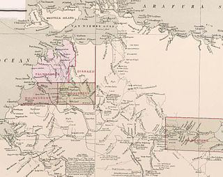
County of Disraeli is one of the five counties in the Northern Territory which are part of the cadastral divisions of Australia.
County of Gladstone was one of the five counties in the Northern Territory which are part of the cadastral divisions of Australia.

The Hundred of Beaconsfield was a hundred within the now-lapsed County of Disraeli in the Northern Territory of Australia.
The Hundred of Douglas was a hundred of Gladstone County in the Northern Territory of Australia.
The Hodgson River is a tributary of the Roper River between Roper Bar and Ngukurr, Northern Territory, Australia.
The Hundred of Glynne was a Hundred of Gladstone County, Northern Territory Australia.
The Hundred of Bundey was a hundred within County of Disraeli in the Northern Territory of Australia. The hundred was gazetted on 7 August 1884 and lapsed with the passage in 1976 and subsequent assent of the Crown Lands Ordinance 1976 and the Crown Lands Ordinance 1976.
County of Malmesbury was one of the five counties in the Northern Territory which are part of the Lands administrative divisions of Australia.
Gundabooka Parish is a civil parish, of Yanda County, a cadasteral division of New South Wales; a Cadastral division of New South Wales.

The Hundred of Reynolds was a hundred of the County of Gladstone in the Northern Territory of Australia which was created in 1873 and which lapsed in 1976. It is located 600 km south-east of the territorial capital of Darwin.
Rakula is a locality in the Northern Territory of Australia, located about 72 kilometres (45 mi) south-west of the territorial capital of Darwin.
Vernon Islands Conservation Reserve is a protected area in the Northern Territory of Australia located in the locality of Vernon Islands about 50 kilometres (31 mi) north-east of the territory capital of Darwin.
Costello is a locality in the Northern Territory of Australia located in the territory's east adjoining the border with the state of Queensland about 1,057 kilometres (657 mi) south-east of the territory capital of Darwin.