The Hillsborough River is a river located in the state of Florida in the United States. It arises in the Green Swamp near the juncture of Hillsborough, Pasco and Polk counties, and flows 60 miles (97 km) through Pasco and Hillsborough Counties to an outlet in the city of Tampa on Tampa Bay. It includes 4 nature trails extending for over seven miles, making it perfect for hikers. The name Hillsborough River first appeared on a British map in 1769. At the time, the Earl of Hillsborough was the British Secretary of State for the Colonies, and thus controlled the pensions of the surveyors working in the American colonies, which included East Florida.

Myakka River State Park is a Florida State Park, that is located nine miles (14 km) east of Interstate 75 in Sarasota County and a portion of southeastern Manatee County. The state park consists of 37,000 acres (150 km2), making it one of the state's largest parks. It is also one of the oldest parks in the state. It was delineated in the 1930s by the Civilian Conservation Corps. A small portion of the park was the gift of the family of Bertha Palmer to the state. The park is named after the Myakka River.

The Ocala National Forest ls the second largest nationally protected forest in the U.S. State of Florida. It covers 607 square miles (1,570 km2) of Central Florida. It is located three miles (5 km) east of Ocala and 16 miles (26 km) southeast of Gainesville. The Ocala National Forest, established in 1908, is the oldest national forest east of the Mississippi River and the southernmost national forest in the continental U.S. The word Ocala is thought to be a derivative of a Timucuan term meaning "fair land" or "big hammock". The forest is headquartered in Tallahassee, as are all three National Forests in Florida, but there are local ranger district offices located in Silver Springs and Umatilla.

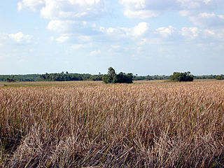
Paynes Prairie Preserve State Park is a Florida State Park, encompassing a 21,000-acre (85 km2) savanna in Micanopy, Florida, south of Gainesville. It is also a U.S. National Natural Landmark. It is crossed by both I-75 and U.S. 441. It is in the center of the Paynes Prairie Basin. The basin's primary source of drainage is Alachua Sink. During occasional wet periods, the basin will become full. A notable period occurred from 1871 to 1891 when the Alachua Sink was temporarily blocked. During this period, shallow draft steamboats were a frequent sight on Alachua Lake in the center of the prairie. The region was also historically known as the Alachua Savannah. Its drainage has been modified by several canals. Since 1927, Camps Canal has linked the basin to the River Styx which leads to Orange Lake and eventually the Atlantic Ocean through the St. Johns River. That reduced the basins water intake by half. Additional changes to the prairie's environment have been detrimental to its hydrology. In 1970, the state of Florida acquired the land and has been in the process of restoring the environment to a more natural condition ever since.

Tate's Hell State Forest is 202,000 acres (819 km²) of land in Franklin and Liberty counties in Florida. The forest is located near Carrabelle off US 98 along the gulf coast. At one time, Tate's Hell supported at least 12 major habitats including: wet flatwoods, wet prairie, seepage slope, baygall, floodplain forest, floodplain swamp, basin swamp, upland hardwood forest, sandhill, pine ridges, dense titi swamp thickets and scrub. Tate's Hell State Forest is an important hydrologic area and includes a section of the New River. The park's watershed provides fresh water into the Apalachicola Bay, the Carrabelle River and the Ochlockonee River.

Rainbow Springs State Park is a Florida State Park located on U.S. 41, three miles (5 km) north of Dunnellon, Florida. It comprises 1,459.07 acres (5.9046 km2) upland and 12.83 acres (51,900 m2) submerged. The most significant natural feature is the first magnitude headspring basin which produces up to 600,000,000 US gallons (2,300,000 m3) of fresh water per day, forming The Rainbow River. The looking glass waters of Rainbow Springs come from several vents, not one large bubbling spring. The river itself supports a wide variety of fish, wildlife, and plants, many within easy viewing by visitors. In total, the park contains 11 distinct natural communities, including sandhills, flatwoods, upland mixed forests, and hydric hammocks.
Hammock is a term used in the southeastern United States for stands of trees, usually hardwood, that form an ecological island in a contrasting ecosystem. Hammocks grow on elevated areas, often just a few inches high, surrounded by wetlands that are too wet to support them. The term hammock is also applied to stands of hardwood trees growing on slopes between wetlands and drier uplands supporting a mixed or coniferous forest. Types of hammocks found in the United States include tropical hardwood hammocks, temperate hardwood hammocks, and maritime or coastal hammocks. Hammocks are also often classified as hydric, mesic or xeric. The types are not exclusive, but often grade into each other.
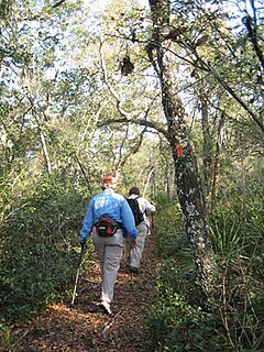
The Florida Trail is one of eleven National Scenic Trails in the United States. It currently runs 1,000 miles (1,600 km), with 300 miles (480 km) planned, from Big Cypress National Preserve to Fort Pickens at Gulf Islands National Seashore, Pensacola Beach. Also known as the Florida National Scenic Trail, the Florida Trail provides permanent non-motorized recreation opportunity for hiking and other compatible activities and is within an hour of most Floridians. The Florida National Scenic Trail is designated as a National Scenic Trail by the National Trails System Act of 1968.

The Wekiva River is a 16.0-mile-long (25.7 km) river in Central Florida, north of Orlando in the United States. It originates in Apopka and joins the St. Johns River, the longest river in the state, in DeBary. The Wekiva River system includes the main stem joined by three main tributaries - Rock Springs Run, Blackwater Creek, and the Little Wekiva River - and about 30 contributing groundwater springs. It is designated as a Florida State Canoe Trail, an Outstanding Florida Water, and an Aquatic Preserve by the Florida Department of Environmental Protection. The Wekiva River system is also one of the two rivers in Florida federally designated as a National Wild and Scenic River for its scenery, recreation, geology, and diverse habitats.
Lake Jesup is one of the largest lakes in Central Florida, one of many that make up the St. Johns River. Located in the heart of Seminole County along the middle basin of the St. Johns, the lake encompasses an area of approximately 16,000 acres (65 km²), including open water and floodplain. It is named in honor of Brigadier General Thomas Jesup, an American military officer who served in the Second Seminole War. The lake boasts one of the longest free-standing bridges, part of the Seminole Expressway, which bisects the lake.
Hal Scott Regional Preserve and Park is a 9,515-acre (38.51 km2) nature preserve located along the banks of the Econlockhatchee River in east Orange County, Florida, United States. The Preserve is bordered by the Econlockhatchee on the West and Wedgefield, Florida on the East. It is managed by the St. Johns River Water Management District and Orange County Parks and Recreation. Recreational amenities include camping, hiking, horseback riding, mountain biking, fishing, and wildlife viewing.

Tsala Apopka Lake is a chain of lakes located within a bend in the Withlacoochee River in Citrus County in north central Florida. This area is known historically as the Cove of the Withlacoochee.
Withlacoochee River Park is located in Pasco County, in the U.S. state of Florida. The property is 260 acres (1.1 km2) and is located at 12449 Withlacoochee Boulevard in Dade City. It includes a canoe launch, dock, 1.5 miles (2.4 km) of hiking trails, as well a bicycling, bird watching, picnic facilities, camping, fishing, an observation tower, and a 30 acre rec field. Habitats in the area include high sandhills and low riverine swamp.
The Green Swamp is a swamp in Florida. It lies west of Highway 27 and east of Interstate 75 in Polk, Lake, Sumter, Hernando and Pasco Counties. The headwaters of the Peace River, Withlacoochee River, Ocklawaha River, and Hillsborough River are located here.

The Southeastern conifer forests are a tropical and subtropical coniferous forest ecoregion of the southeastern United States. It is the largest conifer forest ecoregion east of the Mississippi River.
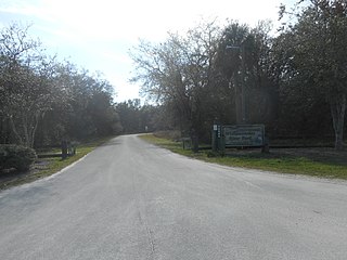
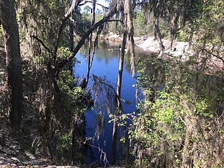
Fish Hawk Creek Preserve is a 1,550-acre (630 ha) nature preserve in Hillsborough County, Florida. Restoration projects have been initiated on the property. Habitats include Pine flatwoods, sandhill, scrub, and creek corridors. The park is located in the area of Riverview, Florida and Lithia, Florida at 4099 Lithia Springs Road.
Not to be confused with Camp Branch Wetlands Natural Area Preserve

Gulf Hammock is a wetlands area in the southern end of Levy County, Florida. It extends along the Gulf of Mexico coast from Cedar Key to the Withlacoochee River, and reaches several miles inland. Gulf Hammock includes the largest expanse of hydric hammock in Florida. The area is mostly uninhabited, with the area closest to the Gulf coast in a state park, and the inland areas primarily used for logging and hunting.