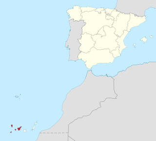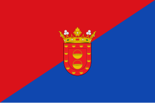
Province of Santa Cruz de Tenerife, also Province of Santa Cruz, is a province of Spain, consisting of the western part of the autonomous community of the Canary Islands. It consists of about half of the Atlantic archipelago: the islands of Tenerife, La Gomera, El Hierro, and La Palma. It occupies an area of 3,381 km2 (1,305 sq mi). It also includes a series of adjacent roques.

The Guanche were the indigenous inhabitants of the Spanish Canary Islands, located in the Atlantic Ocean some 100 kilometres (60 mi) to the west of modern Morocco and the North African coast. The islanders spoke the Guanche language, which is believed to have been related to the Berber languages of mainland North Africa; the language became extinct in the 17th century, soon after the islands were colonized.

Lanzarote is a Spanish island, the easternmost of the Canary Islands in the Atlantic Ocean, 125 kilometres off the north coast of Africa and 1,000 kilometres from the Iberian Peninsula. Covering 845.94 square kilometres, Lanzarote is the fourth-largest of the islands in the archipelago. With 152,289 inhabitants at the start of 2019, it is the third most populous Canary Island, after Tenerife and Gran Canaria. Located in the centre-west of the island is Timanfaya National Park, one of its main attractions. The island was declared a biosphere reserve by UNESCO in 1993. The island's capital is Arrecife, which lies on the eastern coastline. It is the smaller main island of the Province of Las Palmas.
Guanche is an extinct language or dialect continuum that was spoken by the Guanches of the Canary Islands until the 16th or 17th century. It died out after the conquest of the Canary Islands as the Guanche ethnic group was assimilated into the dominant Spanish culture. The Guanche language is known today through sentences and individual words that were recorded by early geographers, as well as through several place-names and some Guanche words that were retained in the Canary Islanders' Spanish.

Caldera de Taburiente National Park is a national park on the island of La Palma, Canary Islands, Spain. It contains the Caldera de Taburiente, which dominates the northern part of the island, and was designated as a national park in 1954. The telescopes of the Roque de los Muchachos Observatory are situated very close to the summit.

Candelaria, also Villa Mariana de Candelaria, is a municipality and city in the eastern part of the island of Tenerife in the Province of Santa Cruz de Tenerife, in the Canary Islands, Spain. The city is located on the coast, 17 km southwest of Santa Cruz de Tenerife. The population is 25,140 (2010), and the area is 49.18 km².

The Canary Islands have been known since antiquity. Until the Spanish colonization between 1402 and 1496, the Canaries were populated by an indigenous population, whose origin was Amazigh from North Africa.
Canary Islanders, or Canarians, are the people of the Canary Islands, an autonomous community of Spain near the coast of Northwest Africa. The distinctive variety of the Spanish language spoken in the region is known as habla canaria or the (dialecto) canario. The Canarians, and their descendants, played a major role during the conquest, colonization, and eventual independence movements of various countries in Latin America. Their ethnic and cultural presence is most palpable in the countries of Uruguay, Venezuela, Cuba and the Dominican Republic as well as the US territory of Puerto Rico.

Canarian Spanish or Canary Island Spanish is a variant of standard Spanish spoken in the Canary Islands by the Canary Islanders.

The Kingdom of the Canary Islands was a vassal state of the Crown of Castile located in North Africa, lasting from 1404 to 1448.

Museo de la Naturaleza y Arqueología (MUNA), is a museum-based in Santa Cruz de Tenerife, Tenerife,. It contains many significant archaeological finds and is considered the best repository of objects from the Pre-Castilian Canary Islands. The museum also houses significant paleontological, botanical, entomological, and marine and terrestrial vertebrate collections, and is considered the best Natural Library of the Canary Islands.

The Mummy of San Andrés is a human mummy belonging to the Guanche culture, who were the ancient inhabitants of the Canary Islands, Spain.

The conquest of the Canary Islands by the Crown of Castile took place between 1402 and 1496 in two periods: the Conquista señorial, carried out by Castilian nobility in exchange for a covenant of allegiance to the crown, and the Conquista realenga, carried out by the Spanish crown itself during the reign of the Catholic Monarchs. It has been described as the first instance of European settler colonialism in Africa.

The Church of the Guanche People is a religious organisation, founded in 2001 in the city of San Cristóbal de La Laguna, Tenerife, Canary Islands, Spain. Its goal is to revive and spread the traditional religion of the indigenous Berber Guanche people who occupied the islands at the time of Castillian conquest.

Cueva del Viento is the largest lava tube system in Europe, and the sixth largest in the world, behind a series of lava tubes in Hawaii. It is also considered the most complex volcanic tube in the world, due to its morphology of several levels and passages.

The Barranco de Badajoz or Chamoco is a ravine on the island of Tenerife, in the province of Santa Cruz de Tenerife, part of the municipality of Güímar in the southeast of the island.

Cave-Shrine of Chinguaro is a cave and associated Roman Catholic church located in Güímar on Tenerife. It was the traditional palace of Acaimo, the Guanche king of the Menceyato de Güímar. After the Spanish conquest, they venerated the cave as a site of the Virgin Mary, and later built a church shrine there.

The Teno massif is one of three volcanic formations that gave rise to Tenerife, Canary Islands, Spain. It is located in the northwestern part of the island between the towns of Santiago del Teide, Los Silos, El Tanque and Buenavista del Norte. The volcanic massif, emerged during the last 5 to 7 million years, is furrowed by deep ravines and ends abruptly in the sea, in an area known as Los Gigantes, a series of high cliffs that plummet over the sea. The villages known as Masca, Teno Alto, Los Carrizales, El Palmar, Las Portelas and Las Lagunetas preserve the old agricultural traditions of Canary Islands.
As in the rest of Spain, the majority religion in the Canary Islands is the Catholic Church. The Catholic religion has been the majority since the Conquest of the Canary Islands in the fifteenth century. This religion would largely replace the Canarian aboriginal religion through the prohibition of the latter and syncretism. According to a survey conducted in 2019, Canary Islands is the fifth autonomous community in Spain with the highest percentage of people who declare themselves to be Catholics after the Region of Murcia, Extremadura, Galicia, Aragon, and Castile and León. 76.7% of the population is Catholic.

Roque Bentayga is a rock formation on the island of Gran Canaria. It is located within the volcanic caldera of Tejeda, in the municipality of the same name, in the heart of the island. Roque Bentayga is considered an archaeological monument because it contains an "almogarén".


