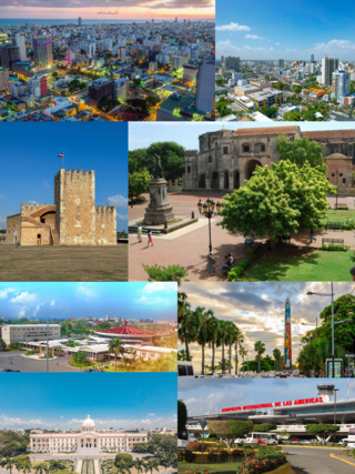
The Dominican Republic is a country on the island of Hispaniola in the Greater Antilles archipelago of the Caribbean Sea, bordered by the Atlantic Ocean to the north. Geographically, the Dominican Republic is part of the North American continent. It occupies the eastern five-eighths of the island, which it shares with Haiti, making Hispaniola one of only two Caribbean islands, along with Saint Martin, that is shared by two sovereign states. It is the second-largest nation in the Antilles by area at 48,671 square kilometers (18,792 sq mi), and second-largest by population, with approximately 11.4 million people in 2024, of whom approximately 3.6 million live in the metropolitan area of Santo Domingo, the capital city.

The Dominican Republic is a country in the West Indies that occupies the eastern five-eighths of Hispaniola. It has an area of 48,670 km2, including offshore islands. The land border shared with Haiti, which occupies the western three-eighths of the island, is 376 km long. The maximum length, east to west, is 390 km from Punta de Agua to Las Lajas, on the border with Haiti. The maximum width, north to south, is 265 km from Cape Isabela to Cape Beata. The capital, Santo Domingo, is located on the south coast.

Hispaniola is an island in the Caribbean that is part of the Greater Antilles. Hispaniola is the most populous island in the West Indies, and the region's second largest in area, after the island of Cuba. The 76,192-square-kilometre (29,418 sq mi) island is divided into two separate nations: the Spanish-speaking Dominican Republic (48,445 km2 to the east and the French/Haitian Creole-speaking Haiti (27,750 km2 to the west. The only other divided island in the Caribbean is Saint Martin, which is shared between France and the Netherlands.

Santo Domingo, once known as Santo Domingo de Guzmán, known as Ciudad Trujillo between 1936 and 1961, is the capital and largest city of the Dominican Republic and the largest metropolitan area in the Caribbean by population. As of 2022, the city and immediate surrounding area had a population of 1,029,110 while the total population is 3,798,699 when including Greater Santo Domingo. The city is coterminous with the boundaries of the Distrito Nacional, itself bordered on three sides by Santo Domingo Province.

San Cristóbal is a province in the southern region of Dominican Republic, located west of the capital Santo Domingo. With approximately 642,000 inhabitants, it is the fourth most populated province in the country, only behind Santo Domingo, Santiago and the National District. It borders the provinces Monseñor Nouel (north), Monte Plata (northeast), Santo Domingo (east), Peravia (west) and San José de Ocoa (northwest). The Caribbean Sea borders the province to the south. The provincial capital is the city of San Cristóbal.

San Cristóbal is a city in the southern region of Dominican Republic. It is the municipal (municipio) capital of the San Cristóbal province. The municipality is located in a valley at the foothills of the mountains belonging to the Cordillera Central, between the Nigua and Nizao rivers. Within this municipality there is one municipal district : Hato Damas.

Dajabón is a northwestern province which currently comprises one of the 32 provinces of the Dominican Republic. It is divided into 5 municipalities and its capital city with the same name. It is bordered by the provinces of Monte Cristi to the north, Santiago Rodríguez to the south, Elías Piña to the south and the Nord-Est department of Haiti to the west.

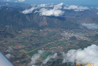
Elías Piña is one of the 32 provinces of the Dominican Republic, located in the westernmost part of the country, along the border with Haiti. It is divided into 6 municipalities and its capital city is Comendador. The Cordillera Central is found in the northern part of the province, and the Sierra de Neiba runs across the southern half. Between those two mountain ranges, there are several valleys formed by the Artibonite River and its tributaries.

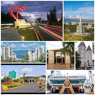
Santiago is a province which currently comprises one of the 32 provinces of the Dominican Republic. It is divided into 10 municipalities and its capital city is Santiago de los Caballeros. Located in north-central Dominican Republic, in the Cibao region, it is bordered by the provinces of Valverde to the north-west, Puerto Plata to the north, Espaillat and La Vega to the east, San Juan to the south and Santiago Rodríguez to the west.

Santiago Rodríguez is a province in the northwest region of the Dominican Republic. It was split from Monte Cristi in 1948. The Santiago Rodríguez province has the Monte Cristi and Valverde provinces to the north, the Santiago province to the east, the San Juan and Elías Piña provinces to the south and the Dajabón province to the west.

Valverde is a province of the Dominican Republic. It was split from Santiago Province in 1959. It is in the northwestern part of the country. Its capital city is Santa Cruz de Mao.

The Cibao, usually referred as "El Cibao", is a region of the Dominican Republic located at the northern part of the country. As of 2009 the Cibao has a population of 5,622,378 making it the most populous region in the country.

La Vega, is the fourth largest city and municipality of the Dominican Republic. It is in La Vega Province. The city is known as the Carnaval epicenter of the Dominican Republic for its tradition and culture, its large agricultural production methods throughout its province.

The Artibonite River is the longest river in Haiti, and the longest on the island of Hispaniola. It is also the second-longest river in the Caribbean, behind the Cauto River in Cuba. Forming part of the international border between Haiti and the Dominican Republic, the river's sources are in the Cordillera Central in the Dominican Republic (68 km); however, most of its length lies in Haiti (253 km).
The Parsley massacre was a mass killing of Haitians living in the Dominican Republic's northwestern frontier and in certain parts of the contiguous Cibao region in October 1937. Dominican Army troops from different areas of the country carried out the massacre on the orders of Dominican dictator Rafael Trujillo.

The Dominican city of Santa Cruz de Mao, or simply Mao, is the head municipality of the Valverde province, in the northwest of the country.

The Dominican Civil War, also known as the April Revolution, took place between April 24, 1965, and September 3, 1965, in Santo Domingo, Dominican Republic. It started when civilian and military supporters of the overthrown democratically elected president Juan Bosch ousted the militarily installed president Donald Reid Cabral from office. The second coup prompted General Elías Wessin y Wessin to organize elements of the military loyal to the dictator Reid ("loyalists"), initiating an armed campaign against the "constitutionalist" rebels.

The Dominican Republic–Haiti border is an international border between the Dominican Republic and the Republic of Haiti on the island of Hispaniola. Extending from the Caribbean Sea in the south to the Atlantic Ocean in the north, the 391 km border was agreed upon in the 1929 Dominican–Haitian border treaty.


