Furuset is residential and suburban area, situated in the northeast of Oslo, Norway. It was a separate borough of Oslo up to January 1, 2004, when it became part of the new borough of Alna. Furuset is a suburb in eastern Groruddalen, consisting of both residential blocks and houses.
Hokksund is a town in the municipality of Øvre Eiker in the county of Buskerud, Norway.

Ørnulf Bast was a Norwegian sculptor and painter particularly known for his public monuments.

Filtvet is a small village along the Oslofjord in Asker municipality, Akershus county, Norway.

Rødenes is a former municipality in the former Østfold county, Norway.

Kirkegrenda is a village in the municipality of Rygge in Østfold, Norway. Its population is 294.

Lierskogen is the easternmost village of Lier municipality in Buskerud county, Norway. Lierskogen makes up the eastern part of Lier together with the nearby village of Tranby. It borders Asker to the east and Drammen to the west.

Ytre Sandsvær is a former municipality in Buskerud county, Norway.

Onsøy is a peninsula and a former municipality in Østfold county, Norway. The administrative centre was Gressvik.

Idd is a parish and former municipality in Halden, Østfold county, Norway.

Mjøndalen is a built up area in Drammen municipality in Buskerud county, Norway. It is situated south of the Drammenselva River opposite of Krokstadelva.

St. Hanshaugen Park is a large public park located just north of the city center of Oslo, Norway. It is a classic urban park located within the borough of St. Hanshaugen, which was named for the park which lies within its center. St. Hanshaugen Park is situated between Geitmyrsveien, Colletts gate, Ullevålsveien and Knud Knudsens plass. Nearby are Bislett Stadium and Alexander Kiellands plass.

Åssiden is the largest borough of Drammen in Buskerud county, Norway.

Uranienborg is a neighborhood in the borough of Frogner in Oslo, Norway.

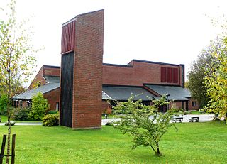
Holmen Church is the principal parish church for Sigdal municipality in the Diocese of Tunsberg. It is located at Prestfoss in Sigdal municipality, Buskerud county, Norway. Holmen Church is situated on a rocky mound with deciduous forest on the north side of the river Simoa. Access to the church is via Fv133 and Rv287.

Furuset kulturpark is a park in the neighborhood of Furuset in Oslo, Norway. It opened in May 2009 at a cost of NOK 5.6 million.

Sofienberg Park is a large park in the Grünerløkka district of Oslo, Norway, covering an area of 74 ha.

The Olsen Nauen Bell Foundry is a Norwegian bell foundry located in the municipality of Tønsberg. The foundry was established in 1844 by Ole Olsen, and it is headed today by the sixth generation of the Olsen Nauen family. The company is based at the Nauen farm in Sem and is Norway's only bell foundry.

The St. Peter's Church is a parish of the Roman Catholic Church in Halden in Østfold county, Norway. It was consecrated on October 10, 1877.

Bygdøy Church is a church that was built in a fan plan in 1968 on the peninsula of Bygdøy in Oslo, Norway. It replaced the Bygdøy chapel, which burned ten years earlier.


