Related Research Articles

Rio de Janeiro, or simply Rio, is the capital of the state of the same name, Brazil's third most populous state, and the second most populous city in Brazil, after São Paulo. Listed by the GaWC as a beta global city, Rio de Janeiro is the sixth most populous city in the Americas. Part of the city has been designated as a World Heritage Site, named "Rio de Janeiro: Carioca Landscapes between the Mountain and the Sea", on 1 July 2012 as a Cultural Landscape.

Rio de Janeiro is one of the 27 federative units of Brazil. It has the second largest economy of Brazil, with the largest being that of the state of São Paulo. The state, which has 8.2% of the Brazilian population, is responsible for 9.2% of the Brazilian GDP.
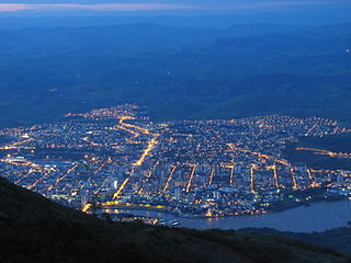
Volta Redonda is the name of a municipality in the Rio de Janeiro state of Brazil with an area of 182.81 km2, located from 350m to 707m above the sea level and with a population of 273,988 inhabitants. The area around the city has nearly 700,000 km2. Its name is due to the round shape of a curve in the Paraíba do Sul river around which the city was built.
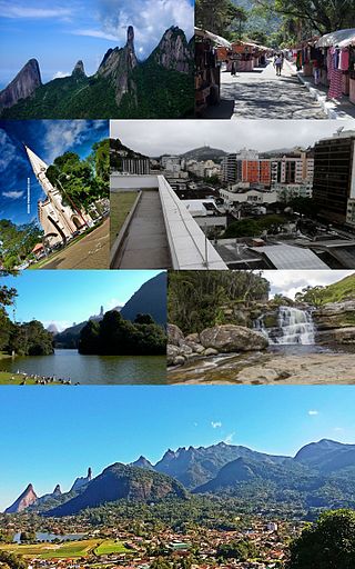
Teresópolis is a Brazilian municipality located in the state of Rio de Janeiro, in a mountainous region known as Região Serrana. The Serra dos Órgãos National Park lies partly within the city limits. The city is known as the home of the Brazil national football team, since it hosts CBF's training ground at Granja Comary.
Governador Valadares is a Brazilian municipality in the countryside of Minas Gerais. In 2020, its population was 281,046 inhabitants, thus being the ninth most populated city in the state. It is an economical axis of the middle valley of the Doce River, having a significant influence on the east and northeast portion of Minas Gerais and local authorities of the state of Espírito Santo. Governador Valadares sits on the bank of the Doce River, 324 km from Belo Horizonte, the state's capital. Governador Valadares has an area of about 2 342 km2, being only 58 km2 of urban area.

Belmiro Braga is a city in the state of Minas Gerais, Brazil close to the border with Rio de Janeiro state. It was emancipated from Juiz de Fora in 1962. As of 2020, the estimated population was 3,425 inhabitants.

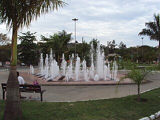
Nova Iguaçu is a municipality in Rio de Janeiro state in Brazil.

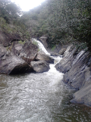
The Paraíba do Sul, or simply termed Paraíba, is a river in southeast Brazil. It flows 1,137 km (706 mi) west to northeast from its farthest source at the source of the river Paraitinga to the sea near Campos dos Goytacazes. The river receives its name when it meets the river Paraibuna at the Paraibuna dam.

Campos dos Goytacazes is a municipality located in the northern region of Rio de Janeiro State, Brazil, with a population of 471,737 inhabitants.

Espera Feliz is a municipality in southeastern Minas Gerais state, Brazil. The altitude is 2,430 m above sea level. Located at 20°39′00″S41°54′25″W, its neighboring cities are Caiana to the south, Dores do Rio Preto to the east, Divino to the west, Alto Caparaó and Caparaó to the north and Carangola to the southwest.

Bom Jesus do Itabapoana is a municipality in the Brazilian state of Rio de Janeiro. It had a population of 37,203 as of 2020, and has an area of 598,8 km2. It was founded in 1939, after being separated from the municipality of Itaperuna.

The Ciénaga Grande de Santa Marta is the largest of the swampy marshes located in Colombia between the Magdalena River and the Sierra Nevada de Santa Marta. It has an area of 4280 km2 and belongs to the outer delta system of the Madgalena River. It is separated from the Caribbean Sea by a narrow, sandy artificial spit built in the 1950s, on which is situated coastal route 90 from Barranquilla to Santa Marta. The marsh's large lagoon is connected to the Caribbean Sea via a narrow strait located between the town of Pueblo Viejo and the city of Ciénaga.

The Ministry of Foreign Affairs conducts Brazil's foreign relations with other countries. It is commonly referred to in Brazilian media and diplomatic jargon as Itamaraty, after the palace which houses the ministry. Since 1 January 2023, the minister responsible is Mauro Vieira.
The Federal Rural University of Rio de Janeiro is a public university located in Seropédica in the State of Rio de Janeiro, Brazil. It possesses the largest campus among Latin American universities and is known for being the first university to offer agriculture related courses in Brazil.
The Bela Joana River is a river of Rio de Janeiro state in southeastern Brazil.
The Dois Rios River is a river of Rio de Janeiro state in southeastern Brazil.
The Guandu-Mirim River is in the state of Rio de Janeiro in southeastern Brazil.
The Macabu River is a river of Rio de Janeiro state in southeastern Brazil.
The Macabuzinho River is a river of Rio de Janeiro state in southeastern Brazil.
Paranisolambda is an extinct genus of proterotheriid litopterns from the Early to Middle Eocene of Brazil. Fossils of Paranisolambda have been recovered from the Itaboraí Formation in the Brazilian state of Rio de Janeiro.
References
Coordinates: 22°25′S41°52′W / 22.417°S 41.867°W