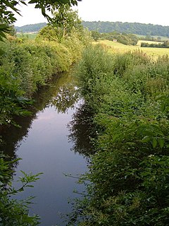
The Liskeard and Looe Union Canal was a broad canal between Liskeard and Looe in Cornwall, United Kingdom. It was almost 6 miles (9.7 km) long and had 24 locks, and it opened progressively from 1827. The engineer was Robert Coad.

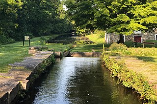
The Morris Canal (1829–1924) was a 107-mile (172-km) common carrier coal canal across northern New Jersey in the United States that connected the two industrial canals at Easton, Pennsylvania, across the Delaware River from its western terminus at Phillipsburg, New Jersey, to New York Harbor and the New York City markets via its eastern terminals in Newark and on the Hudson River in Jersey City, New Jersey.

An inclined plane is a system used on some canals for raising boats between different water levels. Boats may be conveyed afloat, in caissons, or may be carried in cradles or slings. It is a type of cable railway.

A boat lift, ship lift, or lift lock is a machine for transporting boats between water at two different elevations, and is an alternative to the canal lock and the canal inclined plane.

The Bude Canal was a canal built to serve the hilly hinterland in the Devon and Cornwall border territory in the United Kingdom, chiefly to bring lime-bearing sand for agricultural fertiliser. The Bude Canal system was one of the most unusual in Britain.

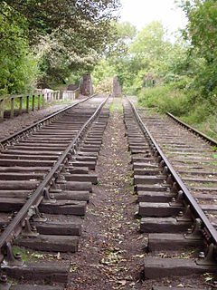
The Chard Canal was a 13.5 miles (21.7 km) tub boat canal in Somerset, England, that ran from the Bridgwater and Taunton Canal at Creech St. Michael, over four aqueducts, through three tunnels and four inclined planes to Chard. It was completed in 1842, was never commercially viable, and closed in 1868. The major engineering features are still clearly visible in the landscape.

The Hay Inclined Plane is a canal inclined plane in the Ironbridge Gorge in Shropshire, with a height of 207 feet (63 m). It was located at the end of the Shropshire Canal, part of a network of canals that linked the industrial region of east Shropshire with the River Severn. The inclined plane was in operation from 1793 to 1894. It can be visited as part of the Blists Hill Victorian Town and is also a waypoint on the South Telford Heritage Trail.

A cable railway is a railway that uses a cable, rope or chain to haul trains. It is a specific type of cable transportation.

The Somerset Coal Canal was a narrow canal in England, built around 1800. Its route began in basins at Paulton and Timsbury, ran to nearby Camerton, over two aqueducts at Dunkerton, through a tunnel at Combe Hay, then via Midford and Monkton Combe to Limpley Stoke where it joined the Kennet and Avon Canal. This link gave the Somerset coalfield access east toward London. The longest arm was 10.6 miles (17.1 km) long with 23 locks. From Midford an arm also ran via Writhlington to Radstock, with a tunnel at Wellow.

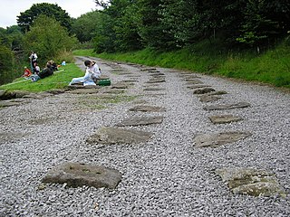
The Peak Forest Tramway was an early horse- and gravity-powered industrial railway system in Derbyshire, England. Opened for trade on 31 August 1796, it remained in operation until the 1920s. Much of the route and the structures associated with the line remain. The western section of the line is now the route of the Peak Forest Tramway Trail.

The Monkland Canal was a 12 1⁄4-mile-long (19.7 km) canal designed to bring coal from the mining areas of Monklands to Glasgow in Scotland. In the course of a long and difficult construction process, it was opened progressively as short sections were completed, from 1771. It reached Gartcraig in 1782, and in 1794 it reached its full originally planned extent, from pits at Calderbank to a basin at Townhead in Glasgow; at first this was in two sections with a 96-foot (29 m) vertical interval between them at Blackhill; coal was unloaded and carted to the lower section and loaded onto a fresh barge. Locks were later constructed linking the two sections, and the canal was also connected to the Forth and Clyde Canal, giving additional business potential.

The Shropshire Union Railways and Canal Company was a Company in England, formed in 1846, which managed several canals and railways. It intended to convert a number of canals to railways, but was leased by the London and North Western Railway (LNWR) from 1847, and although they built one railway in their own right, the LNWR were keen that they did not build any more. They continued to act as a semi-autonomous body, managing the canals under their control, and were critical of the LNWR for not using the powers which the Shropshire Union Company had obtained to achieve domination of the markets in Shropshire and Cheshire by building more railways.

The Ketley Canal was a tub boat canal that ran for about 1.5 miles (2.4 km) from Oakengates to Ketley works in Shropshire, England. The canal was built about 1788 and featured the first inclined plane in Britain. The main cargo of the canal was coal and ironstone. The inclined ceased to be used in 1816, when Ketley Works was closed, but the upper canal was not finally abandoned until the 1880s. A few traces of the canal are still visible in the landscape.

The Tavistock Canal is a canal in the county of Devon in England. It was constructed early in the 19th century to link the town of Tavistock to Morwellham Quay on the River Tamar, where cargo could be loaded into ships. The canal is still in use to supply water to a hydro-electric power plant at Morwellham Quay, and forms part of the Cornwall and West Devon Mining Landscape World Heritage Site. It is unusual for a canal, as it has a gentle slope over its length, resulting in a considerable flow of water.

The Shropshire Canal was a tub boat canal built to supply coal, ore and limestone to the industrial region of east Shropshire, England, that adjoined the River Severn at Coalbrookdale. It ran from a junction with the Donnington Wood Canal ascending the 316 yard long Wrockwardine Wood inclined plane to its summit level, it made a junction with the older Ketley Canal and at Southall Bank the Coalbrookdale (Horsehay) branch went to Brierly Hill above Coalbrookdale; the main line descended via the 600 yard long Windmill Incline and the 350 yard long Hay Inclined Plane to Coalport on the River Severn. The short section of the Shropshire Canal from the base of the Hay Inclined Plane to its junction with the River Severn is sometimes referred to as the Coalport Canal.

The Kidwelly and Llanelly Canal was a canal and tramroad system in Carmarthenshire, Wales, built to carry anthracite coal to the coast for onward transportation by coastal ships. It began life as Kymer's Canal in 1766, which linked pits at Pwll y Llygod to a dock near Kidwelly. Access to the dock gradually became more difficult as the estuary silted up, and an extension to Llanelli was authorised in 1812. Progress was slow, and the new canal was linked to a harbour at Pembrey built by Thomas Gaunt in the 1820s, until the company's own harbour at Burry Port was completed in 1832. Tramways served a number of collieries to the east of Burry Port.

The Wombridge Canal was a tub-boat canal in Shropshire, England, built to carry coal and iron ore from mines in the area to the furnaces where the iron was extracted. It opened in 1788, and parts of it were taken over by the Shrewsbury Canal Company in 1792, who built an inclined plane at Trench. It lowered tub boats 75 feet (23 m), and remained in operation until 1921, becoming the last operational canal inclined plane in the country. The canal had been little used since 1919, and closed with the closure of the plane.
James Green (1781–1849) was a noted civil engineer and canal engineer, who was particularly active in the South West of England, where he pioneered the building of tub boat canals, and inventive solutions for coping with hilly terrain, which included tub boat lifts and inclined planes. Although dismissed from two schemes within days of each other, as a result of construction problems, his contribution as a civil engineer was great.

Port Warren is an unincorporated community located within Greenwich Township in Warren County, New Jersey.


