Related Research Articles

Bay Harbor Islands is a town in Miami-Dade County, Florida, United States. The city is part of the Miami metropolitan area of South Florida. It is separated from the mainland by Biscayne Bay. The population was 5,922 at the 2020 US census.

Indian Creek is a village and man-made barrier island in Miami-Dade County, Florida, United States. It has 41 residential home sites and the Indian Creek Country Club. The village is part of the Miami metropolitan area of South Florida. The concentration of highly affluent people on the island has earned it the nickname Billionaire Bunker. The population was 84 at the 2020 census.

North Miami is a suburban city located in northeast Miami-Dade County, Florida, United States, about 10 miles (16 km) north of Miami. The city lies on Biscayne Bay and hosts the Biscayne Bay Campus of Florida International University.. Originally the town of "Arch Creek", the area was incorporated as the "Town of Miami Shores", which was renamed the "Town of North Miami" in 1931. It was reincorporated as a city in 1953. The city is part of the Miami metropolitan area of South Florida.

Sunny Isles Beach is a city located on a barrier island in northeast Miami-Dade County, Florida, United States. The city is part of the Miami metropolitan area of South Florida, and is bounded by the Atlantic Ocean on the east and the Intracoastal Waterway on the west. As of the 2020 census, it had a population of 22,342.

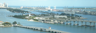
Biscayne Bay is a lagoon with characteristics of an estuary located on the Atlantic coast of South Florida. The northern end of the lagoon is surrounded by the densely developed heart of the Miami metropolitan area while the southern end is largely undeveloped with a large portion of the lagoon included in Biscayne National Park.

South Beach, also nicknamed colloquially as SoBe, is a neighborhood in Miami Beach, Florida. It is located east of Miami between Biscayne Bay and the Atlantic Ocean. The area encompasses Miami Beach south of Dade Boulevard.

Miami Modernist architecture, or MiMo, is a regional style of architecture that developed in South Florida during the post-war period. The style was internationally recognized as a regionalist response to the International Style. It can be seen in most of the larger Miami and Miami Beach resorts built after the Great Depression. Because MiMo styling was not just a response to international architectural movements but also to client demands, themes of glamour, fun, and material excess were added to otherwise stark, minimalist, and efficient styles of the era. The style can be most observed today in Middle and Upper Miami Beach along Collins Avenue, as well as along the Biscayne Boulevard corridor starting from around Midtown, through the Design District and into the Upper Eastside.

State Road 922 is a 5.548 miles (8.929 km) east–west road built in 1951, passing through the cities of North Miami, Bay Harbor Islands, and Bal Harbour, Florida. Locally, the street is also known as North 125th Street, North Miami Boulevard, Northeast 123rd Street, Broad Causeway, 96th Street, and Kane Concourse. Its western terminus is an intersection with Northwest Seventh Avenue, one block west of Interstate 95, its eastern terminus is an intersection with SR A1A. The street is an important commercial artery in northeastern Miami-Dade County, with stores lining much of the route, including the Bal Harbour Shops mall near its eastern terminus.
The General Douglas MacArthur Causeway is a six-lane causeway that connects Downtown Miami to South Beach via Biscayne Bay in Miami-Dade County.

The Rickenbacker Causeway is a causeway that connects Miami, Florida to the barrier islands of Virginia Key and Key Biscayne across Biscayne Bay.

The Venetian Islands are a chain of artificial islands in Biscayne Bay in the cities of Miami and Miami Beach, Florida. The islands are, from west to east: Biscayne Island (Miami), San Marco Island (Miami), San Marino Island, Di Lido Island, Rivo Alto Island, and Belle Isle. Flagler Monument Island remains an uninhabited picnic island, originally built in 1920 as a memorial to railroad pioneer Henry Flagler. The islands are connected by bridges from the Miami mainland to Miami Beach.

Belle Isle is a neighborhood in the city of Miami Beach on an island in Biscayne Bay, Florida, United States. It is the easternmost of the Venetian Islands, a chain of artificial islands in Biscayne Bay in the cities of Miami and Miami Beach. It is home to apartment buildings, a portion of the Venetian Causeway, a city of Miami Beach park, and a hotel. It is between Rivo Alto Island and the main barrier island of Miami Beach.

U.S. Highway 1 (US 1) in Florida runs 545 miles (877 km) along the state's east coast from Key West to its crossing of the St. Marys River into Georgia north of Boulogne and south of Folkston. US 1 was designated through Florida when the U.S. Numbered Highway System was established in 1926. With the exception of Monroe County, the highway runs through the easternmost tier of counties in the state, connecting numerous towns and cities along its route, including nine county seats. The road is maintained by the Florida Department of Transportation (FDOT).

Old Cutler Road is an off-grid plan, 14.9-mile (24.0 km) main northeast–southwest road running south of downtown Miami in Miami-Dade County, Florida, United States.

Collins Avenue, partly co-signed State Road A1A, is a major thoroughfare in South Florida, United States. The road runs parallel to the Atlantic Ocean in Miami Beach, Florida, one block west. It also runs through the cities of Surfside and Sunny Isles Beach to the north. Collins Avenue was named for John S. Collins, a developer who, in 1913, completed Miami’s first bridge, Collins Bridge, connecting Miami Beach to the mainland across Biscayne Bay.
Eastern Shores is a neighborhood within the city of North Miami Beach in Miami-Dade County, Florida, United States. It is located about 12 miles (19 km) north of Miami, just south of the city of Aventura.
Isle of Normandy or Normandy Island or Normandy Isles or Normandy Isle is a neighborhood of North Beach in the city of Miami Beach, Florida. It is located along the eastern shore of Biscayne Bay.
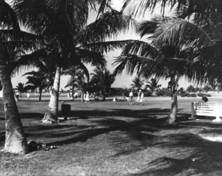
Bayshore is a neighborhood of Mid-Beach in the city of Miami Beach, Florida, United States. It is located in the center portion of the main island that the city occupies. Originally built around Carl Fisher's Bayshore Golf and Country Club, with a course designed by H.C. Tippet which opened in 1923, the area is roughly bound by the Collins Canal to the south, 41st Street to the north, Indian Creek to the east, and Biscayne Bay to the west. The neighborhood is characterized largely by single family homes and municipal uses.
References
- ↑ South Beach Information and Description
- ↑ Brennan, Morgan. "Inside Indian Creek Island, Miami's Billionaire Bunker". Forbes. Retrieved 2023-07-13.
25°49′12″N80°07′25″W / 25.820136°N 80.123506°W
| | This Miami-Dade County, Florida location article is a stub. You can help Wikipedia by expanding it. |