Related Research Articles

Royal Air Force Menwith Hill is a Royal Air Force station near Harrogate, North Yorkshire, England, which provides communications and intelligence support services to the United Kingdom and the United States. The site contains an extensive satellite ground station and is a communications intercept and missile warning site. It has been described as the largest electronic monitoring station in the world.

A radome is a structural, weatherproof enclosure that protects a radar antenna. The radome is constructed of material transparent to radio waves. Radomes protect the antenna from weather and conceal antenna electronic equipment from view. They also protect nearby personnel from being accidentally struck by quickly rotating antennas.
The Satellite Control Network (SCN), operated by the United States Space Force's Space Delta 6, provides support for the operation, control, and maintenance of a variety of United States Department of Defense and some non-DoD satellites. This involves continual execution of Telemetry, Tracking, and Commanding (TT&C) operations. In addition, the SCN provides prelaunch checkout and simulation, launch support, and early orbit support while satellites are in initial or transfer orbits and require maneuvering to their final orbit. The SCN provides tracking data to help maintain the catalog of space objects and distributes various data such as satellite ephemeris, almanacs, and other information. It was previously known as the Air Force Satellite Control Network (AFSCN) while under Air Force Space Command's 50th Network Operations Group.

USNS Kingsport (T-AG-164) was built as SS Kingsport Victory, a United States Maritime Commission VC2-S-AP3 (Victory) type cargo ship. During the closing days of World War II the ship was operated by the American Hawaiian Steamship Company under an agreement with the War Shipping Administration. After a period of layup the ship was operated as USAT Kingsport Victory by the Army under bareboat charter effective 8 July 1948. When Army transports were transferred to the Navy's Military Sea Transportation Service the ship continued as USNS Kingsport Victory (T-AK-239), a cargo transport. On 14 November 1961, after conversion into the first satellite communication ship, the ship was renamed Kingsport, reclassified as a general auxiliary, and operated as USNS Kingsport (T-AG-164).

Andover Earth Station was one of the first satellite earth stations, located at Andover in the US state of Maine. It was built by AT&T in 1961 to communicate with the Telstar 1 satellite, the first direct relay communications satellite. It provided the first experimental satellite telephone and television service between North America and Europe. It was also used with the Relay satellite. The giant horn was dismantled in the mid 1980s along with the visitor center.

TOPEX/Poseidon was a joint satellite altimeter mission between NASA, the U.S. space agency; and CNES, the French space agency, to map ocean surface topography. Launched on August 10, 1992, it was the first major oceanographic research satellite. TOPEX/Poseidon helped revolutionize oceanography by providing data previously impossible to obtain. Oceanographer Walter Munk described TOPEX/Poseidon as "the most successful ocean experiment of all time." A malfunction ended normal satellite operations in January 2006.

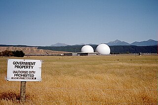
New Boston Space Force Station (BOSS) is a United States Space Force facility located in Hillsborough County in south central New Hampshire. It was transferred from the United States Air Force to the Space Force in the summer of 2020.

Mahé is the largest island of Seychelles, with an area of 157.3 square kilometres (60.7 sq mi), lying in the northeast of the Seychellois nation in the Somali Sea part of the Indian Ocean. The population of Mahé was 77,000, as of the 2010 census. It contains the capital city of Victoria and accommodates 86% of the country's total population. The island was named after Bertrand-François Mahé de La Bourdonnais, a French governor of Isle de France.

GCHQ Bude, also known as GCHQ Composite Signals Organisation Station Morwenstow, abbreviated to GCHQ CSO Morwenstow, is a UK Government satellite ground station and eavesdropping centre located on the north Cornwall coast at Cleave Camp, between the small villages of Morwenstow and Coombe. It is operated by the British signals intelligence service, officially known as the Government Communications Headquarters, commonly abbreviated GCHQ. It is located on part of the site of the former World War II airfield, RAF Cleave.

Islam in the Indian Ocean was established by Muslim sea merchants well before the European discovery of Seychelles. However, unlike in other island countries such as the Comoros or the Maldives, there were no permanent inhabitants in Seychelles until the French settlement in 1770. Today, the Muslim population of the islands is reported to be approximately 1.1%, roughly 900 people. Many of its island neighbours in the southern Indian Ocean, including the Comoros, Maldives, and Zanzibar, have a much larger Muslim influence because of their settlement by Muslims before European colonization. Mauritius also has a much higher Muslim population due to the importation of labour from British India on a scale not seen in Seychelles. The government of Seychelles allows 15 minutes of religious broadcasting every Friday for the Muslim community.
Mount Hebo Air Force Station is a closed United States Air Force General Surveillance Radar station. It is located 5.2 miles (8.4 km) east-southeast of Hebo, Oregon, located at the top of 3,154-foot (961 m) Mount Hebo. It was closed in 1980.

The 21st Space Operations Squadron is a satellite control unit of the Space Delta 6 of the United States Space Force, located at Vandenberg Space Force Base, California. Prior to July 2020, it was part of the 50th Network Operations Group. It operated Onizuka Air Force Station from its formation in 1991 until the closure of the station in 2010.
The Manned Space Flight Network was a set of tracking stations built to support the American Mercury, Gemini, Apollo, and Skylab space programs.

The British Indian Ocean Territory (BIOT) is an Overseas Territory of the United Kingdom situated in the Indian Ocean, halfway between Tanzania and Indonesia. The territory comprises the seven atolls of the Chagos Archipelago with over 1,000 individual islands, many very small, amounting to a total land area of 60 square kilometres. The largest and most southerly island is Diego Garcia, 27 square kilometres, the site of a Joint Military Facility of the United Kingdom and the United States. Official administration is remote from London, though the local capital is often regarded as being on Diego Garcia.
Indian Deep Space Network (IDSN) is a network of large antennas and communication facilities operated by the Indian Space Research Organisation to support the interplanetary spacecraft missions of India. Its hub is located at Byalalu, Ramanagara in the state of Karnataka in India. It was built under the leadership of S K Shivakumar, the then ISTRAC Director and inaugurated on 17 October 2008 by the former ISRO chairman G. Madhavan Nair.
The Australian Defence Satellite Communications Station (ADSCS), an Earth station in Australia is located at Kojarena 30 km (19 mi) east of Geraldton, Western Australia. The ADSCS is part of the US signals intelligence and analysis network ECHELON.

Telstar is the name of various communications satellites. The first two Telstar satellites were experimental and nearly identical. Telstar 1 launched on top of a Thor-Delta rocket on July 10, 1962. It successfully relayed through space the first television pictures, telephone calls, and telegraph images, and provided the first live transatlantic television feed. Telstar 2 was launched May 7, 1963. Telstar 1 and 2—though no longer functional—still orbit the Earth.

Svalbard Satellite Station or SvalSat is a satellite ground station located on Platåberget near Longyearbyen in Svalbard, Norway. Opened in 1997, it is operated by Kongsberg Satellite Services (KSAT), a joint venture between Kongsberg Defence & Aerospace and the Norwegian Space Centre (NSC). SvalSat and KSAT's Troll Satellite Station (TrollSat) in Antarctica are the only ground stations that can see a low altitude polar orbiting satellite on every revolution as the Earth rotates. As of 2021, the facility consists of 100 multi-mission and customer-dedicated antennas which operate in the C, L, S, X and K bands. The station provides ground services to more satellites than any other facility in the world.
The Waihopai Station is a secure communication facility, located near Blenheim, run by New Zealand's Government Communications Security Bureau. The station started operating in 1989, and collects data that is then shared with New Zealand's allies. In 2021, it was announced that the parts of the station would be deconstructed and removed from the site. Several protests and disputes surrounding its use and the wider implications of the information gathered has gained the facility some local and international notoriety.
Laredo Air Force Station was a Cold War radar station of the United States Air Force in Texas.
References
- ↑ "U.s.-Seychelles Relations". Archived from the original on 2016-03-03. Retrieved 2013-07-16.
- ↑ "Chapter 7 Space Systems". Archived from the original on 2006-12-12. Retrieved 2007-01-16.
- ↑ "The USAF tracking station and Sheikh Kalifa's villas at la Misere". Archived from the original on 2013-02-06. Retrieved 2013-07-16.
- ↑ Coker, Margaret. "Sheikh Abode a Sore Point in Seychelles". WSJ. Archived from the original on 2018-02-20.
- ↑ Administrator. "Location". www.seychellestourismacademy.edu.sc. Archived from the original on 2013-08-08.
- ↑ LABLACHE, JOHN (6 November 1988). "Seychelles Station Tracks U.S. Satellites : Air Force Facility Marks 25th Anniversary of Indian Ocean Duty". Archived from the original on 8 November 2012 – via LA Times.
- ↑ "Nation Home". www.nation.sc. Archived from the original on 2018-02-26.