
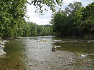
The Lackawanna River is a 42-mile-long (68 km) tributary of the Susquehanna River in Northeastern Pennsylvania. It flows through a region of the northern Pocono Mountains that was once a center of anthracite coal mining in the United States. It starts in north Wayne County, Pennsylvania and ends in east Luzerne County, Pennsylvania in Duryea, Pennsylvania. The lower reaches of the river flow through the urban areas of Scranton, which grew around its banks in the 19th century as an industrial center. Its name comes from a Lenape word meaning "stream that forks".

The Beaver Kill, sometimes written as the Beaverkill or Beaverkill River, is a tributary of the East Branch Delaware River, a main tributary of the Delaware River, approximately 44 miles (71 km) long, in the U.S. state of New York. The kill drains a 300-square-mile (780 km2) area of the Catskill Mountains and has long been celebrated as one of the most famous trout streams in the United States. Its preservation helped establish many of the basic conservation principles of rivers in the United States.

The Oswegatchie River is a 137-mile-long (220 km) river in northern New York that flows from the Adirondack Mountains north to the Saint Lawrence River. The Oswegatchie River begins at Partlow Lake in Hamilton County, New York. The river continues through Cranberry Lake which was 'doubled in size' through construction of a dam in the late 1860s. The river continues from the dam to Gouverneur, to near Talcville in St. Lawrence County, where it joins the West Branch. Much of it is within Adirondack State Park. The city of Ogdensburg developed at the mouth of the river at its confluence with the St. Lawrence.

The West Canada Creek is a 76-mile-long (122 km) river in upstate New York, United States. West Canada Creek is an important water way in Hamilton, Oneida, and Herkimer counties, draining the south part of the Adirondack Mountains before emptying into the Mohawk River near the Village of Herkimer. The name "Canada" is derived from an Iroquoian word for "village" (Kanata).
Carp River is a 40.2-mile-long (64.7 km) river in Chippewa and Mackinac counties in the U.S. state of Michigan. 21.7 miles (34.9 km) of the river were added to the National Wild and Scenic Rivers System in 1992.

Esopus Creek is a 65.4-mile-long (105.3 km) tributary of the Hudson River that drains the east-central Catskill Mountains in the U.S. state of New York. From its source at Winnisook Lake on the slopes of Slide Mountain, the Catskills' highest peak, it flows across Ulster County to the Hudson at Saugerties. Many tributaries extend its watershed into neighboring Greene County and a small portion of Delaware County. Midway along its length, it is impounded at Olive Bridge to create Ashokan Reservoir, the first of several built in the Catskills as part of New York City's water supply system. Its own flow is supplemented 13 miles (21 km) above the reservoir by the Shandaken Tunnel, which carries water from the city's Schoharie Reservoir into the creek.
Fishing Creek is a 29.98-mile (48.25 km) long tributary of the Susquehanna River in Columbia County, Pennsylvania, in the United States. It joins the Susquehanna River near the census-designated place of Rupert and the town of Bloomsburg. The watershed has an area of 385 square miles (1,000 km2).

The Lochsa River is in the northwestern United States, in the mountains of north central Idaho. It is one of two primary tributaries of the Middle Fork of the Clearwater River in the Clearwater National Forest. Lochsa is a Nez Perce word meaning rough water. The Salish name is Ep Smɫí, "It Has Salmon."

The Pemadumcook Chain of Lakes are a set of large lakes in north-central Maine in the United States.

The Moose River Plains Wild Forest is a 64,322-acre tract in the Adirondack Park in Hamilton and Herkimer counties in the state of New York in the United States of America; it is designated as Wild Forest by the New York State Department of Environmental Conservation.

The Baker Branch Saint John River is a 48.0-mile-long (77.2 km) river. This river is a tributary of the Saint John River, flowing in the Maine North Woods, in Maine, in the Northeastern United States.

The West Branch Penobscot River is a 117-mile-long (188 km) tributary of the Penobscot River through the North Maine Woods in Maine. The river is also known as Abocadneticook, Kahgognamock, and Kettegwewick.

Enchanted Pond is a mountain pond in the U.S. state of Maine. Situated in the Western Maine Mountains in the Northwest Somerset Region, the pond is located in a deep mountain valley between Coburn Mountain and Shutdown Mountain. Near its southern end, the pond is distinguished by two rockslides from the exposed cliffs of these mountains that extend down into the water along both shores. Enchanted Pond is fed by mountain springs and Little Enchanted Pond, and is the primary source of Enchanted Stream which flows into the Dead River, a tributary of the Kennebec River. Development on the pond is limited to a small set of sporting camps at the northern end of the pond and one remote camp on the southwest shore, both a part of Bulldog Camps. There are no islands in the pond.

Spring Brook is a tributary of the Lackawanna River in Lackawanna County and Luzerne County, in Pennsylvania, in the United States. It is approximately 17 miles (27 km) long and flows through Covington Township, Spring Brook Township, and Moosic in Lackawanna County and Pittston Township in Luzerne County. The watershed of the stream has an area of 57.2 square miles (148 km2). It is designated as a High-Quality Coldwater Fishery and a Migratory Fishery above Interstate 476 and as a Coldwater Fishery and a Migratory Fishery below it. A section is also designated as Class A Wild Trout Waters. The stream's tributaries include Panther Creek, Plank Bridge Creek, Rattlesnake Creek, Green Run, Monument Creek, and Covey Swamp Creek. It has a relatively high level of water quality and is very slightly acidic, with a pH of 6.4 to 6.9.

West Branch Sacandaga River is a river in Hamilton County in the state of New York. It begins northwest of Benson and flows west then northward then eastward before converging with the Sacandaga River south of Wells.

Batavia Kill is a 21-mile-long (34 km) tributary of Schoharie Creek, that flows across the towns of Windham, Ashland and Prattsville in the U.S. state of New York. Its waters reach the Hudson River via Schoharie Creek and the Mohawk River. Since it drains into the Schoharie upstream of Schoharie Reservoir, it is part of the New York City water supply system. From the source to Maplecrest, Batavia Kill drains the northern slopes of the Blackhead Mountains, which include Thomas Cole Mountain, Black Dome, and Blackhead Mountain, the fourth-, third-, and fifth-highest peaks in the Catskills, respectively.

The Rivière à Mars is a tributary of the Baie des Ha! Ha! Crossing the borough La Baie, in Saguenay (city), in the administrative region of Saguenay–Lac-Saint-Jean, in Quebec, in Canada. The "rivière à Mars" is a tributary of the Saguenay River and has its source in the Laurentides Wildlife Reserve. This river to salmons was badly affected by the Saguenay Flood which occurred from July 19 to 21, 1996.
The Trout River is a tributary of the Missisquoi River, flowing successively in municipalities of Montgomery, in Enosburg and in East Berkshire, in Franklin County, in northern Vermont in the United States.
