Indigenous Collection (Miles District Historical Village)

Last updated

The Miles District supported the Barunggam clan of the Murri people and was a transition stop for other aboriginal tribes. The collection of Australian Aboriginal artifacts from the local area and western Queensland, some of which are extremely rare, has national historic significance by its association with Australia's indigenous peoples.

The Murri is a demonym for Indigenous Australians of modern-day Queensland and north-west New South Wales. For some people and organisations, the use of indigenous language regional terms is an expression of pride in their heritage. The term includes many ethno-linguistic groups within the area,such as the Kamilaroi (Gamilaraay) and Yuggera (Jagera) peoples.

Australian Aboriginal artifacts

Australian Aboriginal artifacts consist the boomerangs, spears, shields, dillybags and other things Aboriginals had to carry around. Broadly aboriginal artifacts can be catagorised as weapons, every day items and ritual or secret sacred objects. Many artifacts were devised to address the harsh living conditions in the Australian environment.

Contents

Background

The Barunggam clan lived in the area from Tchanning Creek near Yuleba on the west, to Myall Creek near Dalby on the east, north to the Great Dividing Range, and south to the Moonie and Condamine watersheds. There are no known descendants in the area today, as the Barunggam were moved to Taroom in 1916, and then eventually to Cherbourg or Woorabinda.

Dalby, Queensland Town in Queensland, Australia

Dalby is a town and locality in the Darling Downs region of Queensland, Australia. Dalby is within and is the administrative centre of the Western Downs Region. At the 2016 census, Dalby had a population of 12,719.

Great Dividing Range mountain range in the Australian states of Queensland, New South Wales and Victoria

The Great Dividing Range, or the Eastern Highlands, is Australia's most substantial mountain range and the third longest land-based range in the world. It stretches more than 3,500 kilometres (2,175 mi) from Dauan Island off the northeastern tip of Queensland, running the entire length of the eastern coastline through New South Wales, then into Victoria and turning west, before finally fading into the central plain at the Grampians in western Victoria. The width of the range varies from about 160 km (100 mi) to over 300 km (190 mi). The Greater Blue Mountains Area, Gondwana Rainforests, and Wet Tropics of Queensland World Heritage Areas are located in the range.

Moonie, Queensland Town in Queensland, Australia

Moonie is a town in the Western Downs Region and a locality split between the Western Downs Region and the Goondiwindi Region in Queensland, Australia.

On the sandstone slabs that abound on the banks of L Tree Creek north of Miles, grooves in the stone are clear evidence that they were popular spear sharpening spots. There were places on Dogwood Creek and Chinaman's Lagoon (about 1 km south of Miles) where the aboriginals stopped and ate, and there are old middens of mussel shells on the west bank of the river at Condamine, and at the Round Waterhole north of Dulacca.

Miles, Queensland Town in Queensland, Australia

Miles is a town and a locality in the Western Downs Region, Queensland, Australia. In the 2016 census, Miles had a population of 1,746 people.

The region was also a transition stop for other aboriginal tribes as they travelled through every three years until 1876 on their way to the Bunya Mountains for the ripening of the bunya nuts. The Village collection includes the 'Ilbalunga Cave' as an example of a transition stop. Local aboriginal people were involved in its creation and decorated the cave with their hand prints.

Bunya Mountains mountain range in Queensland, Australia

The Bunya Mountains are a distinctive set of peaks forming an isolated section of the Great Dividing Range in southern Queensland. The mountain range forms the northern edge of the Darling Downs in the locality also called Bunya Mountains near Bell and Dalby. The mountains are south of Kingaroy and just to the south west of Nanango. The range is the remains of a shield volcano which was built from numerous basalt lava flows about 23-24 million years ago.

<i>Araucaria bidwillii</i> species of plant

Araucaria bidwillii, the bunya pine, is a large evergreen coniferous tree in the plant family Araucariaceae. It is found naturally in south-east Queensland Australia and two small disjunct populations in north eastern Queensland's World Heritage listed Wet Tropics. There are many old planted specimens in New South Wales, and around the Perth, Western Australia metropolitan area. They can grow up to 30–45 m (98–148 ft). The tallest presently living is one in Bunya Mountains National Park, Queensland which was reported by Robert Van Pelt in January 2003 to be 169 feet (51.5 m) in height.

The collection also includes a map showing the tribal areas, an extensive assortment of rubbing stones, boomerangs, stone axes, grinding and milling stones and other tools, predominantly from two major donors – the Keenan and the Mayfield families as well as dilly bags and other handcrafted items. Of particular significance are a Koala skin rug, an original Notice regarding the Aboriginal Protection Act, and a chest plate which are detailed below.

Koala Skin rug

Koala Skin rug Koala Skin rug.jpg
Koala Skin rug

As few rugs of aboriginal origin are in existence today, this koala skin rug is rare and of great historical significance as a handcrafted aboriginal artefact. It may also be useful for researching sewing and rug construction techniques. The rug was found in a cave on Mt Moffatt Station, near Roma, by Mr Dayne Vincent. The twine is made of boodioorie bark and the stitching is particularly unusual. The rug would have provided warmth and comfort due to the thick and soft nature of the koala fur.

Koala An arboreal herbivorous marsupial native to Australia.

The koala is an arboreal herbivorous marsupial native to Australia. It is the only extant representative of the family Phascolarctidae and its closest living relatives are the wombats, which comprise the family Vombatidae. The koala is found in coastal areas of the mainland's eastern and southern regions, inhabiting Queensland, New South Wales, Victoria, and South Australia. It is easily recognisable by its stout, tailless body and large head with round, fluffy ears and large, spoon-shaped nose. The koala has a body length of 60–85 cm (24–33 in) and weighs 4–15 kg (9–33 lb). Pelage colour ranges from silver grey to chocolate brown. Koalas from the northern populations are typically smaller and lighter in colour than their counterparts further south. These populations possibly are separate subspecies, but this is disputed.

Roma, Queensland Town in Queensland, Australia

Roma is a town, locality and the administrative centre in the Maranoa Region, Queensland, Australia. The town was incorporated in 1867 and is named after Lady Diamantina Bowen, the wife of Sir George Bowen, the Governor of Queensland at the time. At the 2016 census, Roma had a population of 6,848..

Other koala skin rugs exist in Australian Museums, however they are not of aboriginal manufacture but made after British colonisation when native furs were used in Australia for clothing and other wares. Millions of koalas were killed for their pelts up until the 1930s when protective measures were implemented by State governments to rebuild their numbers and stop the fur trade. Today koala is protected by legislation in all States and Territories where they are found.

Notice regarding 'The Aboriginals Protection and Restriction of the Sale of Opium Act 1897'

The notice Notice re Sale of Opium Act 1897.jpg
The notice

This notice came from Taroom where it had been displayed in the old Police Station for over 50 years, probably since 1897. The Notice is written in English and Chinese, and could be very rare as there are no other known copies.

Eleven of the 32 sections dealt stringently with control of the supply of opium to Aboriginal people. However the Act had wider social significance as its practical outcome was oppressive and restricted the rights and freedoms of Aboriginal people.

The legislation established reserves – geographically isolated enclaves – to which Aboriginal people could be forcibly removed by designated 'Aboriginal Protectors' – civil servants, police and missionaries. People were restricted to these reserves ostensibly to protect them from the ravages of European immorality and disease. Furthermore, the legislation was used to control Aboriginal people at the workplace and to remove their basic civil rights, reducing them to the position of State wards. This Act was not overturned until the Community Services Act 1984.

King Dick of Boondie Plate

King Dick of Boondie Plate King Dick of Boondie plate.jpg
King Dick of Boondie Plate

King plates were a form of regalia used in pre-Federation Australia by white colonial authorities to recognise local Aboriginal leaders. This chest plate belonged to a chief of the Palparara tribe of western Queensland in the WintonWindorah area, near Julia Creek.

King plates were metallic crescent-shaped plaques worn around the neck which sat across the chest. This chest plate belonged to King Dick of Boondie. A 'boondie' is an Australian term for a sand cake that is carved from, or broken off, a larger, hardened pocket of sand and can be thrown like a snow ball. Boondies are common in Western Queensland.

Known 'Kings' of the Miles district were King Billy of Tiereyboo who came in to live at Chinaman's Lagoon (near Miles) in the early 1900s, and King Sandy of Moraby. Tiereyboo was one of the early holdings taken up in this area, and was situated between the Condamine River and Dogwood Creek, and Moraby was an adjoining early holding further west. [1]

See also

Related Research Articles

Bunya Mountains National Park Protected area in Queensland, Australia

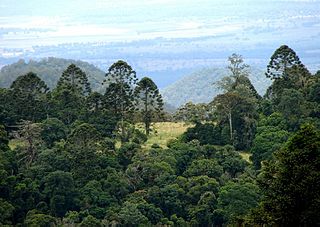
Bunya Mountains is a national park in the South Burnett Region, Queensland, Australia.

Kondalilla National Park Protected area in Queensland, Australia

Kondalilla is a national park in the Blackall Range of South East Queensland, Australia, 91 km north of Brisbane. William Skene founded this area on his property while searching for lost cattle. He named it Bon Accord before giving it to the Queensland Government who, during the fifties, renamed it Kondalilla which is an Aboriginal word for running water. The area was first officially protected in 1906 as a recreational area, becoming a national park in 1945.

Balonne River river in Australia

The Balonne River, part of the Murray-Darling Basin system, is a short and important part of the inland river group of South West Queensland, Australia.

Tarragindi, Queensland Suburb of Brisbane, Queensland, Australia

Tarragindi is a suburb on the south side of the City of Brisbane, Queensland, Australia. It is represented through the Holland Park and Moorooka Ward councillors on the Brisbane City Council. In the 2016 census, Tarragindi had a population of 10,779 people.

Darling Downs Region in Queensland, Australia

The Darling Downs is a farming region on the western slopes of the Great Dividing Range in southern Queensland, Australia. The Downs are to the west of South East Queensland and are one of the major regions of Queensland. The name was generally applied to an area approximating to that of the Condamine River catchment upstream of Condamine township but is now applied to a wider region comprising the Southern Downs, Western Downs, Toowoomba and Goondiwindi local authority areas. The name Darling Downs was given in 1827 by Allan Cunningham, the first European explorer to reach the area and recognises the then Governor of New South Wales, Ralph Darling.

Moonie Highway highway in Queensland

The Moonie Highway is a state highway of Queensland, Australia. Part of State Route 49, it leaves the Warrego Highway at Dalby and runs for over 290 km until it reaches St George. From there, State Route 49 continues west as the Balonne Highway. From Dalby, it continues north-east as the Bunya Highway.

Nanango Town in Queensland, Australia

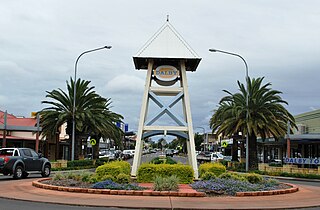
Nanango is a town and locality in the South Burnett Region of Queensland, Australia. In the 2016 census, Nanango had a population of 3,599 people.

Aboriginal breastplate

Aboriginal breastplates were a form of regalia used in pre-Federation Australia by white colonial authorities to recognise those they perceived to be local Aboriginal leaders. The breastplates were usually metallic crescent-shaped plaques worn around the neck by wearer.

Woorabinda, Queensland Town in Queensland, Australia

Woorabinda is an Aboriginal community in Central Queensland, Australia, inland about two hours' west drive of Rockhampton. At the 2006 census, Woorabinda had a population of 851.

Taroom Town in Queensland, Australia

Taroom is a town in the Shire of Banana and locality split between the Shire of Banana and the Western Downs Region in Queensland, Australia. At the 2016 census, Taroom had a population of 869 people.

The Turrbal are an Australian Aboriginal nation located around the region of present-day Brisbane, Queensland. The name primarily referred to the dialect they spoke, the tribe itself being alternatively called Mianjin/Meanjin. The Turrbal are regarded as interchangeable with the Jagera.

The Wakka Wakka are an indigenous Australian people of the state of Queensland.

Dogwood Creek (Queensland) river in Australia

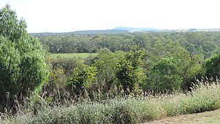
Dogwood Creek is a creek in the Maranoa Region, Queensland, Australia.

Taroom Aboriginal Settlement Aboriginal reserve at Bundulla, Taroom, Shire of Banana, Queensland, Australia

Taroom Aboriginal Settlement is a heritage-listed Aboriginal reserve at Bundulla, Taroom, Shire of Banana, Queensland, Australia. It was added to the Queensland Heritage Register on 13 May 2011. It is also known as Taroom Aboriginal Reserve and Taroom Aboriginal Mission.

The Yiman, also referred to as Yeeman/Eoman or Jiman, and by themselves in modern times as Iman, are an Indigenous Australian tribe living in the Upper Dawson River region around Taroom of eastern Central Queensland.

The Baruŋgam are an indigenous Australian people of Southeast Queensland

The Jarowair are an indigenous Australian people of the Darling Downs area of Queensland.

Warkon Suburb of Maranoa Region, Queensland, Australia

Warkon is a rural locality in the Maranoa Region, Queensland, Australia. In the 2016 census, warkon had a population of 33 people.

References

  1. Significance Assessment of the Miles & District Historical Society Collections 2010