
The Dwight D. Eisenhower National System of Interstate and Defense Highways, commonly known as the Interstate Highway System, is a network of controlled-access highways that forms part of the National Highway System in the United States. The system extends throughout the contiguous United States and has routes in Hawaii, Alaska, and Puerto Rico.

A ring road is a road or a series of connected roads encircling a town, city or country. The most common purpose of a ring road is to assist in reducing traffic volumes in the urban centre, such as by offering an alternate route around the city for drivers who do not need to stop in the city core. Ring roads can also serve to connect suburbs to each other, allowing efficient travel between them.
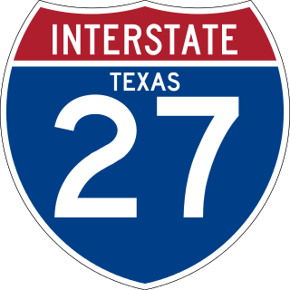
Interstate 27 (I-27) is an Interstate Highway, entirely in the US state of Texas, running north from Lubbock to I-40 in Amarillo. These two cities are the only control cities on I-27; other cities and towns served by I-27 include New Deal, Abernathy, Hale Center, Plainview, Kress, Tulia, Happy, and Canyon. In Amarillo, I-27 is commonly known as the Canyon Expressway, although it is also called Canyon Drive on its access roads. I-27 was officially designated the Marshall Formby Memorial Highway after former attorney and State Senator Marshall Formby in 2005. The entire length of I-27 replaced US Highway 87 (US 87) for through traffic. An extension of I-27 north to Raton, New Mexico, and south to Laredo, Texas was approved in 2022.

Interstate 45 (I-45) is a major Interstate Highway located entirely within the US state of Texas. While most Interstate routes which have numbers ending in "5" are cross-country north–south routes, I-45 is comparatively short, with the entire route located in Texas. Additionally, it has the shortest length of all the interstates that end in a "5." It connects the cities of Dallas and Houston, continuing southeast from Houston to Galveston over the Galveston Causeway to the Gulf of Mexico.

Interstate 820 (I-820) is a loop of I-20 in Fort Worth, Texas, of approximately 35.17 miles (56.60 km) around the city and some of its suburbs. Exit numbers begin at its intersection with I-20 in southwest Fort Worth, and continue in a clockwise direction around the city until it ends at its intersection with I-20 in southeast Fort Worth. A portion of I-820 in the northeast quadrant is cosigned with State Highway 121 (SH 121) as well as SH 183.

Interstate 435 (I-435) is an Interstate Highway beltway that encircles much of the Kansas City metropolitan area within the states of Kansas and Missouri in the United States.

Interstate 390 (I-390) is a 76.06-mile (122.41 km) north–south auxiliary Interstate Highway located entirely within New York in the United States. The southern terminus of the route is at the Southern Tier Expressway in the town of Avoca. Its northern terminus is at I-490 in Gates, just west of Rochester. North of I-490, the expressway continues as NY 390 to the Lake Ontario State Parkway in Greece. I-390 connects to its parent, I-90, in Henrietta, a southern suburb of Rochester. The route is known as the Genesee Expressway from Avoca to I-590 in Brighton, where it becomes part of the Rochester Outer Loop.

Interstate 610 (I-610) is a freeway that forms a 38-mile-long (61 km) loop around the inner city sector of the city of Houston, Texas. I-610, colloquially known as The Loop, Loop 610, The Inner Loop, or just 610, traditionally marks the border between the inner city of Houston and its surrounding areas. It is the innermost of the three Houston beltways, the other two being Beltway 8 and State Highway 99, of which various segments are under construction or planning. In Houston, the area inside the 610 Loop is the urban core. Jeff Balke of the Houston Press wrote that the freeway "is as much a social and philosophical divide as a physical one". Mike Snyder in the Houston Chronicle wrote that as someone from the 610 Loop he historically felt "kind of special" due to being close to "the city’s historical core and its major business, educational and cultural institutions".

Interstate 490 (I-490) is an auxiliary Interstate Highway that serves the city of Rochester, New York, in the United States. It acts as a northerly alternate route to the New York State Thruway (I-90), leaving it at exit 47 in the town of Le Roy and rejoining the highway at exit 45 in the town of Victor 37.4 miles (60.2 km) to the east. I-490 connects with I-390 and New York State Route 390 (NY 390) on the western side of Rochester and I-590 and NY 590 on the east side of the city at an interchange known as the Can of Worms. The highway comprises the southernmost portion of the Inner Loop, a beltway around the interior of Rochester. Outside the city, I-490 serves several suburban villages, such as Churchville and Pittsford.

Interstate 635 (I-635) is a 37-mile-long (60 km) partial loop around Dallas, Texas, in the United States between I-20 in Balch Springs and State Highway 121 (SH 121) at the north entrance of the Dallas/Fort Worth International Airport (DFW Airport) in Grapevine. It intersects I-35E at exits 27B and 27C, but does not connect with I-35W. A small part of I-635 and I-20 is collectively designated as the Lyndon B. Johnson Freeway; known locally as the LBJ Freeway, or simply LBJ. The roadway is named after Lyndon B. Johnson, the former US Senator from Texas, 37th Vice President, and the 36th President of the United States. Where I-635 ends at I-20, I-20 continues the LBJ Freeway designation heading west. Since the portion of I-20 between State Highway Spur 408 (Spur 408) to I-635 retains the same names as I-635, the two highways are considered 3/4 of the beltway around Dallas. Together with Spur 408, a portion of State Highway Loop 12, and a portion of I-35E, the Stemmons Freeway, I-635 and I-20 complete the beltway.
The Inner Loop was two planned freeways around downtown Washington, D.C. The innermost loop would have formed an oval centered on the White House, with a central freeway connecting the southern segment to the northern segment and then continuing on to Interstate 95. Interstate 95 would have met Interstate 66, Interstate 295, Interstate 695, and US 50 while traversing the Inner Loop. A second loop was an arc across the northern section of the city, beginning at East Capitol Street at the Anacostia River and using the Missouri Avenue NW and Nebraska Avenue NW commercial corridors to terminate in Georgetown.

In the U.S. state of Arizona, Interstate 10 (I‑10), the major east–west Interstate Highway in the United States Sun Belt, runs east from California, enters Arizona near the town of Ehrenberg and continues through Phoenix and Tucson and exits at the border with New Mexico near San Simon. The highway also runs through the cities of Casa Grande, Eloy, and Marana. Segments of the highway are referred to as either the Papago Freeway, Inner Loop, or Maricopa Freeway within the Phoenix area and the Pearl Harbor Memorial Highway outside metro Phoenix.
The Inner Loop, formerly a complete loop, is now a "C"-shaped freeway in downtown Rochester, New York, in the United States. Only the portions north of Interstate 490 (I-490) are signed as the "Inner Loop". The official western terminus of the Inner Loop is at I-490 exit 13 in the shadow of Frontier Field west of downtown, while the eastern terminus is at I-490 exits 15 and 16 directly south of downtown on the east bank of the Genesee River. This section of the loop is designated New York State Route 940T (NY 940T), an unsigned reference route, by the New York State Department of Transportation. Although the NY 940T designation is not signed, the road is signed with orange trapezoidal route markers containing the words "Inner Loop" in white.

Loop 375 is a beltway that partially encircles the city of El Paso, Texas. The beltway is mostly a freeway, except for its northern section, which includes at-grade intersections. The highway passes through various areas of El Paso, funneling traffic within and around the city. The road is known locally under different names, as Woodrow Bean Transmountain Drive in the northern section, Purple Heart Memorial Freeway in the northeastern section, Joe Battle Boulevard in the eastern section, the César Chávez Border Highway in the southern section, and the Border West Expressway on the southwest section.

Interstate 10 (I-10) is the major east–west Interstate Highway in the Southern United States. In the U.S. state of Texas, it runs east from Anthony, at the border with New Mexico, through El Paso, San Antonio, and Houston to the border with Louisiana in Orange, Texas. At just under 880 mi (1,420 km), the Texas segment of I-10, maintained by the Texas Department of Transportation, is the longest continuous untolled freeway in North America that is operated by a single authority. It is also the longest stretch of Interstate Highway with a single designation within a single state. Mile marker 880 and its corresponding exit number in Orange, Texas, are the highest numbered mile marker and exit on any freeway in North America. After widening was completed in 2008, a portion of the highway west of Houston is now also believed to be the widest in the world, at 26 lanes when including feeders.

Inner–outer directions are labels that identify the direction of travel on opposing lanes of traffic on certain ring roads or beltways. They can be used to sign individual routes that encircle a city or metropolitan area, where east–west and north–south orientations cannot be applied uniformly. The labels are also used in select double track rail systems that form a loop, indicating the direction of travel of each line.
The transportation system of Arizona comprises car, rail, air, bus, and bicycle transport.
The metropolitan area of Phoenix in the U.S. state of Arizona contains one of the nation's largest and fastest-growing freeway systems, with over 1,405 lane miles (2,261 km) as of 2005.