Related Research Articles

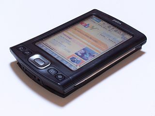
A personal digital assistant (PDA) is a multi-purpose mobile device which functions as a personal information manager. PDAs have been mostly displaced by the widespread adoption of highly capable smartphones, in particular those based on iOS and Android, and thus saw a rapid decline in use after 2007.
Location-based service (LBS) is a general term denoting software services which use geographic data and information to provide services or information to users. LBS can be used in a variety of contexts, such as health, indoor object search, entertainment, work, personal life, etc. Commonly used examples of location-based services include navigation software, social networking services, location-based advertising, and tracking systems. LBS can also include mobile commerce when taking the form of coupons or advertising directed at customers based on their current location. LBS also includes personalized weather services and even location-based games.

An intelligent transportation system (ITS) is an advanced application which aims to provide innovative services relating to different modes of transport and traffic management and enable users to be better informed and make safer, more coordinated, and 'smarter' use of transport networks.
Enhanced 911 is a system used in North America to automatically provide the caller's location to 911 dispatchers. 911 is the universal emergency telephone number in the region. In the European Union, a similar system exists known as E112 and known as eCall when called by a vehicle.

Wireless communication is the transfer of information (telecommunication) between two or more points without the use of an electrical conductor, optical fiber or other continuous guided medium for the transfer. The most common wireless technologies use radio waves. With radio waves, intended distances can be short, such as a few meters for Bluetooth or as far as millions of kilometers for deep-space radio communications. It encompasses various types of fixed, mobile, and portable applications, including two-way radios, cellular telephones, personal digital assistants (PDAs), and wireless networking. Other examples of applications of radio wireless technology include GPS units, garage door openers, wireless computer mouse, keyboards and headsets, headphones, radio receivers, satellite television, broadcast television and cordless telephones. Somewhat less common methods of achieving wireless communications involve other electromagnetic phenomena, such as light and magnetic or electric fields, or the use of sound.
Automatic vehicle location is a means for automatically determining and transmitting the geographic location of a vehicle. This vehicle location data, from one or more vehicles, may then be collected by a vehicle tracking system to manage an overview of vehicle travel. As of 2017, GPS technology has reached the point of having the transmitting device be smaller than the size of a human thumb, able to run 6 months or more between battery charges, easy to communicate with smartphones — all for less than $20 USD.

Telematics is an interdisciplinary field encompassing telecommunications, vehicular technologies, electrical engineering, and computer science. Telematics can involve any of the following:

Traffic Message Channel (TMC) is a technology for delivering traffic and travel information to motor vehicle drivers. It is digitally coded using the ALERT C or TPEG protocol into Radio Data System (RDS) carried via conventional FM radio broadcasts. It can also be transmitted on Digital Audio Broadcasting or satellite radio. TMC allows silent delivery of dynamic information suitable for reproduction or display in the user's language without interrupting audio broadcast services. Both public and commercial services are operational in many countries. When data is integrated directly into a navigation system, traffic information can be used in the system's route calculation.

An automotive navigation system is part of the automobile controls or a third party add-on used to find direction in an automobile. It typically uses a satellite navigation device to get its position data which is then correlated to a position on a road. When directions are needed routing can be calculated. On the fly traffic information can be used to adjust the route.

Since the Global Positioning System (GPS) was introduced in the late 1980s there have been many attempts to integrate it into a navigation-assistance system for blind and visually impaired people.

TomTom N.V. is a Dutch multinational developer and creator of location technology and consumer electronics. Founded in 1991 and headquartered in Amsterdam, TomTom released its first generation of satellite navigation devices to market in 2004. As of 2019 the company has over 4,500 employees worldwide and operations in 29 countries throughout Europe, Asia-Pacific, and the Americas.
Magellan Navigation, Inc. is an American producer of consumer and professional grade global positioning system receivers, named after Ferdinand Magellan, the first explorer to circumnavigate the globe. Headquartered in San Dimas, California, with European sales and engineering centres in Nantes, France and Moscow, Russia, Magellan also produces aftermarket automotive GPS units, including the Hertz Neverlost system found in Hertz rental cars. The Maestro, RoadMate, Triton, and eXplorist lines are Magellan's current consumer offerings. The company also produces proprietary road maps (DirectRoute), topographic maps (Topo), and marine charts (BlueNav) for use with its consumer GPS receivers.
Global Navigation Satellite System (GNSS) receivers, using the GPS, GLONASS, Galileo or BeiDou system, are used in many applications. The first systems were developed in the 20th century, mainly to help military personnel find their way, but location awareness soon found many civilian applications.

Radio is the technology of communicating using radio waves. Radio waves are electromagnetic waves of frequency between 3 hertz (Hz) and 300 gigahertz (GHz). They are generated by an electronic device called a transmitter connected to an antenna which radiates the waves. They are received by another antenna connected to a radio receiver. In addition to communication, radio is used for radar, radio navigation, remote control, remote sensing, and other applications.

A Personal Navigation Assistant (PNA) also known as Personal Navigation Device or Portable Navigation Device (PND) is a portable electronic product which combines a positioning capability and navigation functions.

A satellite navigation device, satnav device or satellite navigation receiver is a user equipment that uses one or more of several global navigation satellite systems (GNSS) to calculate the device's geographical position and provide navigational advice. Depending on the software used, the satnav device may display the position on a map, as geographic coordinates, or may offer routing directions.
Beat the Traffic was a provider of vehicle traffic reporting solutions for broadcast media and consumers. With a focus on daily commuters, Beat the Traffic was founded in 2001 by former CEO Andre Gueziec. On September 10, 2012, Pelmorex announced it had acquired Beat the Traffic.
A vehicle tracking system combines the use of automatic vehicle location in individual vehicles with software that collects these fleet data for a comprehensive picture of vehicle locations. Modern vehicle tracking systems commonly use GPS or GLONASS technology for locating the vehicle, but other types of automatic vehicle location technology can also be used. Vehicle information can be viewed on electronic maps via the Internet or specialized software. Urban public transit authorities are an increasingly common user of vehicle tracking systems, particularly in large cities.

Internavi is a vehicle telematics service offered by the Honda Motor Company to drivers in Japan. In the United States, the service is known as HondaLink, or sometimes MyLink. It provides mobile connectivity for on-demand traffic information services and internet provided maps displayed inside selected Honda vehicles. The service began August 1997 and was first offered in the 1998 Honda Accord and the Honda Torneo sold only in Japan starting July 1998. The service received a revision to services offered October 2002, adding traffic information delivery capabilities for subscribers to the Internavi Premium Club, and was optional on most Honda vehicles sold in Japan. VICS was integrated into the service starting September 2003. Membership in the service has steadily grown to exceed 5 million subscribers as of March 2007.

Toyota Entune is an integrated multimedia navigation and telematics system for Toyota automobiles that provides satellite-based information on traffic, weather, sports scores, stocks, and fuel prices via subscription through SiriusXM. When connected to a compatible cellular phone running the Entune app via radio or USB cable, the system provided a browser and other apps including those from music services such as iHeartRadio, Pandora and XM Satellite Radio. The cell phone app supported iOS, Android, and Blackberry with different versions utilizing cell data. The system could be controlled with (limited) speech recognition, and optionally include the “Safety Connect” personalization system.
References
- ↑ Understanding GPS navigation traffic services: Consumer Reports Cars Blog Archived 2007-12-27 at the Wayback Machine
- ↑ "Clear Channel". Archived from the original on 2007-12-11. Retrieved 2008-01-22.
- ↑ For example, Patents US 5933100A: Automobile navigation system with dynamic traffic data [ dead link ]