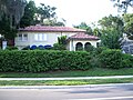
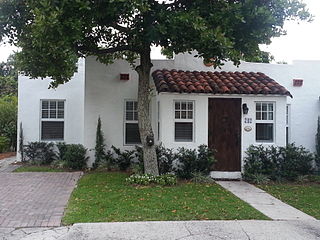
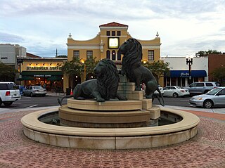
Winter Haven is a city in Polk County, Florida, United States. It is located about 51 miles (82 km) east of Tampa and about 47 miles (76 km) southwest of Orlando, with neighboring Lakeland located to its west. The city's population was 49,219 at the 2020 census, making it the second most populated city in Polk County after Lakeland. It is a principal city of the Lakeland-Winter Haven, Florida Metropolitan Statistical Area.

Hyde Park is a neighborhood and historic district in Austin, Texas. Located in Central Austin, Hyde Park is defined by 38th Street to the south, 45th Street to the north, Duval Street to the east, and Guadalupe Street to the west. It is situated just north of the University of Texas and borders the neighborhoods of Hancock and North Loop.

Navarre is a neighborhood of the city of New Orleans. A subdistrict of the Lakeview District Area, its boundaries as defined by the City Planning Commission are: I-610, Canal Boulevard and Florida Boulevard to the north, Orleans Avenue to the east, City Park Avenue to the south and the Pontchartrain Expressway and Pontchartrain Boulevard to the west.

The Bay Shore Historic District is a U.S. historic district located in Miami, Florida. The district is bounded by Northeast 55th Street, Biscayne Boulevard, Northeast 60th Street and Biscayne Bay, in the Morningside section of the Upper Eastside neighborhood. It contains 223 historic buildings.

The Miami Beach Architectural District is a U.S. historic district located in the South Beach neighborhood of Miami Beach, Florida. The area is well known as the district where Italian fashion designer Gianni Versace lived and was assassinated by Andrew Cunanan, in a mansion on Ocean Drive. It is bounded by the Atlantic Ocean to the east, Sixth Street to the south, Alton Road to the west and the Collins Canal and Dade Boulevard to the north. It contains 960 historic buildings.
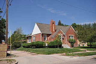
The Grandview Heights Historic District is a U.S. historic district located in West Palm Beach, Florida. The district is bounded by Park Place, Alabama Avenue, M Street, and Lake Avenue.

There are more than 500 neighborhoods within the area of Jacksonville, Florida, the largest city in the contiguous United States by area. These include Downtown Jacksonville and surrounding neighborhoods. Additionally, greater Jacksonville is traditionally divided into several major sections with amorphous boundaries: Northside, Westside, Southside, and Arlington, as well as the Jacksonville Beaches.

The Upper Eastside is a neighborhood in Miami, Florida. It is north of Edgewater, east of Little Haiti, south of the village of Miami Shores, and sits on Biscayne Bay. In geographical order from south to north and east to west, it contains the subdivisions of Magnolia Park, Bay Point, Morningside, Bayside, Belle Meade, Shorecrest, and Palm Grove. The MiMo District along Biscayne Boulevard in the area is host to many art galleries, shops and restaurants.

Herron–Morton Place is a historic district in Indianapolis, Indiana, United States. The boundaries of the neighborhood are East 16th Street on the south, East 22nd Street on the north, North Pennsylvania Street on the west, and Central Avenue on the east.

The Dwight Street Historic District is an irregularly shaped 135-acre (55 ha) historic district in New Haven, Connecticut. The district is located immediately west of the center of Downtown New Haven and is generally bounded by Elm Street on the north, Park Street on the east, North Frontage Road on the south, and Sherman Avenue on the west. It contains one of the city's highest concentrations of well-preserved 19th and early 20th-century residential architecture, much of which was developed for the working classes in the city's factories. It was listed on the National Register of Historic Places in 1983. The historic district includes most of the Dwight neighborhood and several blocks of the northeast corner of the West River neighborhood.
Riverside and Avondale are two adjacent and closely associated neighborhoods, alternatively considered one continuous neighborhood, of Jacksonville, Florida. The area is primarily residential, but includes some commercial districts, including Five Points, the King Street District, and the Shoppes of Avondale.
San Marco is a neighborhood of Jacksonville, Florida, south of Downtown across the St. Johns River. The neighborhood was formerly the independent city of South Jacksonville until it was annexed by Jacksonville in 1932. The neighborhood is primarily residential, with an integrated commercial sector known as San Marco Square.
Lake Howard is a fresh water lake, located in Winter Haven, Florida. The lake is part of the headwaters of the Peace River watershed. Lake Howard is a prominent lake in Winter Haven's Chain of Lakes. Lake Howard is on the southern chain of lakes. It is connected to Lake Cannon, to the north-west, and Lake May, to the south-east. Lake Howard has a surface area of 624 acres. It has a mean depth of 10.9 feet (3.3 m), and maximum depth of 18.7 feet (5.7 m).
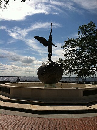
The Chain of Lakes is a famous series of lakes in Central Florida. There are two chains of lakes, the northern chain and the southern chain. The northern chain extends across three cities: Winter Haven, Lake Alfred, and Lake Hamilton. It has ten lakes, connected by a series of canals. The ten lakes on the northern chain are Lake Haines, Lake Rochelle, Lake Echo, Lake Conine, Lake Fannie, Lake Smart, Lake Henry, Lake Hamilton, Middle Lake Hamilton, and Little Lake Hamilton.
Lake May, a wedge-shaped lake, is a natural freshwater lake in southwest Winter Haven, Florida. This lake has a 49.07-acre (198,600 m2) surface area. It is bounded on the east and northeast by vacant land, on the northwest by commercial property, on the west and most of the south by vacant land and on the east and southeast by more commercial property. Much of the shore around the lake is lined by swampy areas.
Lake Cannon, an almost round lake, has a surface area of 333-acre (1,350,000 m2). Lake Cannon is in a highly urbanized area. On the north shore is a some vacant land and the Boys Club is also on the north shore. The rest of the lake is surrounded by residential areas. About 300 feet (91 m) to the lake's east is Lake Mirror and 500 feet (150 m) to the southeast is Lake Howard.
Lake Hartridge, with somewhat of a figure eight shape, has a surface area of 433-acre (1,750,000 m2). This lake is on the north side of Winter Haven in Polk County, Florida. Most of the lake's west shore is bordered by residential areas. The northwest shore is bordered by woods. The north shore is bordered woods and clearings. The northeast is bordered by more clearings. The east central and southeast shores are bordered by woods and a few residences. At the very southeast corner is Aldora Park, a small public park. The south shore is bordered by a large church. On the southwest shore is Lake Hartridge Nature Park, a public park.

The South Monroe Street Historic District is a primarily residential historic district located at 89-175 and 90-146 South Monroe Street, and 17 Park Avenue, in Coldwater, Michigan. It was listed on the National Register of Historic Places in 1990. It is the best-preserved section of modest houses constructed in Coldwater in the 1850s-1870s, and contains the former Lake Shore & Michigan Southern depot, constructed in 1883.
The Moore Haven Heights Historic District, in Cheyenne, Wyoming, is a 100 acres (40 ha) historic district which was listed on the National Register of Historic Places in 2009. The listing included 445 contributing buildings.