
Interstate 80 (I-80) is an east–west transcontinental freeway that crosses the United States from San Francisco, California, to Teaneck, New Jersey, in the New York metropolitan area. The highway was designated in 1956 as one of the original routes of the Interstate Highway System; its final segment was opened in 1986. The second-longest Interstate Highway in the United States after I-90, it runs through many major cities, including Oakland, Sacramento, Reno, Salt Lake City, Omaha, Des Moines, and Toledo and passes within 10 miles (16 km) of Chicago, Cleveland, and New York City.

Interstate 90 (I-90) is an east–west transcontinental freeway and the longest Interstate Highway in the United States at 3,021 miles (4,862 km). It begins in Seattle, Washington, and travels through the Pacific Northwest, Mountain West, Great Plains, Midwest, and the Northeast, ending in Boston, Massachusetts. The highway serves 13 states and has 15 auxiliary routes, primarily in major cities such as Chicago, Cleveland, Buffalo, and Rochester.
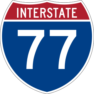
Interstate 77 (I-77) is a north–south Interstate Highway in the Eastern United States. It traverses diverse terrain, from the mountainous state of West Virginia to the rolling farmlands of North Carolina and Ohio. It largely supplants the old U.S. Route 21 (US 21) between Cleveland, Ohio, and Columbia, South Carolina, as an important north–south corridor through the middle Appalachian Mountains. The southern terminus of I-77 is in Cayce, South Carolina, in Lexington County at the junction with I-26. The northern terminus is in Cleveland at the junction with I-90. Other major cities that I-77 connects to include Columbia, South Carolina; Charlotte, North Carolina; Charleston, West Virginia; and Akron, Ohio. The East River Mountain Tunnel, connecting Virginia and West Virginia, is one of only two instances in the U.S. where a mountain road tunnel crosses a state line. The other is the Cumberland Gap Tunnel, connecting Tennessee and Kentucky. I-77 is a snowbird route to the Southern U.S. for those traveling from the Great Lakes region.

Interstate 271 (I-271) is an auxiliary Interstate Highway in the suburbs of Cleveland and Akron in the US state of Ohio. The highway is officially designated the Outerbelt East Freeway but is rarely referred to by that name by locals, instead simply referring to it as "271".
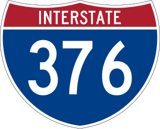
Interstate 376 (I-376) is a major auxiliary route of the Interstate Highway System in the US state of Pennsylvania, located within the Allegheny Plateau. It runs from I-80 near Sharon south and east to a junction with the Pennsylvania Turnpike in Monroeville, after having crossed the Pennsylvania Turnpike at an interchange in Big Beaver. The route serves Pittsburgh and its surrounding areas and is the main access road to Pittsburgh International Airport (PIT). Portions of the route are known as the Beaver Valley Expressway, Southern Expressway, and Airport Parkway. Within Allegheny County, the route runs along the majority of the Penn-Lincoln Parkway, known locally as Parkway West and Parkway East. It is currently the ninth-longest auxiliary Interstate route in the system and second only to I-476 within Pennsylvania.

Interstate 84 (I-84) is an Interstate Highway in the northwestern United States. The highway runs almost 770 miles from Portland, Oregon, to a junction with I-80 near Echo, Utah. The highway serves and connects Portland, Boise, and Ogden, Utah. With connections to other highways, I-84 connects these cities to points east and also serves as part of a corridor between Seattle and Salt Lake City. The sections running through Oregon and Idaho are also known as the Vietnam Veterans Memorial Highway.

Interstate 76 (I-76) is an east–west Interstate Highway in the Eastern United States. The highway runs approximately 435.66 miles (701.13 km) from an interchange with I-71 west of Akron, Ohio, east to I-295 in Bellmawr, New Jersey. This route is not contiguous with I-76 in Colorado and Nebraska.

Interstate 490 (I-490) is a 2.43-mile (3.91 km) auxiliary Interstate Highway in Cleveland, Ohio. The western terminus is a junction with I-90 and I-71 on Cleveland's west side. After spanning the Cuyahoga River, I-490 reaches its eastern terminus at a junction with East 55th Street, just east of I-77.
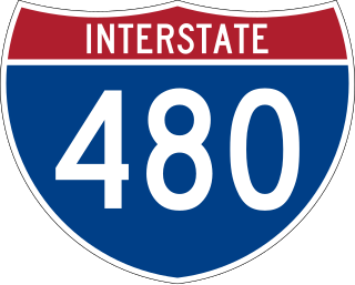
Interstate 480 (I-480) is a 41.77-mile-long (67.22 km) auxiliary Interstate Highway of I-80 in the US state of Ohio that passes through much of the Greater Cleveland area, including the southern parts of the city of Cleveland. I-480 is one of 13 auxiliary Interstate Highways in the state. The western terminus of I-480 is an interchange with I-80 and the Ohio Turnpike in North Ridgeville. Starting east through suburban Lorain County, I-480 enters Cuyahoga County, then approaches Cleveland Hopkins International Airport, which serves as the primary airport for Northeast Ohio. After traversing Brooklyn and crossing the Cuyahoga River on the Valley View Bridge, the highway continues east toward the communities of Bedford and Twinsburg toward its eastern terminus at I-80 and the Ohio Turnpike in Streetsboro. On its route, I-480 crosses I-71 and I-77 and is concurrent with I-271 for approximately four miles (6.4 km). In 1998, the governor of Ohio, George Voinovich, gave I-480 the additional name of the "Senator John Glenn Highway", in honor of the former NASA astronaut and US senator from Ohio for 24 years.
Interstate 80N may refer to:
The Mount Hood Freeway is a partially constructed but never to be completed freeway alignment of U.S. Route 26 and Interstate 80N, which would have run through southeast Portland, Oregon. Related projects would have continued the route through the neighboring suburb of Gresham, out to the city of Sandy.

A directional interchange, colloquially known as a stack interchange, is a type of grade-separated junction between two controlled-access highways that allows for free-flowing movement to and from all directions of traffic. These interchanges eliminate the problems of weaving, have the highest vehicle capacity, and vehicles travel shorter distances when compared to different types of interchanges.

Interstate 680 (I-680) in Nebraska and Iowa is the northern bypass of the Omaha–Council Bluffs metropolitan area. I-680 spans 16.49 miles (26.54 km) from its southern end in western Omaha, Nebraska, to its eastern end near Crescent, Iowa. The freeway passes through a diverse range of scenes and terrains—the urban setting of Omaha, the Missouri River and its valley, the rugged Loess Hills, and the farmland of Pottawattamie County, Iowa.
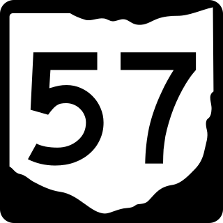
State Route 57 is a north–south state highway in northeast Ohio. SR 57 runs from US 30 near Orrville to US 6 in Lorain, a distance of 61.2 miles (98.5 km).
Interstate 80 (I-80) in the US state of Ohio runs across the northern part of the state. Most of the route is part of the Ohio Turnpike; only an 18.78-mile (30.22 km) stretch is not part of the toll road. That stretch of road is the feeder route to the Keystone Shortway, a shortcut through northern Pennsylvania that provides access to New York City.
Interstate 90 (I-90) runs east–west across the northern tier of the US state of Ohio. Much of it is along the Ohio Turnpike, but sections outside the turnpike pass through Cleveland and northeast into Pennsylvania.
Interstate 90 (I-90) is a part of the Interstate Highway System that runs from Seattle, Washington, to Boston, Massachusetts. In the US state of New York, I-90 extends 385.48 miles (620.37 km) from the Pennsylvania state line at Ripley to the Massachusetts state line at Canaan, and is the second-longest highway in the state after New York State Route 17 (NY 17). Although most of the route is part of the tolled New York State Thruway, two non-tolled sections exist along I-90. Within New York, I-90 has a complete set of auxiliary Interstates, which means that there are Interstates numbered I-190 through I-990 in the state, with no gaps in between. For most of its length in New York, I-90 runs parallel to the former Erie Canal route, NY 5, US Route 20 (US 20) and the CSX Transportation railroad mainline that traverses the state.

Interstate 895 was a proposed Interstate Highway in Rhode Island and Massachusetts that would have supplemented Interstate 295 to create a full beltway around Providence.
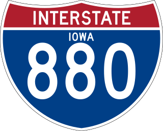
Interstate 880 (I-880) is an auxiliary Interstate Highway in Iowa. Its route was created in 2019 from a section of I-680 in order to facilitate the movement of I-29 traffic around Council Bluffs in the event of Missouri River flooding. It follows the same routing as Interstate 80N (I-80N), which originally connected I-29 and I-80 from 1966 to 1973.


 I-90 / Ohio Turnpike from near Milan to Elyria
  I-490 The entire length of I-490
 I-290 A short portion of unbuilt I-290
 I-80N A section of unbuilt highway connecting to Interstate 480
  I-480 from Maple Heights to I-480's east terminus
 I-76 / I-80 Interstate 80N ended at a junction with the mainline route of I-80 around Ravenna. The road at which I-80N ended is now Interstate 76.