Related Research Articles

An earthquake – also called a quake, tremor, or temblor – is the shaking of the Earth's surface resulting from a sudden release of energy in the lithosphere that creates seismic waves. Earthquakes can range in intensity, from those so weak they cannot be felt, to those violent enough to propel objects and people into the air, damage critical infrastructure, and wreak destruction across entire cities. The seismic activity of an area is the frequency, type, and size of earthquakes experienced over a particular time. The seismicity at a particular location in the Earth is the average rate of seismic energy release per unit volume.

A seismometer is an instrument that responds to ground displacement and shaking such as caused by quakes, volcanic eruptions, and explosions. They are usually combined with a timing device and a recording device to form a seismograph. The output of such a device—formerly recorded on paper or film, now recorded and processed digitally—is a seismogram. Such data is used to locate and characterize earthquakes, and to study the internal structure of Earth.

Valentia Island is one of Ireland's most westerly points. It lies off the Iveragh Peninsula in the southwest of County Kerry. It is linked to the mainland by the Maurice O'Neill Memorial Bridge at Portmagee. A car ferry also departs from Reenard Point to Knightstown, the island's main settlement, from April to October. Another, smaller village named Chapeltown sits at roughly the midpoint of the island, three kilometres from the bridge. Valentia Island's permanent population is 658. It is about 11 kilometres long by almost three kilometres wide, making it the fifth-biggest island off the Irish coast.

Kamaʻehuakanaloa Seamount is an active submarine volcano about 22 mi (35 km) off the southeast coast of the island of Hawaii. The top of the seamount is about 3,200 ft (975 m) below sea level. This seamount is on the flank of Mauna Loa, the largest active subaerial shield volcano on Earth. Kamaʻehuakanaloa is the newest volcano in the Hawaiian–Emperor seamount chain, a string of volcanoes that stretches about 3,900 mi (6,200 km) northwest of Kamaʻehuakanaloa. Unlike most active volcanoes in the Pacific Ocean that make up the active plate margins on the Pacific Ring of Fire, Kamaʻehuakanaloa and the other volcanoes of the Hawaiian–Emperor seamount chain are hotspot volcanoes and formed well away from the nearest plate boundary. Volcanoes in the Hawaiian Islands arise from the Hawaii hotspot, and as the youngest volcano in the chain, Kamaʻehuakanaloa is the only Hawaiian volcano in the deep submarine preshield stage of development.

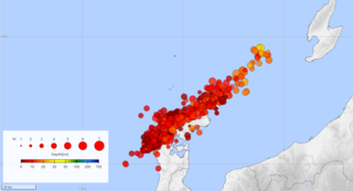
In seismology, an earthquake swarm is a sequence of seismic events occurring in a local area within a relatively short period. The time span used to define a swarm varies, but may be days, months, or years. Such an energy release is different from the situation when a major earthquake is followed by a series of aftershocks: in earthquake swarms, no single earthquake in the sequence is obviously the main shock. In particular, a cluster of aftershocks occurring after a mainshock is not a swarm.
The Pacific Northwest Seismic Network, or PNSN, collects and studies ground motions from about 400 seismometers in the U.S. states of Oregon and Washington. PNSN monitors volcanic and tectonic activity, gives advice and information to the public and policy makers, and works to mitigate earthquake hazard.

The Dublin Institute for Advanced Studies (DIAS) is a statutory independent research institute in Ireland. It was established in 1940 on the initiative of the Taoiseach, Éamon de Valera, in Dublin.

Shishaldin Volcano, or Mount Shishaldin, is one of six active volcanoes on Unimak Island in eastern the Aleutian Islands of Alaska. It is the highest mountain peak of the Aleutian Islands, rising to a height of 9,373 ft above sea level. Shishaldin's magma supply is generated via flux melting above the Aleutian Trench, where the Pacific Plate subducts beneath the North American Plate. Due to its remote location and frequently inclement weather, the Alaska Volcano Observatory (AVO) monitors the volcano remotely via satellite and a seismic network deployed in 1997. Shishaldin is one of the most active volcanoes in the Aleutian Islands, with 40 confirmed eruptions in the last 11,700 years. Notably, Shishaldin produced a sub-Plinian eruption in 1999.

A tsunami warning system (TWS) is used to detect tsunamis in advance and issue the warnings to prevent loss of life and damage to property. It is made up of two equally important components: a network of sensors to detect tsunamis and a communications infrastructure to issue timely alarms to permit evacuation of the coastal areas. There are two distinct types of tsunami warning systems: international and regional. When operating, seismic alerts are used to instigate the watches and warnings; then, data from observed sea level height are used to verify the existence of a tsunami. Other systems have been proposed to augment the warning procedures; for example, it has been suggested that the duration and frequency content of t-wave energy is indicative of an earthquake's tsunami potential.

The Lamont-Doherty Earth Observatory (LDEO) is a research institution specializing in the Earth science and climate change. Though part of Columbia University, it is located on a separate closed campus in Palisades, New York.

The EarthScope project (2003-2018) was an National Science Foundation (NSF) funded Earth science program using geological and geophysical techniques to explore the structure and evolution of the North American continent and to understand the processes controlling earthquakes and volcanoes. The project had three components: USArray, the Plate Boundary Observatory, and the San Andreas Fault Observatory at Depth. Organizations associated with the project included UNAVCO, the Incorporated Research Institutions for Seismology (IRIS), Stanford University, the United States Geological Survey (USGS) and National Aeronautics and Space Administration (NASA). Several international organizations also contributed to the initiative. EarthScope data are publicly accessible.

The Air Force Technical Applications Center (AFTAC), based at Florida's Patrick Space Force Base, is an Air Force surveillance organization assigned to the Sixteenth Air Force. Its mission is to monitor nuclear treaties of all applicable signatory countries. This is accomplished using seismic, hydroacoustic and satellite-detection systems alongside ground based and airborne materials collection systems.

An earthquake warning system or earthquake alarm system is a system of accelerometers, seismometers, communication, computers, and alarms that is devised for rapidly notifying adjoining regions of a substantial earthquake once one begins. This is not the same as earthquake prediction, which is currently not capable of producing decisive event warnings.

The Ocean Observatories Initiative (OOI) is a National Science Foundation (NSF) Major Research Facility composed of a network of science-driven ocean observing platforms and sensors in the Atlantic and Pacific Oceans. This networked infrastructure measures physical, chemical, geological, and biological variables from the seafloor to the sea surface and overlying atmosphere, providing an integrated data collection system on coastal, regional and global scales. OOI's goal is to deliver data and data products for a 25-year-plus time period, enabling a better understanding of ocean environments and critical ocean issues.
Striking southern Italy on 8 September, the 1905 Calabria earthquake had a moment magnitude of 7.2 and a maximum Mercalli intensity of XI (Extreme). The first major earthquake of the 20th century, it severely damaged parts of Lipari, Messina Province and a large area between Cosenza and Nicotera and killed between 557 and 2,500 people.

The National Tsunami Warning Center (NTWC) is one of two tsunami warning centers in the United States, covering all coastal regions of the United States and Canada, except Hawaii, Guam, the Northern Mariana Islands, Puerto Rico and the U.S. Virgin Islands. Until 2013, it was known as the West Coast and Alaska Tsunami Warning Center.

Weston Observatory is a geophysical research laboratory of the Department of Earth and Environmental Sciences at Boston College. The Observatory is located in the town of Weston, Massachusetts, about 13 miles (21 km) west of downtown Boston.

The National Seismological Center of the University of Chile is part of the Department of Physical and Mathematical Sciences at the University of Chile. The center collects information about seismic activity in Chile and delivers it to the National Office of Emergency at the Ministry of the Interior (ONEMI) and the Hydrographic and Oceanographic Service of the Chilean Navy (SHOA). The current director of the CSN is Sergio Barrientos Parra. The National Seismological Center is housed by the Department of Geophysics (DGF).
The Advanced National Seismic System (ANSS) is a collaboration of the United States Geological Survey (USGS) and regional, state, and academic partners that collects and analyzes data on significant earthquakes to provide near real-time information to emergency responders and officials, the news media, and the public. Such information is used to anticipate the likely severity and extent of damage, and to guide decisions on the responses needed.
References
- 1 2 3 4 5 Ryan-Christensen, Aoife (9 January 2020). "The science of earthquakes in Ireland". RTÉ. Retrieved 8 April 2020.
- ↑ "Valentia Observatory - Seismology". Met Éireann . Retrieved 8 April 2020.