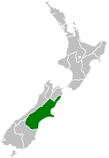
Hanmer Springs is a small town in the Canterbury region of the South Island of New Zealand.

The Haast Pass, a mountain pass in the Southern Alps of the South Island of New Zealand, takes its name from Julius von Haast, a 19th-century explorer who also served as Provincial Geologist for the Provincial government of Canterbury. Māori used the pass in pre-European times.

Lewis Pass is a mountain pass in the South Island of New Zealand.
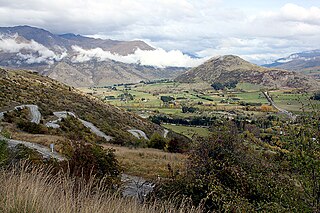
The Crown Range lies to the east of the Wakatipu Basin in Otago, New Zealand. It is noted for two features, the Cardrona Alpine Resort, on the slopes of the 1900 metre Mount Cardrona, and a highway, known as the Crown Range Road, which winds steeply between Arrow Junction, just south of Arrowtown, and Wanaka to the north.

The Conway River is part of the traditional boundary between the Canterbury and Marlborough regions in the South Island of New Zealand.

Route 200, known locally as Saddle Road, traverses the width of the Island of Hawaiʻi, from downtown Hilo to its junction with Hawaii Route 190 near Waimea. The road was once considered one of the most dangerous paved roads in the state, with many one-lane bridges and areas of marginally maintained pavement. Most of the road has now been repaved, and major parts have new re-alignments to modern standards. The highway is mostly one-lane in each direction, but there are two lanes on the uphill portions. The highway reaches a maximum elevation of 6,632 feet (2,021 m) and is subject to fog and low visibility. Many rental car companies used to prohibit use of their cars on Saddle Road, but now allow use of the road. The highway experiences heavy use as it provides the shortest driving route from Hilo to Kailua-Kona and access to the slopes of Mauna Loa and the Mauna Kea Observatories.

The Hope Fault is an active dextral strike-slip fault in the northeastern part of South Island, New Zealand. It forms part of the Marlborough Fault System, which accommodates the transfer of displacement along the oblique convergent boundary between the Indo-Australian Plate and Pacific Plate, from the transform Alpine Fault to the Hikurangi Trench subduction zone.
In New Zealand, a club skifield is a small ski resort run by a ski club to provide affordable skiing to its members. While members of the public can ski, members of the club receive heavily discounted rates, in exchange for a yearly membership fee and usually several days of voluntary work maintaining the resort.
Hanmer Springs Ski Area, located on Mount Saint Patrick, South Island, New Zealand is a club skifield 17km from the town of Hanmer Springs. It has New Zealands longest Poma lift at over 800m, a nutcracker rope tow and a new beginners fixed grip rope tow, giving access to trails rated as 10% beginner, 60% intermediate and 30% advanced. Elevation is 1769m at the top of the field with 52ha of ski terrain.

State Highway 7 is a major New Zealand state highway. One of the eight national highways, it crosses the Southern Alps to link the West Coast Region with Canterbury and to form a link between the South Island's two longest highways, State Highway 1 and State Highway 6. Distances are measured from east to west with the major junction list going from east to west.
The 1888 North Canterbury earthquake occurred at 4:10 am on 1 September following a sequence of foreshocks that started the previous evening, and whose epicentre was in the North Canterbury region of the South Island of New Zealand. The epicentre was approximately 35 kilometres (22 mi) west of Hanmer.

The Hanmer River is a river in the Hurunui District of New Zealand. It originates in the Hossack Saddle between the Hanmer Range and the Amuri Range, and flows south-west into the Waiau River about 8 kilometres (5.0 mi) south-west of Hanmer Springs.
The Hossack River is a river on the South island of New Zealand. It flows north from close to the Hossack Saddle, 17 kilometres (11 mi), northwest of Hanmer Springs, before joining the Acheron River.
Wards Pass, 1,145 metres or 3,757 feet above sea level, is an alpine pass in the Rachel Range of the Inland Kaikoura Ranges of New Zealand's northern South Island. It lies between the valleys of the upper Acheron and Awatere rivers and was discovered by the surveyor Joseph Ward and his brother-in-law, Cyrus Goulter, in March 1847.

State Highway 83 is a South Island state highway in New Zealand running up the Waitaki Valley between the settlements of Pukeuri and Omarama. It forms part of the southernmost of the east-west roads crossing the South Island.

New Zealand State Highway 43, also called the Forgotten World Highway, is a road that runs 148 km from Stratford in Taranaki to Taumarunui in the King Country. It contains the only unsealed portion of the New Zealand state highway network.

Springs Junction is a significant road junction in New Zealand that connects two major highways, State Highway 7 and State Highway 65.

Lake Tennyson is a glacial high-country lake in Canterbury, New Zealand. The first European settler to see the lake was Frederick Weld in 1853, who also named it. The headwaters of the Clarence River are just to the north, and the river flows through Lake Tennyson.