Look up islip in Wiktionary, the free dictionary.
Islip may refer to:
Islip may refer to:
Milton may refer to:

Suffolk County is the easternmost county in the U.S. state of New York, constituting the eastern two-thirds of Long Island. It is bordered to its west by Nassau County, to its east by Gardiners Bay and the open Atlantic Ocean, to its north by Long Island Sound, and to its south by the Atlantic Ocean.

Clarence is a town and affluent suburb located in the northeastern part of Erie County, New York, United States, northeast of Buffalo. The population was 32,950 according to the 2020 census estimate. This represents an increase of 7.4% from the 2010 census figure. The Clarence census-designated place occupies the southeast part of the town and roughly corresponds to a postal district with ZIP code 14031 and 14221 in the western side which it shares with nearby Williamsville. The town is named in honor of Prince William, Duke of Clarence and St Andrews (1765–1837), the third son of King George III and later king himself, as William IV.

Bohemia is a hamlet in Suffolk County, New York, United States. The population was 9,852 at the 2020 census. It is situated along the South Shore of Long Island in the Town of Islip, approximately 50 miles from New York City.
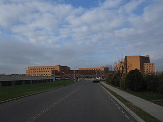
Central Islip is a hamlet and census-designated place (CDP) within the Town of Islip in Suffolk County, New York, United States. The population was 34,450 at the 2010 census.
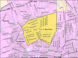
Deer Park is a hamlet and census-designated place (CDP) in the Town of Babylon, in Suffolk County, on Long Island, in New York, United States. The population was 27,745 at the 2010 census.
East Islip is a hamlet and CDP in the Town of Islip, Suffolk County, New York, United States. At the time of the 2010 census, the CDP had a population of 14,475.

Holbrook is a hamlet and census-designated place (CDP) in Suffolk County, New York, United States. The population was 27,195 at the 2010 census. The community borders the eastern side of Long Island MacArthur Airport.
Islip Terrace is a hamlet and census-designated place (CDP) in the Town of Islip in Suffolk County, on the South Shore of Long Island, in New York, United States. The population was 5,323 at the time of the 2020 census.
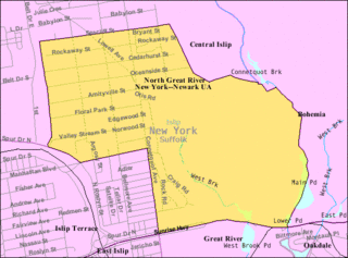
North Great River is a hamlet and census-designated place (CDP) in the Town of Islip, in Suffolk County, on Long Island, in New York, United States. The CDP population was 4,001 at the 2010 census. The hamlet is served by the Islip Terrace Post Office (11752).

Ronkonkoma is a hamlet and census-designated place (CDP) mostly in the Town of Islip of Long Island, with a small eastern portion in the Town of Brookhaven in Suffolk County in New York, United States. The population was 19,082 at the 2010 census. The Ronkonkoma post office has the ZIP Code 11779, and serves parts of several hamlets and CDPs adjacent to Ronkonkoma.

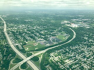
Long Island MacArthur Airport, formerly known as Islip Airport, is a public airport in Ronkonkoma, in the Town of Islip, in Suffolk County, on Long Island, New York, United States. Covering 1,311 acres (531 ha), the airport was established in 1942, was activated in 1943, and began serving as a commercial airport in 1960. It has three runways and two helipads.

Islip is a town in Suffolk County, New York, United States, on the South Shore of Long Island. The population was 335,543 at the 2010 census, making it the fourth most populous city or town in the New York metropolitan area.

Brookhaven is a large suburban town in Suffolk County, Long Island, New York. With a population of 488,497 as of 2022, it is the second most populous town in the United States and in New York and the third most populous community in the state.

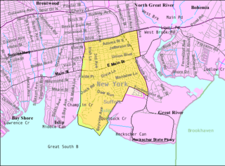
Islip is a hamlet and census-designated place (CDP) that lies within the town of the same name in Suffolk County, New York. Located on the south shore of Long Island, the CDP had a population of 18,869 at the time of the 2010 census, a decline of 8% from the 2000 census.
Shelter Island may refer to:
Alplaus is a hamlet located in Schenectady County, New York, United States. Its name is derived from the Dutch Aal Plaats, or "Place of the Eels."

The Outer Barrier, also known as the Long Island and New York City barrier islands, refers to the string of barrier islands that divide the lagoons south of Long Island, New York from the Atlantic Ocean. These islands include Long Beach Barrier Island, Barnum Island, Jones Beach Island, Fire Island and Westhampton Island. The outer barrier extends 75 miles (121 km) along the South Shore of Long Island, from the Rockaway Peninsula in New York City to the east end of Shinnecock Bay in Suffolk County.
Bay Shore may refer to a location in the United States: