A street is a public thoroughfare in a built environment. It is a public parcel of land adjoining buildings in an urban context, on which people may freely assemble, interact, and move about. A street can be as simple as a level patch of dirt, but is more often paved with a hard, durable surface such as concrete, cobblestone or brick. Portions may also be smoothed with asphalt, embedded with rails, or otherwise prepared to accommodate non-pedestrian traffic.

Wakō is a city located in Saitama Prefecture, Japan. As of 1 February 2016, the city had an estimated population of 80,666, and a population density of 7310 persons per km2. Its total area is 11.04 square kilometres (4.26 sq mi).

Nerima is a special ward in Tokyo, Japan. The ward refers to itself as Nerima City.

Adachi is a special ward located in Tokyo Metropolis, Japan. It is located north of the heart of Tokyo. The ward consists of two separate areas: a small strip of land between the Sumida River and Arakawa River and a larger area north of the Arakawa River. The ward is bordered by the cities of Kawaguchi, Sōka and Yashio in Saitama and Katsushika, Sumida, Arakawa, and Kita in Tokyo. The ward is called Adachi City in English.
Katsushika is a special ward located in Tokyo, Japan. The ward calls itself Katsushika City in English.

Akihabara Station is a railway station in Tokyo's Chiyoda ward. It is at the center of the Akihabara shopping district specializing in electronic goods.

Kita is a special ward located in Tokyo Metropolis, Japan. The English translation of its Japanese self-designation is City of Kita. The ward was founded on March 15, 1947.
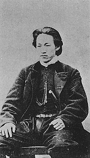
Hijikata Toshizō was a Japanese warrior. As Vice-Commander of the Shinsengumi, he resisted the Meiji Restoration.

Toyo University is a university with several branches in Japan, including Hakusan, Asaka, Kawagoe, and Itakura.

The Tōhoku Expressway is a national expressway in Japan. It is owned by Japan Expressway Holding and Debt Repayment Agency and operated by East Nippon Expressway Company. The expressway is signed E4 under the "2016 Proposal for Realization of Expressway Numbering", because it roughly parallels National Route 4.
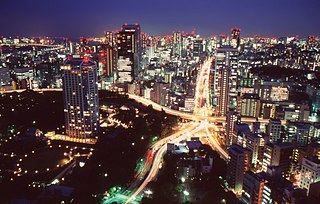
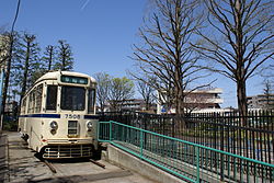
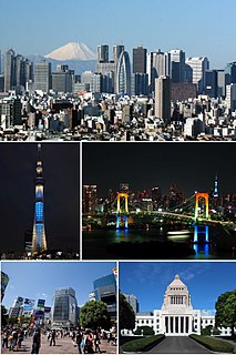
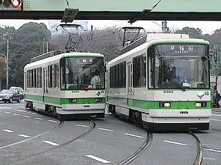
The transport network in Greater Tokyo includes public and private rail and highway networks; airports for international, domestic, and general aviation; buses; motorcycle delivery services, walking, bicycling, and commercial shipping. While the nexus is in the central part of Tokyo, every part of the Greater Tokyo Area has rail or road transport services. The sea and air transport is available from a limited number of ports for the general public.

Minamibōsō is a city located in Chiba Prefecture, Japan. As of December 1, 2015, the city had an estimated population of 38,945, and a population density of 169 persons per km². The total area is 230.22 square kilometres (88.89 sq mi), making it the fifth largest city in Chiba Prefecture in terms of area.

A traffic park or children's traffic park is a park in which children can learn the rules of the road. A traffic park is also called a transportation park or traffic garden or safety village depending on locale.

Tokyo Kasei University is a private university in Itabashi, Tokyo, Japan, established in 1949. The predecessor of the school was founded in 1881.

A bicycle rodeo is a clinic to teach children the skills and precautions to ride a bicycle safely.

The Tokyo Fire Department is a fire department headquartered in Ōtemachi, Chiyoda, Tokyo, Japan. The TFD was formed on March 7, 1948, and is responsible for protecting the Tokyo Metropolis Area. The Fire Department is the largest urban fire department in the world. Covering the 23 Wards of Tokyo and parts of Western Tokyo, it provides assistance in case of fires, biological, chemical, and radioactive hazards, as well as earthquakes and flooding. First response for medical services and all types of rescues are also provided. The department handles varied challenges from urban settings to mountain forests. The department is part of the Tokyo Metropolitan Government.
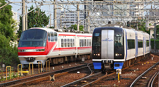
Transport in Greater Nagoya (Chūkyō) is similar to that of the Tokyo and Osaka, but is more automobile oriented, as the urban density is less than Japan's two primary metropolises, and major automobile manufacturers like Toyota are based here. Still, compared to most cities of its size worldwide it has a considerable rail transport network with 3 million passenger trips daily, with a similar density and extent of passenger rail to London or New York City, complemented with highways and surface streets for private motor transport. It includes public and private rail and highway networks; airports for international, domestic, and general aviation; buses; motorcycle delivery services, walking, bicycling, and commercial shipping. The nexus of the public transport system is Nagoya Station. Every region of Greater Nagoya, also known as the Chūkyō Metropolitan Area (中京圏), has rail or road transport services, and the area as a whole is served by sea and air links.

In Japan, road signs are standardized by the "Order on Road Sign, Road Line, and Road Surface Marking (道路標識、区画線及び道路標示に関する命令)" established on 1968 whose origins are Tokyo Metropolitan Police Department's "Order on Standardization of Road Sign" on 1934 and Home Ministry of Japan's "Order on Road Signs" on 1942. The previous designs have been used since 1986 after several amendments of order.

Two-wheelers are a common sight and widely used in Japan. Of these, bicycles and scooters are the most common.