This article needs additional citations for verification .(February 2024) |


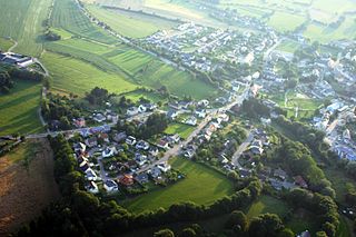
Itzig (Luxembourgish : Izeg) is a town in the commune of Hesperange, in southern Luxembourg. As of 2024 [update] , the town has a population of 2,414. [1]

This article needs additional citations for verification .(February 2024) |
Itzig (Luxembourgish : Izeg) is a town in the commune of Hesperange, in southern Luxembourg. As of 2024 [update] , the town has a population of 2,414. [1]

Ząbkowice County is a unit of territorial administration and local government (powiat) in Lower Silesian Voivodeship, south-western Poland. It came into being on January 1, 1999, as a result of the Polish local government reforms passed in 1998. The county covers an area of 801.75 square kilometres (309.6 sq mi). Its administrative seat is Ząbkowice Śląskie, and it also contains the towns of Ziębice, Złoty Stok and Bardo.

The District of Luxembourg was one of three districts of the Grand Duchy of Luxembourg. It contained four cantons, divided into 44 communes:

The South Moravian Region, or just South Moravia, is an administrative unit of the Czech Republic, located in the south-western part of its historical region of Moravia. The region's capital is Brno, the nation's 2nd largest city. South Moravia is bordered by the South Bohemian Region to the west, Vysočina Region to the north-west, Pardubice Region to the north, Olomouc Region to the north-east, Zlín Region to the east, Trenčín and Trnava Regions, Slovakia to the south-east and Lower Austria, Austria to the south.
Bastendorf is a small town in the commune of Tandel, in north-eastern Luxembourg. As of 2024, the town has a population of 640.

Bettange-sur-Mess is a small village in the commune of Dippach, in south-western Luxembourg. As of 2023, the town has a population of 1,385.
Schouweiler is a small town in the commune of Dippach, in south-western Luxembourg. As of 2023, the town has a population of 1,610. It is the administrative centre of the commune of Dippach.

Alzingen is a town in the commune of Hesperange, in southern Luxembourg. As of 2024, the town has a population of 2,988.

Blaschette is a small town in the commune of Lorentzweiler, in central Luxembourg. As of 2024, it has a population of 521.
Greiveldange is a small town in the commune of Stadtbredimus, in south-eastern Luxembourg. As of 2024, the town has a population of 959.
Dolobay is one of the woredas in the Somali Region of Ethiopia. Part of the Afder Zone, Dolobay is bordered on the south by the Provisional Administrative Line with Somalia, on the west by the Ganale Dorya River which separates it from the Liben Zone, on the northwest by Cherti, on the north by Afder, and on the east by Bare. The major town in Dolobay is Weldiya.
Dega is one of the woredas in the Oromia Region of Ethiopia. Part of the Buno Bedelle Zone, Dega is bordered on the south by Chora, on the west by Supena Sodo, on the north by the Mirab Welega Zone, on the northeast by the southern exclave of the Benishangul-Gumuz Region, and on the east by Bedele. Towns in Dega include Dega and Mako. Mako woreda was part of Dega woreda.
Nensebo is one of the Aanaas in the Oromia of Ethiopia. Part of the West Arsi Zone, Nensebo is bordered on the south by the Borena Zone, on the west by the Southern Nations, Nationalities and Peoples Region, on the northwest by Kokosa, on the north by Dodola, on the northeast by Adaba, on the east by Bale Zone. Towns in Nensebo include Werka.
Uraga is one of the Aanaas in the Oromia of Ethiopia. Part of the Guji Zone, Uraga is bordered on the south by Odo Shakiso, on the west by the Borena Zone, on the north by the Southern Nations, Nationalities, and Peoples Region, and on the east by Bore. The largest town in Uraga is Haro Wachu. Dama and Hambela Wamena woredas were separated from Uraga.
Chong Kal District is a district in Oddar Meancheay province in northern Cambodia. According to the 1998 census of Cambodia, it had a population of 18,843.

Sotresgudo is a municipality and town located in the province of Burgos, Castile and León, Spain. According to the 2004 census (INE), the municipality has a population of 645 inhabitants.
Châu Phú is a rural district (huyện) of An Giang province in the Mekong Delta region of Vietnam. As of 2019, the district had a population of 206,676. The district covers an area of 426 km2. The district capital lies at Cái Dầu. There are some festivals here, such as the "Bình Thủy temple worshiping" and the "Sir Tây An worshiping"
Santo Domingo Chihuitán is a town and municipality in Oaxaca in south-western Mexico. The municipality covers an area of km². It is part of the Tehuantepec District in the west of the Istmo Region.
Illawatura is a small village located in Gampola, Central Province, Sri Lanka. It lies about 6 kilometers east of the main city of Gampola, around 20 km south of the capital of Central Province, Kandy, and approximately 85 km west of the commercial capital of Sri Lanka, Colombo.
Lohi Bher is a populated area situated in the city of Islamabad, Pakistan. It constitutes one of the union councils within the city and falls under Union Council No. 34, following the latest district boundary updates of 2022. This union council encompasses a range of residential regions, such as Coring Town, Pakistan Town, Lohi Bher, and Jinnah Garden.

The Levoča Mountains is a mountain range in the Prešov Region of northern Slovakia. Geologically the range stands within the Podhale-Magura Area of the Outer Western Carpathians.
| International | |
|---|---|
| National | |
49°35′N6°10′E / 49.583°N 6.167°E
| | This article related to the geography of Luxembourg canton is a stub. You can help Wikipedia by expanding it. |