This page is based on this
Wikipedia article Text is available under the
CC BY-SA 4.0 license; additional terms may apply.
Images, videos and audio are available under their respective licenses.

European route E 40 is the longest European route, more than 8,000 kilometres long, connecting Calais in France via Belgium, Germany, Poland, Ukraine, Russia, Kazakhstan, Uzbekistan, Turkmenistan, and Kyrgyzstan, with Ridder in Kazakhstan near the border with Russia and China.

Luhansk Oblast is the easternmost oblast (province) of Ukraine. Its administrative center is Luhansk. The oblast was established in 1938 and bore the name Voroshilovgrad Oblast in honor of Kliment Voroshilov. Its population is 2,239,500.

Luhansk or Lugansk, formerly known as Voroshilovgrad is a city in eastern Ukraine near the border of western Russia.
Molodohvardiysk is a city in southeastern Ukraine. It is located in the Krasnodon Municipality of Luhansk Oblast (region). Its population is approximately 22,937 (2017 est.).
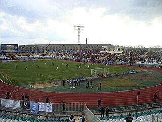
Avanhard Stadium is a multi-purpose stadium in Luhansk, Ukraine. The stadium held 22,288 people.
Artemivsk is a city in Perevalsk Raion of Luhansk Oblast in eastern Ukraine. Population: 7,506 (2013 est.).
Sukhodilsk is a city in Krasnodon Municipality in Luhansk Oblast (region) of Ukraine. Population: 21,061 (2013 est.).
Oleksandrivsk or Aleksandrovsk is a small city in Luhansk Municipality, Luhansk Oblast (region) of Ukraine. Population: 6,635 (2013 est.).
Shchastya is a town in Novoaidar Raion in Luhansk Oblast (province) of Ukraine. Population: 12,773 (2013 est.).

Highway M04 is a Ukraine international highway connecting Znamianka to Krasnodon on the border with Russia, where it continues into Russia as the A260.

Volodymyr Dahl East Ukrainian National University (SNU) is one of the leading establishments of higher education in Ukraine. It was founded in 1920, and in 1991 it was named after Vladimir Dal. It was the first higher educational establishment in which specialists in machine-building were trained. During World War II the institute was evacuated to Omsk (Russia). There it became the basis for the foundation of Omsk State Technical University.
Biryukove is an urban-type settlement in Sverdlovsk Raion of Luhansk Oblast, a part of Ukraine. Population: 4,027 (2013 est.).
Izvaryne-Donetsk is a land border crossing between Ukraine and Russia, on autoroute in the Donbass region.
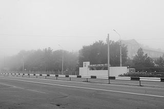
Dovzhansky is a land border crossing between Ukraine and Russia on the Ukrainian side, in the town of Dovzhansky, Sverdlovsk city municipality, Luhansk Oblast.
Donetsk Railway station is a railway station in Donetsk, Ukraine. It is located between Rutchenkove railway station and a fork towards Avdiivka (northwestern) and Yasynuvata (northeastern) through Donetsk-Pivnichnyi railway station.

Luhansk station is a junction railway station in Luhansk, Ukraine.

Leonid Ivanovich Pasechnik is the leader of the self-proclaimed state Luhansk People's Republic who also performs the functions of Minister of State Security.

European route E 40 (E 40) is a west–east European route, running from the port of Calais in France to Altai Mountains near Ridder in Kazakhstan.


