JUICE (software)

Last updated
Juice soft.jpg

JUICE is a widely used[ citation needed ] non-commercial software package for editing and analysing phytosociological data.

Software non-tangible executable component of a computer

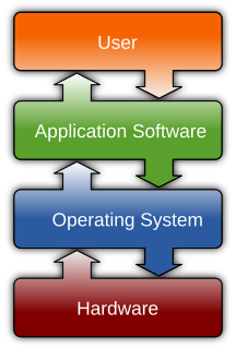
Computer software, or simply software, is a collection of data or computer instructions that tell the computer how to work. This is in contrast to physical hardware, from which the system is built and actually performs the work. In computer science and software engineering, computer software is all information processed by computer systems, programs and data. Computer software includes computer programs, libraries and related non-executable data, such as online documentation or digital media. Computer hardware and software require each other and neither can be realistically used on its own.

Phytosociology is the branch of science which deals with plant communities, their composition and development, and the relationships between the species within them. A phytosociological system is a system for classifying these communities.

Contents

It was developed at the Masaryk University in Brno, Czech Republic in 1998, and is fully described in English manual. It makes use of the previously-developed TURBOVEG software for entering and storing such data) and it offers a quite powerful tool for vegetation data analysis, including:

Czech Republic Republic in Central Europe

The Czech Republic, also known by its short-form name, Czechia, is a landlocked country in Central Europe bordered by Germany to the west, Austria to the south, Slovakia to the east and Poland to the northeast. The Czech Republic covers an area of 78,866 square kilometres (30,450 sq mi) with a mostly temperate continental climate and oceanic climate. It is a unitary parliamentary republic, with 10.6 million inhabitants; its capital and largest city is Prague, with 1.3 million residents. Other major cities are Brno, Ostrava, Olomouc and Pilsen. The Czech Republic is a member of the European Union (EU), NATO, the OECD, the United Nations, the OSCE, and the Council of Europe.

Indicator value is a term that has been used in ecology for two different indices. The older usage of the term refers to Ellenberg's indicator values, which are based on a simple ordinal classification of plants according to the position of their realized ecological niche along an environmental gradient. More recently, the term has also been used to refer to Dufrêne & Legendre's indicator value, which is a quantitative index that measures the statistical alliance of a species to any one of the classes in a classification of sites.

In ecology, alpha diversity (α-diversity) is the mean species diversity in sites or habitats at a local scale. The term was introduced by R. H. Whittaker together with the terms beta diversity (β-diversity) and gamma diversity (γ-diversity). Whittaker's idea was that the total species diversity in a landscape is determined by two different things, the mean species diversity in sites or habitats at a more local scale and the differentiation among those habitats.

In ecology, beta diversity is the ratio between regional and local species diversity. The term was introduced by R. H. Whittaker together with the terms alpha diversity (α-diversity) and gamma diversity (γ-diversity). The idea was that the total species diversity in a landscape (γ) is determined by two different things, the mean species diversity at the habitat level (α) and the differentiation among habitats (β). Other formulations for beta diversity include "absolute species turnover", "Whittaker's species turnover" and "proportional species turnover".

See also

Uses in scientific journals

Related Research Articles

A geographic information system (GIS) is a system designed to capture, store, manipulate, analyze, manage, and present spatial or geographic data. GIS applications are tools that allow users to create interactive queries, analyze spatial information, edit data in maps, and present the results of all these operations. GIS sometimes refers to geographic information science (GIScience), the science underlying geographic concepts, applications, and systems.

Data mining computational process of discovering patterns in large data sets involving methods at the intersection of artificial intelligence, machine learning, statistics, and database systems; interdisciplinary subfield of computer science

Data mining is the process of discovering patterns in large data sets involving methods at the intersection of machine learning, statistics, and database systems. Data mining is an interdisciplinary subfield of computer science and statistics with an overall goal to extract information from a data set and transform the information into a comprehensible structure for further use. Data mining is the analysis step of the "knowledge discovery in databases" process, or KDD. Aside from the raw analysis step, it also involves database and data management aspects, data pre-processing, model and inference considerations, interestingness metrics, complexity considerations, post-processing of discovered structures, visualization, and online updating. The difference between data analysis and data mining is that data analysis is used to test models and hypotheses on the dataset, e.g., analyzing the effectiveness of a marketing campaign, regardless of the amount of data; in contrast, data mining uses machine-learning and statistical models to uncover clandestine or hidden patterns in a large volume of data.

Ecological land classification is a cartographical delineation or regionalisation of distinct ecological areas, identified by their geology, topography, soils, vegetation, climate conditions, living species, habitats, water resources, and sometimes also anthropic factors. These factors control and influence biotic composition and ecological processes.

Image analysis is the extraction of meaningful information from images; mainly from digital images by means of digital image processing techniques. Image analysis tasks can be as simple as reading bar coded tags or as sophisticated as identifying a person from their face.

The British National Vegetation Classification or NVC is a system of classifying natural habitat types in Great Britain according to the vegetation they contain.

Gene ontology (GO) is a major bioinformatics initiative to unify the representation of gene and gene product attributes across all species. More specifically, the project aims to: 1) maintain and develop its controlled vocabulary of gene and gene product attributes; 2) annotate genes and gene products, and assimilate and disseminate annotation data; and 3) provide tools for easy access to all aspects of the data provided by the project, and to enable functional interpretation of experimental data using the GO, for example via enrichment analysis. GO is part of a larger classification effort, the Open Biomedical Ontologies (OBO).

SAGA GIS map software

System for Automated Geoscientific Analyses is a geographic information system (GIS) computer program, used to edit spatial data. It is free and open-source software, developed originally by a small team at the Department of Physical Geography, University of Göttingen, Germany, and is now being maintained and extended by an international developer community.

Multispectral image

A multispectral image is one that captures image data within specific wavelength ranges across the electromagnetic spectrum. The wavelengths may be separated by filters or by the use of instruments that are sensitive to particular wavelengths, including light from frequencies beyond the visible light range, i.e. infrared and ultra-violet. Spectral imaging can allow extraction of additional information the human eye fails to capture with its receptors for red, green and blue. It was originally developed for space-based imaging, and has also found use in document and painting analysis.

Relevé can refer to:

Neural network software is used to simulate, research, develop, and apply artificial neural networks, software concepts adapted from biological neural networks, and in some cases, a wider array of adaptive systems such as artificial intelligence and machine learning.

A scientific echosounder is a device which uses sonar technology for the measurement of underwater physical and biological components—this device is also known as scientific sonar. Applications include bathymetry, substrate classification, studies of aquatic vegetation, fish, and plankton, and differentation of water masses.

Geomorphometry, or geomorphometrics, is the science of quantitative land surface analysis. It gathers various mathematical, statistical and image processing techniques that can be used to quantify morphological, hydrological, ecological and other aspects of a land surface. Common synonyms for geomorphometry are geomorphological analysis, terrain morphometry or terrain analysis and land surface analysis. Geomorphometrics is the discipline based on the computational measures of the geometry, topography and shape of the Earth's horizons, and their temporal change.

Structured analysis method for analyzing and converting business requirements into specifications

In software engineering, structured analysis (SA) and structured design (SD) are methods for analyzing business requirements and developing specifications for converting practices into computer programs, hardware configurations, and related manual procedures.

MEDCIN, a system of standardized medical terminology, is a proprietary medical vocabulary and was developed by Medicomp Systems, Inc. MEDCIN is a point-of-care terminology, intended for use in Electronic Health Record (EHR) systems, and it includes over 280,000 clinical data elements encompassing symptoms, history, physical examination, tests, diagnoses and therapy. This clinical vocabulary contains over 38 years of research and development as well as the capability to cross map to leading codification systems such as SNOMED CT, CPT, ICD-9-CM/ICD-10-CM, DSM, LOINC, CDT, CVX, and the Clinical Care Classification (CCC) System for nursing and allied health.

Acoustic seabed classification is the partitioning of a seabed acoustic image into discrete physical entities or classes. This is a particularly active area of development in the field of seabed mapping, marine geophysics, underwater acoustics and benthic habitat mapping. Seabed classification is one route to characterizing the seabed and its habitats. Seabed characterization makes the link between the classified regions and the seabed physical, geological, chemical or biological properties. Acoustic seabed classification is possible using a wide range of acoustic imaging systems including multibeam echosounders, sidescan sonar, single-beam echosounders, interferometric systems and sub-bottom profilers. Seabed classification based on acoustic properties can be divided into two main categories; surficial seabed classification and sub-surface seabed classification. Sub-surface imaging technologies use lower frequency sound to provide higher penetration, whereas surficial imaging technologies provide higher resolution imagery by utilizing higher frequencies.

Reverse engineering, also called back engineering, is the process by which a man-made object is deconstructed to reveal its designs, architecture, or to extract knowledge from the object; similar to scientific research, the only difference being that scientific research is about a natural phenomenon.

The Unscrambler X is a commercial software product for multivariate data analysis, used for calibration of multivariate data which is often in the application of analytical data such as near infrared spectroscopy and Raman spectroscopy, and development of predictive models for use in real-time spectroscopic analysis of materials. The software was originally developed in 1986 by Harald Martens and later by CAMO Software.