Related Research Articles

Sergipe, officially State of Sergipe, is a state of Brazil. Located in the Northeast Region along the Atlantic coast of the country, Sergipe is the smallest state in Brazil by geographical area at 21,910 square kilometres (8,460 sq mi), larger only than the Federal District. Sergipe borders Bahia to the south and west and Alagoas to the north. Aracaju is the capital and the largest city in the state; the state is divided into 75 municipalities. The state has 1.1% of the Brazilian population and produces only 0.6% of the Brazilian GDP.

Aracaju is the capital of the state of Sergipe, Brazil, located in the northeastern part of the country on the coast, about 350 km (217 mi) north of Salvador. According to the 2020 estimate, the city has 664,908 inhabitants, which represents approximately 33% of the state population. Adding to the populations of the municipalities forming the Metropolitan area: Barra dos Coqueiros, Nossa Senhora do Socorro and São Cristóvão. Its Metropolitan Cathedral Nossa Senhora da Conceiçao, dedicated to Our Lady of Immaculate Conception, is the archiepiscopal see of the Roman Catholic Archdiocese of Aracaju.

Club Sportivo Sergipe, or Sergipe as they are usually called, is a Brazilian football team from Aracaju, the second oldest club in the state of Sergipe, founded on October 17, 1909. Club Sportivo Sergipe is the only team from Sergipe to have played against foreign opposition, having faced the Argentina youth team, Sparta Prague, Alianza Lima and the Ghana national team. Sergipe is the only team to have won six state championships in a row. Sergipe's main rival is Confiança. Sergipe's home field is the Estádio João Hora de Oliveira, capacity 8,000.

Salgado is a municipality located in the Brazilian state of Sergipe. It has an area of 248 km2 (96 sq mi) and an estimated population of 20,025 (2020).
Santa Rosa de Lima is a municipality located in the Brazilian state of Sergipe. Its population was 3,923 in 2020, and its area is 68 km².

Mangue Seco is a beach village in Jandaíra, Bahia, Brazil. It is famous in Brazil because of a soap-opera (telenovela) adaptation of the novel Tieta do Agreste, by the Brazilian writer Jorge Amado, which was shot on its white beaches in 1996.

Pompéu is a municipality in the north of the Brazilian state of Minas Gerais. As of 2020 the population was 32,035 in a total area of 2,557 km2. It became a municipality in 1938.
The following article presents a summary of the 1982 football (soccer) season in Brazil, which was the 81st season of competitive football in the country.

The Roman Catholic Archdiocese of Aracaju is a Latin Metropolitan archdiocese in the State of Sergipe, northeastern Brazil. Its cathedral archiepiscopal see is Our Lady of the Conception Cathedral, dedicated to Our Lady of Immaculate Conception, in the city of Aracaju. Two World Heritage Sites are owned by the Archdiocese in São Cristóvão, Sergipe: the Misericórdia Hospital and Church and the Church and Convent of Santa Cruz, also known as the Church and Convent of Saint Francis.
The Indiaroba River is a river of Sergipe state in northeastern Brazil.
The Itamirim River is a river of Sergipe state in northeastern Brazil.
The Jacarecica River is a river of Sergipe state in northeastern Brazil.
The Parnamirim River is a river of Sergipe state in northeastern Brazil.
The Pomonga River is a river of Sergipe state in northeastern Brazil.
Sunrise is an unincorporated community in Bath County, Virginia, in the United States.
Noser Mill is an unincorporated community in Franklin County, Missouri, United States. The community is located on the Bourbeuse River, adjacent to Route 185 south of Beaufort.
Ginlet is an unincorporated community in Boone County, in the U.S. state of Missouri.
Bear Creek is a stream in Miller County in the U.S. state of Missouri. It is a tributary of the Osage River.

Coon Island is an island in the Napa River, upstream of San Pablo Bay. It is in Napa County, California, and managed as part of the Napa-Sonoma Marshes Wildlife Area. Its coordinates are 38°11′33″N122°19′24″W, and the United States Geological Survey measured its elevation as 3 ft (0.91 m) in 1981.

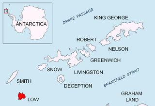
Groma Rock is the 45 m long in south-north direction and 30 m wide rock off the northwest extremity of Low Island in the South Shetland Islands. Its surface area is 0.1 ha.
References
Coordinates: 11°11′33″S38°00′12″W / 11.19250°S 38.00333°W