Jackass Flat Nature Conservation Reserve

Last updated

Jackass Flat Nature Conservation Reserve
Victoria
Eucalyptus tricarpa 7061.jpg
Eucalyptus tricarpa in Jackass Flat Nature Conservation Reserve
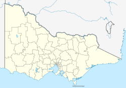
Australia Victoria location map.svg
Red pog.svg
Jackass Flat Nature Conservation Reserve
Nearest town or city Jackass Flat
Coordinates 36°43′39″S144°17′06″E / 36.72750°S 144.28500°E / -36.72750; 144.28500 Coordinates: 36°43′39″S144°17′06″E / 36.72750°S 144.28500°E / -36.72750; 144.28500
Established1980
Area73.4 ha (181 acres)
Managing authorities Parks Victoria
Website Jackass Flat Nature Conservation Reserve

Jackass Flat Nature Conservation Reserve is a 73.4 hectares (181 acres) reserve, located in Jackass Flat, a northern suburb of Bendigo in Victoria, Australia. The reserve was established in 1980 and is managed by Parks Victoria. [1]

The dominant tree species within the reserve are ironbark ( Eucalyptus tricarpa ), red box (Eucalyptus polyanthemos ) and grey box ( Eucalyptus microcarpa ). [2] Flowering shrub species include totem poles ( Melaleuca decussata ), violet honey-myrtle ( Melaleuca wilsonii ), common fringe-myrtle ( Calytrix tetragona ), sticky boronia, ( Boronia anemonifolia ), fairy wax-flower (Philotheca verrucosa), goldfields grevillea ( Grevillea dryophylla ), shrub violet ( Hybanthus floribundus ) and the rare star hair ( Astrotricha linearis ). [2] Other plant species include golden pennants ( Glischrocaryon behrii ) as well as numerous orchids. [2] [3]
Related Research Articles

<span class="mw-page-title-main">Fitzgerald River National Park</span> Protected area in Western Australia

Fitzgerald River National Park is a national park in the Shires of Ravensthorpe and the Jerramungup in Western Australia, 419 kilometres (260 mi) southeast of Perth. The park is recognised on Australia's National Heritage List for its outstanding diversity of native plant species, including many plants which are unique to the local area.

Freshwater is a national park in Queensland, Australia, 34 km north of Brisbane. The park is west of Redcliffe, near Deception Bay, within Caboolture Shire.

<span class="mw-page-title-main">Apudthama National Park</span> Protected area in Queensland, Australia

The Apudthama National Park is a national park in Queensland, Australia, 2,137 km (1,328 mi) northwest of Brisbane and about 900 km (559 mi) northwest of Cairns, on the tip of Cape York Peninsula.

<span class="mw-page-title-main">Ord Victoria Plain</span> Bioregion in Australia

The Ord Victoria Plain, an interim Australian bioregion, is located in the Northern Territory and Western Australia, comprising 12,540,703 hectares.

<span class="mw-page-title-main">Purple-gaped honeyeater</span> Species of bird

The purple-gaped honeyeater is a species of bird in the family Meliphagidae. It is endemic to semi-arid southern Australia, where it inhabits mallee, tall heath and associated low eucalypt woodland.

<i>Grevillea barklyana</i> Species of tree in the family Proteceae endemic to Victoria, Australia

Grevillea barklyana, also known as gully grevillea or large-leaf grevillea, is a species of flowering plant in the family Proteaceae and is endemic to Western Gippsland in Victoria, Australia. It is an erect shrub or small tree, with mostly pinnatifid leaves with two to eleven lobes, and whitish pink to fawn flowers.

<i>Grevillea montis-cole</i> Species of shrub in the family Proteaceae endemic to Victoria, Australia

Grevillea montis-cole, commonly known as Mount Cole grevillea, is a species of flowering plant in the family Proteaceae and is endemic to central-western Victoria, Australia. It is a shrub with divided leaves with 5 to 15 lobes, the end lobes more or less triangular to narrowly oblong and sharply-pointed, and clusters of greenish to fawn and dull purplish flowers.

<span class="mw-page-title-main">Mulligans Flat Woodland Sanctuary</span> Protected area in Australian Capital Territory

Mulligans Flat Woodland Sanctuary is a protected area situated in the Gungahlin district in north Canberra in the Australian Capital Territory. It has several trails for walking, running and cycling. The sanctuary functions as a fieldwork site for researchers studying native ecology.

<span class="mw-page-title-main">Garawarra State Conservation Area</span> Protected area in New South Wales, Australia

The Garawarra State Conservation Area is a protected conservation area that is located on the southern suburban fringe of Greater Sydney, in the state of New South Wales, in eastern Australia. The 949-hectare (2,350-acre) reserve abuts the Royal National Park and is situated 40 kilometres (25 mi) south of the Sydney central business district, near Helensburgh. Garawarra was gazetted as a park in 1987, and added, together with the Royal National Park, to the Australian National Heritage List on 15 September 2006.

The Burrinjuck Nature Reserve is a protected nature reserve on the south west slopes of New South Wales, Australia. The 5,250-hectare (13,000-acre) reserve is located adjacent to the Burrinjuck Dam, with 5,118 hectares of the reserve located on the northern side of the reservoir, and the remaining 89 hectares located on the southern side of the reservoir to the northeast of Black Andrew Nature Reserve. It includes land formerly managed as the Burrinjuck State Forest and Burrinjuck State Recreation Area.

The Black Andrew Nature Reserve is a protected nature reserve located on the south west slopes of New South Wales, Australia. The 1,559-hectare (3,850-acre) reserve is situated on the southern shore of Burrinjuck Dam on the Murrumbidgee River, an important reservoir for the Murrumbidgee Irrigation Area.

Jackass Flat is a suburb of the city of Bendigo in central Victoria, Australia. Jackass Flat is in the City of Greater Bendigo, 6.5 kilometres (4.0 mi) north of the Bendigo central business district.

Mount Elizabeth is a mountain to the east of Tambo Crossing in East Gippsland, Victoria, Australia. It lies within the Mount Elizabeth Nature Conservation Reserve managed by Parks Victoria. The reserve, which covers 5,234 hectares, was established in 1984. The reserve is the only known location where the endangered plant species leafy nematolepis occurs. Other rare or vulnerable plant species found in the reserve include Tullach Ard grevillea, outcrop guinea-flower, Mount Elizabeth hovea, monkey mint-bush and leafless pink-bells. Fauna species of note include the lace monitor, yellow-tailed black cockatoo and gang-gang cockatoo.

<i>Dipodium hamiltonianum</i> Species of orchid

Dipodium hamiltonianum, commonly known as yellow hyacinth-orchid, is a leafless mycoheterotroph orchid that is endemic to eastern Australia. It has up to twenty five greenish flowers with dark red spots on a tall flowering stem.

The Queanbeyan Nature Reserve is a protected nature reserve that is located in the Southern Tablelands region of New South Wales, in eastern Australia. The 67-hectare (170-acre) reserve is situated approximately 4 kilometres (2.5 mi) west-south-west of the City of Queanbeyan.

Ingalba, Big Bush and Pucawan Nature Reserves are three Nature Reserves situated to the west of Temora, New South Wales. Ingalba Nature Reserve is situated 10 kilometres west of Temora and Pucawan Nature Reserve a further 6 km west. Big Bush Nature Reserve is 15 kilometres northwest of Temora. All three reserves are located within Temora Shire. They are managed concurrently by the New South Wales Parks and Wildlife Service. The reserves are linked by corridors of vegetation in adjacent private land and along roads and Travelling Stock Routes.

Desert Camp Conservation Reserve is a protected area in the Australian state of South Australia located in the state's Limestone Coast in the gazetted locality of Marcollat about 44 kilometres (27 mi) south of the town centre in Keith. It is classified as an IUCN Category VI protected area.

<span class="mw-page-title-main">Cumberland Plain Woodland</span> Indigenous woodland community in Sydney, Australia

The Cumberland Plain Woodland, also known as Cumberland Plain Bushland and Western Sydney woodland, is a grassy woodland community found predominantly in Western Sydney, New South Wales, Australia, that comprises an open tree canopy, a groundcover with grasses and herbs, usually with layers of shrubs and/or small trees.

Scabby Range Nature Reserve is a heritage-listed protected area at Sams River Fire Trail, Yaouk, New South Wales, Australia. It was established on 3 December 1982 and added to the former Australian Register of the National Estate on 30 June 1992. It was added to the Australian National Heritage List as part of the Australian Alps National Parks and Reserves on 7 November 2008.

<span class="mw-page-title-main">Ecology of Sydney</span> Geographic aspect of Sydney, Australia

The ecology of Sydney, located in the state of New South Wales, Australia, is diverse for its size, where it would mainly feature biomes such as grassy woodlands or savannas and some sclerophyll forests, with some pockets of mallee shrublands, riparian forests, heathlands, and wetlands, in addition to small temperate rainforest fragments.

References

  1. "Jackass Flat N.C.R". Parks Victoria. Retrieved 29 October 2014.
  2. 1 2 3 "Experience Bendigo Outdoors - City Map" (PDF). Bendigo Tourism. Retrieved 29 October 2014.
  3. Sprague, Marilyn (3 October 2008). "Wild Bush Delights". The Bendigo Miner. p. 13.