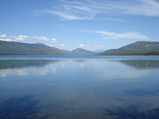
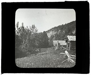
Jacksons is a settlement in British Columbia. According to a Canadian government resource, Jacksons is a scattered settlement of fifty or fewer individuals. [1]
Jacksons is a settlement in British Columbia. According to a Canadian government resource, Jacksons is a scattered settlement of fifty or fewer individuals. [1]

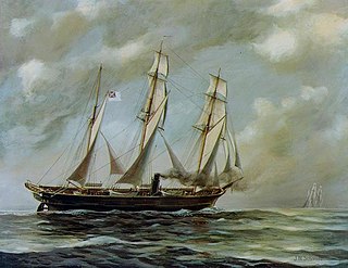
The Alabama Claims were a series of demands for damages sought by the government of the United States from the United Kingdom in 1869, for the attacks upon Union merchant ships by Confederate Navy commerce raiders built in British shipyards during the American Civil War. The claims focused chiefly on the most famous of these raiders, the CSS Alabama, which took more than sixty prizes before she was sunk off the French coast in 1864.

The Adams–Onís Treaty of 1819, also known as the Transcontinental Treaty, the Spanish Cession, the Florida Purchase Treaty, or the Florida Treaty, was a treaty between the United States and Spain in 1819 that ceded Florida to the U.S. and defined the boundary between the U.S. and Mexico. It settled a standing border dispute between the two countries and was considered a triumph of American diplomacy. It came during the successful Spanish American wars of independence against Spain.

The Alford Valley Railway is a 2 ft narrow gauge railway in the Howe of Alford, Aberdeenshire, Scotland. It is located at what used to be the terminus of the passenger and goods Alford Valley Railway which connected with the Great North of Scotland Railway main line at Kintore.

The Stickeen Territories, also colloquially rendered as Stickeen Territory,Stikine Territory, and Stikeen Territory, was a territory of British North America whose brief existence began July 19, 1862, and concluded July of the following year. The region was split from the North-Western Territory in the wake of the Stikine Gold Rush. The initial strike attracted large numbers of miners — mostly American — to the region; by detaching the region from the exclusive trade zone of the Hudson's Bay Company, British authorities were able to impose tariffs and licences on the speculators. The new territory, named after the Stikine River, was under the responsibility of the Governor of the Colony of British Columbia, James Douglas, who was appointed "Administrator of the Stickeen Territories" and under British law, within the jurisdiction of the Supreme Court of British Columbia.

Kinaskan Lake Provincial Park is a provincial park in British Columbia, Canada, located at the south end of Kinaskan Lake along the Stewart-Cassiar Highway near Mowdade Lake and southeast of Mount Edziza. At the south end of the park, the Iskut River, of which the lake is an expansion, spills over 12.2-metre Cascade Falls. The park is approximately 800 ha. in size.
Prophet River Hot Springs Provincial Park is a provincial park in British Columbia, Canada. Established high in the Muskwa Ranges, on the course of the Prophet River, it is part of the larger Muskwa-Kechika Management Area.

Moresby Island is a large island (3,399.39 km2 [1,312.51 sq mi]) that forms part of the Haida Gwaii archipelago in British Columbia, Canada, located at 53°04′44″N132°07′40″W It is separated by the narrow Skidegate Channel from the other principal island of the group to the north, Graham Island.

Heart Peaks, originally known as the Heart Mountains, is a mountain massif in the Northern Interior of British Columbia, Canada. It is 90 km (56 mi) northwest of the small community of Telegraph Creek and just southwest of Callison Ranch. With a maximum elevation of 2,012 m (6,601 ft), it rises above the surrounding landscape on the Nahlin Plateau, which is part of the western Stikine Plateau. Heart Peaks has been an area of prospecting since the 1980s with the discovery of precious metals.
The Stikine Ranges are a group of mountain ranges and mountainous plateaus in northwestern British Columbia, Canada. They are the northernmost subdivision of the Cassiar Mountains and among the least explored and most undeveloped parts of the province.
The Williams Lake First Nation is a First Nations government of the Secwepemc (Shuswap) Nation, located in the Cariboo region of the Central Interior region of the Canadian province of British Columbia, at the city of Williams Lake. It was created when the government of the then-Colony of British Columbia established an Indian reserve system in the 1860s. It is a member government of the Northern Shuswap Tribal Council. Its main Indian Reserve is Williams Lake Indian Reserve No. 1, a.k.a. "Sugarcane" or "The Cane" or "SCB".
Klootchman Canyon is a canyon on the Stikine River in northwestern British Columbia, Canada, located south of a bend in the river known as the Devil's Elbow.
The Porcupine River is a left tributary of the Stikine River in northwestern British Columbia, Canada, entering that stream south of the confluence of the Anuk River and above the confluence of the Iskut.

Glenora, also known historically as the Hudson's Bay Company's Fort Glenora and during the Cassiar Gold Rush as Glenora Landing, was an unincorporated settlement in the Stikine Country of northwestern British Columbia, Canada. It was located on the banks of the Stikine River, just southwest and approximately 13 miles downstream from the community of Telegraph Creek. A customs office existed 1901–1903.
The Tahltan First Nation, also known as the Tahltan Indian Band, is a band government of the Tahltan people. Their main community and reserves are located at Telegraph Creek, British Columbia. Their language is the Tahltan language, which is an Athabaskan language also known as Nahanni, is closely related to Kaska and Dunneza. Their Indian and Northern Affairs Canada band number is 682. The Tahltan First Nation is joined with the Iskut First Nation in a combined tribal council-type organization known as the Tahltan Nation.
The Chutine River, originally named the Clearwater River, is a major right tributary of the Stikine River in northwestern British Columbia, Canada. It is located west of the Stikine Icecap and just inside the boundary between Alaska and British Columbia. The former settlement of Chutine or Chutine Landing is located at the confluence of the Chutine and Stikine. The name means "half-people" in the Tahltan language.
Jackson Bay is a settlement in British Columbia. It lies on a northerly inlet from Johnstone Strait north of Hardwicke Island. It is within Topaze Harbour, a good anchorage for ships.
The Leq'á:mel First Nation, formerly known as Lakahahmen First Nation, is a First Nations band government whose community and offices are located in the area near Deroche, British Columbia in the Fraser Valley region in Canada, about 12 kilometres east of the District of Mission. They are a member government of the Sto:lo Nation Chiefs Council, which is one of two tribal councils of the Sto:lo.
The Cassiar Land District is a cadastral survey subdivision of the province of British Columbia, Canada, created with rest of those on Mainland British Columbia via the Lands Act of the Colony of British Columbia in 1860. The British Columbia government's BC Names system, a subdivision of GeoBC, defines a land district as "a territorial division with legally defined boundaries for administrative purposes". All land titles and surveys use the Land District system as the primary point of reference, and entries in BC Names for placenames and geographical objects are so listed.
Cornice Mountain, 1503 m, is a mountain in the Stikine Icecap area of the Boundary Ranges in northwestern British Columbia, Canada. It is located southwest of the confluence of the Flood and Stikine Rivers.