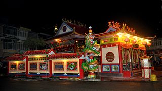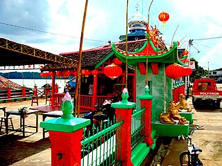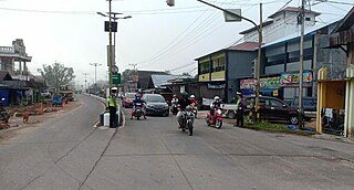
West Kalimantan is a province of Indonesia. It is one of five Indonesian provinces comprising Kalimantan, the Indonesian part of the island of Borneo. Its capital and largest city is Pontianak. It is bordered by East Kalimantan and Central Kalimantan to the east, the Malaysian state of Sarawak to the north, and the Bangka Belitung Islands to the west and the Java Sea to the south. The province has an area of 147,037 km2, and had a population of 4,395,983 at the 2010 Census and 5,414,390 at the 2020 Census; the official estimate as at mid 2023 was 5,623,328, and was projected to rise to 5,695,500 at mid 2024. Ethnic groups include the Dayak, Malay, Chinese, Javanese, Bugis, and Madurese. The borders of West Kalimantan roughly trace the mountain ranges surrounding the vast watershed of the Kapuas River, which drains most of the province. The province shares land borders with Central Kalimantan to the southeast, East Kalimantan to the east, and the Malaysian territory of Sarawak to the north.

East Kalimantan is a province of Indonesia. Its territory comprises the eastern portion of Borneo/Kalimantan. It had a population of about 3.03 million at the 2010 census, 3.42 million at the 2015 census, and 3.766 million at the 2020 census; the official estimate as at mid 2023 was 4,030,488. Its capital is the city of Samarinda.

East Nusa Tenggara is the southernmost province of Indonesia. It comprises the eastern portion of the Lesser Sunda Islands, facing the Indian Ocean in the south and the Flores Sea in the north. It consists of more than 500 islands, with the largest ones being Sumba, Flores, and the western part of Timor; the latter shares a land border with the separate nation of East Timor. The province is subdivided into twenty-one regencies and the regency-level city of Kupang, which is the capital and largest city.

Singkawang, or San-Khew-Jong, is a coastal city and port located in the province of West Kalimantan, on the island of Borneo in Indonesia. It is located at about 145 km north of Pontianak, the provincial capital, and is surrounded by the Pasi, Poteng, and Sakkok mountains. Singkawang is derived from the Salako language, which refers to a very wide area of swamps. In addition, the ancestors of the Hakka Chinese community in Sakawokng also named this area in Hakka as "San-Khew-Jong" (Mount-Mouth-Sea), which means "A city located at the foot of a mountain near the sea and has a river that flows up to the mouth of the river (estuary)."

Bengkayang Regency is a regency ("kabupaten") in West Kalimantan Province of Indonesia,. The area was originally a part of Sambas Regency, but following the expansion of the population in that area, Sambas Regency was divided into a smaller Sambas Regency and a new Bengkayang Regency on 20 April 1999, and then Singkawang City was subsequently cut out of Bengkayang Regency on 21 June 2001. The regency now covers an area of 5,382.74 km2, and had a population of 215,277 at the 2010 Census and 286,366 at the 2020 Census; the official estimate as at mid 2023 was 298,979. The administrative centre is in the town of Bengkayang.

Kapuas Hulu Regency is a regency in West Kalimantan province of Indonesia. Located around the upper drainage area of the Kapuas River, it has a total land area of 31,318.25 square kilometres or around 21.3% of West Kalimantan province's area. The regency seat is located in town of Putussibau, where most of its economic and government activities take place. Kapuas Hulu Regency is one of the few Indonesian regencies having a land border with another country. It is also the largest regency in the province by land area. Due to its relatively large area, it is sparsely populated compared to neighbouring regencies around it. The regency had a population of 222,160 at the 2010 Census and 252,609 according to the 2020 Census; the official estimate as at mid 2023 was 262,404.

Tebedu is a border town in the Serian division of southwestern Sarawak, Malaysia, on the Indonesia-Malaysia border. It lies approximately 63.2 kilometres (39 mi) south of the state capital Kuching. It is the administrative seat for Tebedu District.

Sanggau Regency is a regency in the north-central section of West Kalimantan province of Indonesia. On 18 December 2003, the regency's eastern portion was split off to create a new regency called Sekadau, leaving Sanggau with an area of 12,857.7 km2 (5,000 sq mi). As of the 2020 census, Sanggau Regency had a population of 484,836; the official estimate as at mid 2023 was 503,937. Alongside the Landak, Sekadau, and Sintang regencies, it is one of four West Kalimantan regencies with a predominantly Catholic populations.
The Land Dayak languages are a group of dozen or so languages spoken by the Bidayuh Land Dayaks of Borneo, and by some, also spoken by the Rejang people of southwestern Sumatra.

Yahukimo Regency is one of the regencies (kabupaten) in the Indonesian province of Highland Papua. It covers an area of 17,152 km2, and had a population of 164,512 at the 2010 Census, but this figure more than doubled to reach 350,880 at the 2020 Census; the official estimate as at mid 2022 was 361,776. The official administrative centre of Yahukimo Regency is at Sumohai, which is located 25 kilometres north of the town of Dekai, but - due to the lack of infrastructure in Sumohai - the actual administrative centre of the regency is in Dekai. The regency was formerly part of the Jayawijaya Regency, but was split off to become a separate regency on 11 December 2002.

Sambas Regency is the most northerly regency in West Kalimantan Province of Indonesia. The regency is one of the original regencies in West Kalimantan, but on 20 April 1999 the southern districts were removed from Sambas Regency to form a new Bengkayang Regency. The residual regency now covers 6,394.70 km2, and had a population of 496,120 at the 2010 census and 629,905 at the 2020 census; the official estimate as at mid 2023 was 648,181. The administrative centre is at the town of Sambas.

Lamandau Regency is a regency of Central Kalimantan province of Indonesia. The regency was created in 2002 from the northwestern parts of West Kotawaringin Regency. The regency has a population of 63,119 according to the 2010 census and 97,611 based on the 2020 census. The population estimate as of mid-2023 was 110,132. The regency covers an area of 6,292.03 square kilometres and is divided into eight districts (kecamatan). The regency seat is located in the town of Nanga Bulik, which serves as the regency's economic and administrative center.

Mahakam Ulu Regency is a regency (kabupaten) in the province of East Kalimantan, Indonesia. As the name implies, it comprises the upper valley of the Mahakam River. It covers an area of 18,427.81 km2. The regency was established on 14 December 2012, formed from the former northern districts of West Kutai Regency. The districts now forming the regency held a combined population of 24,994 at the 2010 Census; the population for the new regency at the 2020 Census was 32,513; the official estimate as at mid 2023 was 38,498. The administrative capital is at Ujoh Bilang, which had 3,527 inhabitants as at mid 2022. It is the only regency in East Kalimantan to share an international land border with the Malaysian state of Sarawak.
Krayan is a district in Nunukan Regency, North Kalimantan, Indonesia.

Entikong is a district (kecamatan) and also an administrative village (desa) within that district in Sanggau Regency of West Kalimantan Province, Indonesia. It is the location of the main border crossing between the West Kalimantan and the Malaysian state of Sarawak. The checkpoint on the Malaysian side of the border is called the Tebedu immigration, customs, quarantine and security checkpoint.
Tulin Onsoi is a district located in Nunukan Regency, North Kalimantan, Indonesia. Positioned in the northern part of the province, Tulin Onsoi lies close to the border with Malaysia, contributing to its strategic significance in regional trade and cultural exchange. The district is characterized by its diverse landscapes, which include forested areas, rivers, and mountainous terrain, reflecting the natural environment resources of North Kalimantan.
Lumbis Ogong is one of the districts in Nunukan Regency, North Kalimantan Province, Indonesia. This district is located in the northern part of Nunukan Regency and borders directly with Malaysia to the north.
South Putussibau is a district (kecamatan) located in Kapuas Hulu Regency, West Kalimantan, Indonesia. It is situated in the northeastern part of the regency and is part of the larger West Kalimantan province.
Lemukutan is an island that is administratively located in Sungai Raya Kepulauan District, Bengkayang Regency, West Kalimantan Province, Indonesia.


